Download
1 / 21
210 likes | 286 Views
obs4MIPs: An Overview and Update. O bs4MIPs.

E N D
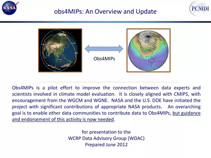
obs4MIPs: An Overview and Update Obs4MIPs Obs4MIPs is a pilot effort to improve the connection between data experts and scientists involved in climate model evaluation. It is closely aligned with CMIP5, with encouragement from the WGCM and WGNE. NASA and the U.S. DOE have initiated the project with significant contributions of appropriate NASA products. An overarching goal is to enable other data communities to contribute data to Obs4MIPs, but guidance and endorsement of this activity is now needed. for presentation to the WCRP Data Advisory Group (WDAC) Prepared June 2012
Acknowledgements D. Waliser, J. Teixeira, R. Ferraro, D. Crichton, L. Cinquini, others.... Jet Propulsion Laboratory, California Institute of Technology, Pasadena, CA P. Gleckler, K. Taylor, D. Williams Program on Climate Modeling Diagnostics and Intercomparison (PCMDI/DOE), Livermore, CA G. Potter, P. Webster Goddard Space Flight Center, Greenbelt, MD T. Lee, J. Kaye, M. Maiden, S. Berrick NASA HQ AIRS, AMSR-E, CERES, MLS, MODIS, OSTM, OVW, TRMM, (PO)DAAC, others… MANY OTHERS NASA obs4MIPs Science Working Group Members: J. Bates (NOAA), K. Bowman, A. da Silva, P. Gleckler (PCMDI), F. Landerer, C. Peters-Lidard, N. Loeb, R. Nemani, S. Platnick, D. Waliser (chair) Program Executive: T. Lee, Program Manager: Robert Ferraro
Observations for CMIP5 SimulationsHistory/Timeline Mid 2007-Mid 2009: JPL discussions on how to improve satellite usage in CMIPx/IPCC ARx. July 2009: JPL/PCMDI IT for Climate Research Workshop held in Pasadena to discuss technical challenges and progress of sharing observations. September 2009: Briefing to WGCM on plans to make satellite observations more accessible for CMIP5/AR5; received WGCM support and encouragement. December 2009: Brief NASA HQ (Lee, Kaye) on plan, solicit support for pilot effort (JPL, GSFC, PCMDI present) March 2010: Briefings to WOAP Meeting & NOAA-led IPCC-observation meeting, Asheville, NC. Spr-Sum 2010: Start work at JPL for prototyping data preparation, documentation and ESG implementation. October 2010: Briefing/update to WGCM on initiative progress. October 2010 : NASA Datasets for IPCC Workshop hosted by PCMDI – identify requirements and NASA or closely-related data sets readily available for CMIP5/AR5 analysis. November 2010 : NASA IT for IPCC Workshop hosted by GSFC – identify IT resources and requirements. December 2010: Update NASA HQ on status of activity, securing continued support for pilot effort. June 2011: JPL/NASA ESG Gateway online and ready to accept/serve obs4MIPs data sets. October 2011: Briefing/update to WGCM & WGNE on initiative progress. Fall 2011: Deliver a number of satellite datasets that are formatted, documented, sampled (e.g. monthly, daily) in a manner analogous to the model outputs, make available via ESG – tagged as “obs4MIPs” October 2011: Recommendation to WCRP to foster activity via Observation Data Council. December 2012: NASA forms Science Steering Group to shepherd NASA component of activity and provide guidance/leadership for including additional agencies/datasets. Meeting at AGU with most members and NASA HQ program executive. March 2012: Obs4MIPs wiki page made public and highlighted at CMIP5 Hawaii Workshop. April 2012: Obs4MIPs briefing at CEOS-Climate Workshop, Asheville to broaden agency participation. May 2012: 1st NASA obs4MIPs Science Steering Group Meeting
(Satellite) Observations and CMIP/IPCC: Better Linkage How to bring as much observational scrutiny as possible to the IPCC process? How to best utilize the wealth of Earth observations for the IPCC process? AR5 – initial target AR6 and other MIPs – long-term targets
Observations for CMIP and IPCC ARsWhy is this timely for AR5 and beyond? Model Scoring w/ Observations: “1 model – 1 vote” to weighting projections based on observation metrics. Earth System Modeling (e.g. Coupled Carbon-Climate): added complexity, more degrees of freedom, need for observational constraints Decadal Predictions: Downscaling GCMs with regional models is key to many decision-support issues. CORDEX
Model and Observation Overlap For what quantities are comparisons viable? Taylor et al. 2008 Example: Current NASA Missions ~14 Total Missions Flown ~ 60 Many with multiple instruments Most with multiple products (e.g. 10-100s) Many cases with the same products Over 1000 satellite- derived quantities ~120 ocean ~60 land ~90 atmos ~50 cryosphere Over 300 Variables in (monthly) CMIP Database
Some Basic Tenets of the Initial Activity Satellite Experts Use the CMIP5 simulation protocol (Taylor et al. 2009) as guideline for deciding which observations to select.InitialTarget was monthly averaged (OMON, AMON) products on 1 x 1 degree grid Convert (Satellite) Observations to CMIP model output formatCMOR output, NetCDF files, CF Convention Metadata, CMIP standard pressure levels, etc. Not a new product. Independent QC check before release. Includes a 6-8 page Technical Note describing strengths/weaknesses, uncertainties, caveats regardingcomparisons with models. (at graduate student level) Host side by side on the ESG with CMIP5 Modelers Analysis Community Main Target Community
Model and Observation Overlap For what quantities are these comparisons viable? Target Quantities After much scrutiny and two workshops, only ~20 satellite variables were identified as being “safely” comparable in the pilot effort. Model Output Variables Satellite Retrieval Variables
NASA-related Datasets for CMIP5 Datasets are Gridded Monthly Averages – Unless otherwise noted Separate files containing Nobs & StdErr for each grid cell are available Match up of available NASA datasets to PCMDI priority list Orange datasets are still in process
ESG Gateway : Side by Side Archive with CMIP obs4MIPS Project
“Technical Note” (See Appendix II) Each Dataset has an accompanying Technical Note Target audience is modeling and model-evaluation community members who often have little experience with the given dataset of interest. Content Intent of the Document/POC Data Field Description Data Origin Validation and Uncertainty Estimate Considerations for Model – Observation Intercomparison Instrument Overview References Revision History
Satellite Observations for Evaluating CMIP5SUMMARY NASA-PCMDI pilot Project to establish a (satellite) observation capability for the climate modeling community to support model-to-data intercomparison. This involves IT, satellite retrieval, data set, modeling and science expertise. ~13 satellite-based datasets currently available on the ESG – more coming; including sea ice, with near-term effort to identify a snow cover, aerosol, additional land and composition products, and CFMIP cloud products. We are seeking inputs with CMUG/ESA, have engaged CEOS-Climate Working Group and work closely with the WGNE/WGCM Climate Metrics Panel. A priority now is to increase collaboration with other agencies and international partners to expand this effort and solicit feedback from model analysis community. NASA has formed a Science Working Group, including rep from PCMDI and NOAA to help guide the expansion and direction of this activity. The activity has already expanded to include ARM and reanalysis data sets.
(Satellite) Observations for IPCC / Climate ModelingFuture Emphases and Needs • Identify additional observations to include in this activity. • Continue to develop cultivate collaboration / data utilization from NOAA and international (e.g. ESA CCI) partner data sets. • Maintain/Strengthen links to WGCM/WGNE Climate Metrics Panel. • Continue to work with the ESG community and PCMDI to facilitate the means to utilize the observations for model evaluation. • Encourage satellite and other observing programs to develop products analogous to model output. • Encourage modeling community to develop the means to output quantities analogous to satellite retrieved or other observed quantities. • Encourage satellite programs to provide modeling community with satellite simulators for more direct comparisons with observations (e.g. CFMIP). • Provide guidance on future funding solicitations. • Cultivate more coherent input from the modeling community on observations critical to model development/evaluation.
Challenges and Questions • Specific areas that present challenges and questions include: • What observations go into obs4MIPs? A fundamental criteria is there has to be a 1-to-1 correspondence with a CMIP model output variable. A second criteria is that the product be well documented with peer-reviewed publications, ideally with examples of use for model evaluation. • What to do when there is more than one observation product for a given variable – 1) keep it simple for the user and attempt to choose the “best”, 2) select the “best” two to account for some observational uncertainty, 3) select more than two if available but run the risk of the offerings become overly complex for the non-expert. For 1) and 2) – by what criteria is this decided? • What if the data sets don’t quite match e.g. product is total column (ozone) but CMIP only requests the vertically resolved profile? • What guidelines should there be regarding update frequency and process? • Who provides quality control over the technical documentation and data set content? • Thus far technical documents were made one per variable, in some cases it may be advantageous to document more than one in the same technical note, how is this decided? • For more details: see Notes/Action Items from recent NASA obs4MIPs Science Working Group Meeting.
Recommendation • What role could WDAC play for Obs4MIPs? • General oversight on the advancement of Obs4MIPs • e.g., via annual updates to WDAC, similar to AMIP/CMIP panels established by the WGNE and WGCM to guide climate model intercomparisons. • WDAC establish an Obs4MIPS panel to: • Ensure that datasets contributed to Obs4MIPs are appropriate for model evaluation • Advance guidelines that are used to recommend, select and document the data • Identify the highest priority observations for model diagnostics and evaluation • Encourage additional contributions to Obs4MIPs and promote activity • WDAC Obs4MIPs panel membership and organization • NASA volunteer to chair the group and provide some support for annual meetings, PCMDI volunteers continued support, membership and/or co-chair responsibilities • Membership should consist of a mix of observation providers and model experts • WDAC/WCRP to recommend members • Obs4MIPs to report annually to WDACand WMAC
Appendix IIExample Technical Documentation: AIRS Specific Humidity
Appendix II…contExample Technical Documentation: AIRS Specific Humidity
Appendix II…contExample Technical Documentation: AIRS Specific Humidity
Appendix II…contExample Technical Documentation: AIRS Specific Humidity