Strategy for Vegetation Classification: Extracting and Analyzing Data
170 likes | 246 Views
Learn how to extract and classify vegetation data from large phytosociological databases, including steps for database establishment, relevé selection, geographical stratification, identification of major gradients, evaluation of expert-based classification, and predictive distribution modeling. Examples and methods provided.

Strategy for Vegetation Classification: Extracting and Analyzing Data
E N D
Presentation Transcript
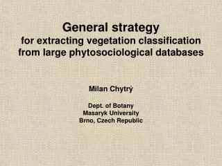
General strategy for extracting vegetation classification from large phytosociological databases Milan Chytrý Dept. of Botany Masaryk University Brno, Czech Republic
1991–2000 1981–1990 1971–1980 1961–1970 Date 1951–1960 1941–1950 1931–1940 1922–1930 0 10 20 30 40 Percentage frequency (Chytry & Rafajova 2003, Preslia 75: 1–15) www.sci.muni.cz/botany/database.htm Step 1: Establishment of the database • Example: Czech National Phytosociological Database • Started in 1996 • Current state: • 55,000 phytosociological relevés • Sampled in 1922–2002 • Made by 332 authors • 1.3 Million individual plant records
Meadows and pastures (Chytry 2001, J. Veg. Sci. 12: 439–444) Step 2: Relevé selection • Deletion of extreme plot sizes
Step 3: Geographical stratification (Chytry & Tichy 2003, Folia Fac. Sci. Univ. Masar. Brun. 108, in press; Kuzelova & Tichy, talk at this Symposium)
Step 3: Geographical stratification (Chytry & Tichy 2003, Folia Fac. Sci. Univ. Masar. Brun. 108, in press; Kuzelova & Tichy, talk at this Symposium)
Step 4: Identification of major gradients and groups in the data set
Step 4: Identification of gradients and groups in the data set (Bruelheide & Chytry2000, J. Veg. Sci. 11: 295–306)
An alternative approach? • Delimitation of vegetation units by formal definitions (Bruelheide & Chytry2000, J. Veg. Sci. 11: 295–306)
Step 5: Evaluation of expert-based phytosociological classification • Calculation of diagnostic capacity of species for traditional phytosociological units (Chytry et al. 2002,J. Veg. Sci. 13: 79–90)
Step 5: Evaluation of expert-based phytosociological classification • Calculation of diagnostic capacity of species for traditional phytosociological units (Chytry et al. 2002,J. Veg. Sci. 13: 79–90)
Step 6: Reproduction of traditional syntaxa by formal definitions • Only well-defined syntaxa are reproduced • Cocktail method, applied to a large database(Bruelheide 2000,J. Veg. Sci. 11: 167–178) • Species co-occurring together are combined into sociological groups • Sociological species groups are combined by logical operators to form definitions of vegetation units • Example of association definition:(Caltha palustris Group AND Cirsium rivulare Group) AND NOT (Carex echinata Group) • Example with cover:Filipendula ulmaria cover > 25 % ANDChaerophyllum hirsutum Group
Step 6: Reproduction of traditional syntaxa by formal definitions
unassigned relevés overlap Step 7: Fixing overlaps and unassigned relevés by similarity criterion (Koci et al. 2003,J. Veg. Sci. 14, in press; Tichy, poster at this Symposium)
Cover herb layer Step 8: Parametrization of formally defined vegetation units • Diagnostic species – statistical comparisons of species occurrences in the relevés of the vegetation unit and in the rest of the database • Constant and dominant species • Means and variances of measured vegetation and environmental variables
Ellenberg temperature value Step 8: Parametrization of formally defined vegetation units • Diagnostic species – statistical comparisons of species occurrences in the relevés of the vegetation unit and in the rest of the database • Constant and dominant species • Means and variances of measured vegetation and environmental variables • Ellenberg indicator values
Mean annual sum of rainfall Festucion pallentis Diantho-Seslerion Festucion valesiacae Koelerio-Phleion Bromion erecti < 5 5-6 6-7 7-9 8-9 >9 [x 100 mm] Step 8: Parametrization of formally defined vegetation units • Diagnostic species – statistical comparisons of species occurrences in the relevés of the vegetation unit and in the rest of the database • Constant and dominant species • Means and variances of measured vegetation and environmental variables • Ellenberg indicator values • GIS overlays
(Chytry et al. 2001) Step 9: Predictive distribution modeling • Coincidence maps of diagnostic species • GIS-based models