Download
1 / 29
290 likes | 312 Views
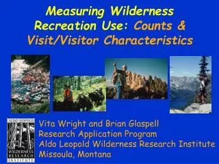
This project aims to assess the impact of recreation activities within the Superstition Wilderness using GPS coordinates and digital images. It also evaluates the effects of campfires on cacti and campfire fuel in the Upland Desert zones.

E N D
Superstition WildernessRecreation Impact Inventory2005-2007 Pam Foti, Ph.D. Andrew Mount, Research Assistant Andrea Bartz, M.A. Candidate Northern Arizona University
Project Foundation • The Limits of Acceptable Change • What have you got on-site (Current Project) • What do you want on-site (Recreation Management Plan) • How will you get to where you want to be on-site related to recreation (Site Management Prescriptions/Decisions) • How do you know when CHANGE ON-SITE occurs? (On-Going Monitoring Program)
Goals of the Project • Rapid Site Inventory (RSI) • Assess all recreation nodes within the Superstition Wilderness using indicators agreed upon by the Forest Service. • To document recreation nodes within the Superstition Wilderness with GPS coordinates and digital images. • To determine the impact of campfires on cactus and the presence of campfire fuel in the Upland Desert zones. • To assess compatibility between the RSI and the Extreme RSI (as developed by David Cole • To make recommendations related to future directions for assessing campsite condition and changes.
Inventory Protocol • Inventory Locations • Trail Numbers & Sites/Trail & %/Trail (Handout) • Superstition Map • Inventory Form • Handout (Handout) • Cole’s “Extreme RSI” • Disturbance to Ground Cover • Tree Damage Rating • Disturbed Area (size) Rating • Overall Impact Rating
2005-2007 RSI Results • RSI Field Assessment Dates: • November, 2005 (5 days) -November, 2006 (4 days) • January, 2006 (2 days) -January, 2007 (4 days) • February, 2006 (2 days) -March, 2007 (5 days) • March, 2006 (3 days) • April, 2006 (7 days) TOTAL DAYS: 32 Field Days • Total Number of RSI Sites:459 Sites
2005-2007 RSI Results: Site Descriptors(N=459) • Site Visibility • From Trail/Route (407) 88.7% • Other Sites Visible (116) 25.3% • Non-Rec Sites Visible (53) 11.5% • Campsite Arrangements • On-Site (291) 63.5% • Alcove Site • Yes (6) 1.3% • Management Actions (Signs, Fencing, etc.) • On-Site (18) 3.9%
2005-2007 RSI Results: Site Descriptors(N=459) • Dominant Vegetation • Ponderosa Pine (2) 0.4% • Pinyon-Juniper (21) 4.6% • Upland Desert (351) 76.5% • Riparian (84) 18.3% • Vegetation Ground Cover On-Site Off-Site 0-5% (248) 54.0% (3) 0.7% 6-25% (150) 32.7% (45) 9.8% 26-50% (39) 8.5% (108) 23.5% 51-75% (17) 3.7% (218) 47.5% 76-95% (5) 1.1% (82) 17.9% 96-100% (0) 0.0% (2) 0.4%
2005-2007 RSI Results: Site Descriptors (N=459) • Water Presence Yes 18.5% • Spring (24) 5.2% • Stream (38) 8.3% • Potholes (23) 5.0% • None (374) 81.5% • Surface Type • Sand (136) 29.6% • Loam (36) 7.8% • Clay (105) 22.9% • Talus/Rocky (173) 37.7% • Slickrock (1) 0.2% • Other (7) 1.5%
2005-2007 RSI Results: Site Descriptors (N=459) • Erosion • On-Site (73) 15.9% • Cryptobiotic Soil • On-Site (6) 1.3% • Impacted (if present) (3) 50.0% • Inherent Site Problems • Too Close to Main Trail (427) 93.0% <26’ = 60.3% • Too Close to Water Features (91) 19.8% <26’ = 8.2% • Too Close to Cultural Features (26) 5.7% <26’ = 3.9% (Note: Too Close = <200 Feet)
2005-2007 RSI Results: Impact Assessment(N=459) • Campsite: • Yes (454) 98.9% • Size: • Small (268) 58.4% • Medium (103) 22.4% • Large (53) 11.5% • Site Cluster (31) 6.8% • Barren Core On-Site:Yes 81.9%Total Number: 726 • Small (398) 54.8% • Medium (177) 24.4% • Large (67) 9.2% • Very Large (71) 9.8% • Unclear (13) 1.8%
2005-2007 RSI Results: Impact Assessment(N=459) • Access Trails:Yes (350) 76.3% • 1-3 (329) 94.0% • 4-6 (16) 4.6% • 7-10 (2) 0.6% • 10+ (0) 0.0% • NA (3) 0.8% • Social Trails: Yes (314) 8.4% • Incipient (84) 26.8% • 1-3 (158) 50.3% • 4-6 (47) 15.0% • 7-10 (12) 3.8% • 10+ (12) 3.8%
2005-2007 RSI Results: Impact Assessment(N=459) • Active Campfire On-Site: Yes (N=222) 48.4% W/Ring (207) • 1 (178) 80.2% • 2 (24) 10.8% • 3 (4) 1.8% • 4+ (1) 0.5% • NA (15) 6.8% • Residual Campfire On-Site: Yes (N=332) 72.3% W/Ring (110) • 1 (106) 31.9% • 2 (4) 1.2% • 3 (0) 0.0% • 4+ (0) 0.0%
2005-2007 RSI Results: Impact Assessment (N=459) • Dead or Down Fuel • <50 Feet (118) 25.7% • <100 Feet (123) 26.8% • 100-200 Feet (129) 28.1% • >200 Feet (175) 38.1% • Evidence of Cactus in Fire Impacts • Yes (54) 11.8% • If Campfire Present 24.3%
2005-2007 RSI Results: Impact Assessment(N=459) • Litter On-Site • Micro-Litter (286) 62.3% • Macro-Litter (174) 37.9% • Evidence of Human Waste On-Site:Yes (100) 21.8% • Toilet Paper (94) 94.0% • Fecal Matter (20) 20.0% • Cathole Construction (8) 8.0%
2005-2007 RSI Results: Impact Assessment(N=459) • Tree Damage Incidents:Yes (139) 30.3% • 1-2 (40) 28.8% • 3-5 (42) 30.2% • 6-8 (29) 20.9% • 10-15 (7) 5.0% • >15 (1) 0.7% • Root Exposure: • Yes (41) 8.9%
2005-2007 RSI Results: Impact Assessment (N=459) • Shrub Damage Incidents:Yes (168) 36.6% • 1-2 (57) 33.9% • 3-5 (50) 29.8% • 6-8 (38) 22.6% • 10-15 (14) 8.3% • >15 (9) 5.4% • Cactus Damage Incidents:Yes (42) 9.2% • 1-2 (31) 73.8% • 3-5 (10) 23.8% • 6-8 (0) 0.0% • 10-15 (1) 2.4% • >15 (0) 0.0%
2005-2007 RSI Results: Impact Assessment(N=459) • Rock Impacts:Yes (243) 52.9% • Breaking (55) 22.6% • Scratching (6) 2.5% • Burning (229) 94.2% • Displaying (5) 2.1% • Chipping (2) 0.8% • Streambank Impacts:Yes (92) 20.0% • Graffiti:Yes (12) 2.6% • Vandalism:Yes (2) 0.4%
2005-2007 RSI Results: Impact Assessment(N=459) • Motorized Intrusions:Yes (1) 0.2% • Tracks (1) 100% • Observed, Debri, Oil, Skid Marks • Livestock Impacts:Yes (43) 9.4% • Manure (43) 100% • Hoof (4) 9.3% • Vegetative (4) 9.3% • Equestrian Impacts:Yes (120) 26.1% • Manure (69) 57.5% • Hoof (85) 70.8% • Vegetative (32) 26.7%
2005-2007 RSI Results: Impact Assessment(N=459) • Archeological Resources Present:Yes (31) 6.8% • Dwellings (6) 19.4% • Dwelling Impacts (1) 16.6% • Rock Art/Historic (1) 3.2% • Rock Art/Hist. Impacts (0) 0.0% • Artifacts (28) 90.3% • Artifact Impacts (4) 14.3%
2005-2007 RSI Results: Impact Assessment(N=459) • Overall Site Impact Rating: • EXTREME (13) 2.8% • HEAVY (32) 7.0% • MODERATE (162) 35.3% • SLIGHT (211) 46.0% • UNIMPACTED (41) 8.9%
2005-2007 RSI Results: Extreme RSI(N=459) • Disturbance to Ground Cover Rating: • <1 (1) 0.2% • 1 (252) 54.9% • 2 (116) 25.3% • 3 (73) 15.9% • 4 (17) 3.7% • Tree Damage Rating: • 0 (428) 93.3% • 1 (29) 6.3% • 2 (2) 0.4%
2005-2007 RSI Results: Extreme RSI(N=459) • Disturbed Area Rating • 0 (276) 60.2% • 1 (138) 30.1% • 2 (45) 9.8% • Overall Impact Rating • 1 (225) 49.0% Cole NAU • 2 (66) 14.4% (90.4%) [90.2%] • 3 (70) 15.3% • 4 (54) 11.7% • 5 (26) 5.7% (7.8%) [7.0%] • 6 (10) 2.1% • 7 (7) 1.5% • 8 (1) 0.2% (1.7%) [2.8%]
2005-2007 RSIWhat Does It Mean? • What do Superstition Wilderness Sites Look Like? • Visible from the trail • Campsite Arrangements • Upland Desert Vegetation • 0-25% On-site Vegetation or 51-75% Off-site Vegetation • No Water…no surprise here! • Surface: Talus/Rocky or Sandy • Minimal Cryptobiotic Soil, but “impacted” if present • Too Close to the Main Trail
2005-2007 RSIWhat Does It Mean? • What are the major recreation site impacts? • Slightly to Moderately Impacted • Only 9.8% Heavy or Extremely Impacted (45 Sites) • Campsite; Small Size; 1.6 Barren Cores • Barren Cores: Small to Medium in Size • Access Trails and Social Trails Likely On-Site • Residual (more likely) or Active Fire On-Site • Not a High % of Human Waste (Primary Indicator = TP)
2005-2007 RSIWhat Does It Mean? • What are the major recreation site impacts? • Tree and Shrub Damage about 30% of the time On-Site • Rock Impacts On-Site from Fire Scars • Other Impacts: • Equestrian • Livestock • Motorized Intrusions • Few “Obvious” Archeological Resource Impacts
2005-2007 RSIWhat Does It Mean? • What are the major recreation site impacts? • Cole: • Low Ground Cover Disturbance • Minimal Tree Damage • Low Disturbed Area Rating • Comparison Results: • Similar outcomes…but somewhat unclear as to Overall Impact Rating Distribution (In essence, I made it work). • Very limited impact information related to sites ( indicators and 2 are weak desert indicators (Groundcover and Trees). • Next Step: Evaluation by Site to Site Rating considering Efficiency and Effectiveness. (Andrea Bartz)
2005-2007 RSIWhat Does It Mean? • Things to Watch: • GENERAL • Site Proliferation • Non-Recreational Activity & Dumping Intrusions • Increasing “Special” Group Use • Urban Fringe Impacts • Motorized Intrusions (which are very minimal at this point) • SPECIFIC • Increasing Site Size (Usually see vegetative impacts) • Social Trails • Fire Impacts –> Wood Gathering –> Cactus Damage • Fire Impacts with Very Limited Resources
2005-2007 RSIWhat Does It Mean? • Things to Watch: • SPECIFIC • General On-Site Cactus Damage • Litter (Site are currently clean) • Non-Recreational Trash Dumping • Sanitary Waste (LNT Issue) • Campsites near Very Limited Water Resources