Download
1 / 54
540 likes | 641 Views
Global Ocean Monitoring: Recent Evolution, Current Status, and Predictions. Prepared by Climate Prediction Center , NCEP/NOAA December 6, 2013. http://www.cpc.ncep.noaa.gov/products/GODAS/ This project to deliver real-time ocean monitoring products is implemented

E N D
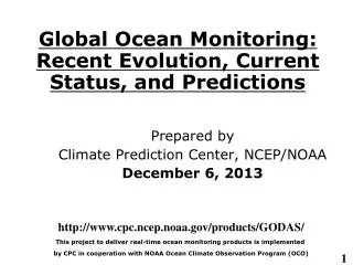
Global Ocean Monitoring: Recent Evolution, Current Status, and Predictions Prepared by Climate Prediction Center, NCEP/NOAA December 6, 2013 http://www.cpc.ncep.noaa.gov/products/GODAS/ This project to deliver real-time ocean monitoring products is implemented by CPC in cooperation with NOAA Ocean Climate Observation Program (OCO)
Outline • Overview • Recent highlights • Pacific/Arctic Ocean • Pacific Ocean Observing System • Long-lead ENSO index • Indian Ocean • Atlantic Ocean • Atlantic hurricane season • Global SST Predictions
Summary • Pacific Ocean • ENSO-neutral conditions continued during Nov 2013. • The consensus forecast favors ENSO-neutral conditions to continue into the Northern Hemisphere summer 2014. • New long-lead ENSO indices were introduced. • Negative PDO phase has persisted since May 2010, and NCEP CFSv2 has successfully forecast the persistence of negative PDO up to 9 month lead. • Tropical Pacific in situ data input for GODAS was reviewed and most of the TAO moorings east of 155W failed to delivery data. • Atlantic Ocean • NAO switched from negative to positive, and NAO= +0.8 in Nov 2013. • The 2013 Atlantic hurricane season has 13 tropical storms, 2 hurricanes and 0 major hurricanes, and it has the fewest number of hurricanes since 1982. The accumulated cyclone energy (ACE) was about 35% of the 1981-2010 median. • Possible factors accounting for the very low hurricane activity in 2013 includes near-normal/below-normal vertical wind shear, below-normal humidity off Africa Continent, strong sinking motion related to un-predictable atmospheric circulation pattern.
Global SST Anomaly (0C) and Anomaly Tendency • SST was near-normal in the central-eastern tropical Pacific. • Positive SST anomalies presented in W. tropical Pacific, Northeast Pacific, subtropical N. Atlantic and most of Indian Ocean. • Negative SST anomalies presented in southeast tropical Pacific. • A tripole pattern of SST tendency presented in N. Atlantic. • A warming tendency was observed near Gulf of Alaska, eq. Pacific and most of Indian Ocean. Fig. G1. Sea surface temperature anomalies (top) and anomaly tendency (bottom). Data are derived from the NCEP OI SST analysis, and anomalies are departures from the 1981-2010 base period means.
Longitude-Depth Temperature Anomaly and Anomaly Tendency in 2OS-2ON Fig. G3. Equatorial depth-longitude section of ocean temperature anomalies (top) and anomaly tendency (bottom). Data are derived from the NCEP's global ocean data assimilation system which assimilates oceanic observations into an oceanic GCM. Anomalies are departures from the 1981-2010 base period means. • Positive temperature anomalies cover most of the equatorial Pacific Ocean. • Positive anomalies dominated at the upper 100m of equatorial Indian and Atlantic Ocean. • A tripole pattern of tendency was observed near the thermocline, largely due to propagation of downwelling and upwelling oceanic Kelvin waves (slide 11).
Evolution of Pacific NINO SST Indices JJASON ENSO-Neutral • All Nino indices were near-normal. • Keyed on NINO3.4, the tropical Pacific was ENSO-neutral during Atlantic hurricane season (JJASON). • The indices were calculated based on OISST. They may have some differences compared with those based on ERSST.v3b. Fig. P1a. Nino region indices, calculated as the area-averaged monthly mean sea surface temperature anomalies (oC) for the specified region. Data are derived from the NCEP OI SST analysis, and anomalies are departures from the 1981-2010 (bar) and last ten year (green line) means.
Last Three Month SST, OLR and 925hp Wind Anom. • Positive SSTA shifted eastward to west of Dateline, while negative SSTA persisted in the far E. Pacific. • Atmospheric circulations dominated by strong intra-seasonal variability in Aug-Nov 2013. • Surface divergent wind anomalies were associated with suppressed convection near Dateline.
Equatorial Pacific SST (ºC), HC300 (ºC), u850 (m/s) and OLR(W/m2 )Anomalies CPC MJO Indices - MJO-related surface zonal wind anomalies dominated during Dec 12-Feb 13 and Aug-Nov 2013. • Downwelling (upwelling) oceanic Kelvin waves shown in HC300 anomalies were forced by westerly (easterly) surface zonal wind anomalies. • Eastward propagation of negative (positive) SSTA in Oct (Nov) 2013 appears associated with upwelling (downwelling) oceanic Kelvin waves. Fig. P4. Time-longitude section of anomalous pentad sea surface temperature (left), upper 300m temperature average (heat content, middle-left), 850-mb zonal wind (U850, middle-right) averaged in 2OS-2ON and Outgoing Long-wave Radiation (OLR, right) averaged in 5OS-5ON. SST is derived from the NCEP OI SST, heat content from the NCEP's global ocean data assimilation system, U850 from the NCEP CDAS. Anomalies for SST, heat content and U850/OLR are departures from the 1981-2010 base period pentad means respectively.
Oceanic Kelvin Wave Indices • Downwelling oceanic Kelvin wave (OKW, dash line) emerged in early Oct in the W. Pacific propagated eastward and is expected to reach the coast of S. America in December. • Upwelling OKW (solid line) emerged in mid-Nov in the W. Pacific is expected to propagate eastward and bring cooler subsurface temperature to the central-eastern Pacific in Dec 2013 and Jan 2014. • Oceanic Kelvin wave indices are defined as standardized projections of total anomalies onto the 14 patterns of Extended EOF 1 of equatorial temperature anomalies (Seo and Xue , GRL, 2005).
Evolution of Equatorial Pacific Surface Zonal Current Anomaly (cm/s) • Positive (negative) zonal current anomalies were associated with downwelling (upwelling) oceanic Kelvin waves.
NINO3.4 Heat Budget • SSTA tendency (dT/dt) in NINO3.4 region (dotted black line) was positive in Oct-Nov 2012, indicating a warming of NINO3.4. • All the advection terms were positive, contributing to the recent warming in NINO3.4. Huang, B., Y. Xue, X. Zhang, A. Kumar, and M. J. McPhaden, 2010 : The NCEP GODAS ocean analysis of the tropical Pacific mixed layer heat budget on seasonal to interannual time scales, J. Climate., 23, 4901-4925. Qu: Zonal advection; Qv: Meridional advection; Qw: Vertical entrainment; Qzz: Vertical diffusion Qq: (Qnet - Qpen + Qcorr)/ρcph; Qnet = SW + LW + LH +SH; Qpen: SW penetration; Qcorr: Flux correction due to relaxation to OI SST
Tropical Pacific Observing SystemsReal time plots can be accessed at http://www.cpc.ncep.noaa.gov/products/GODAS/ocean_briefing.shtml
The data coverage from the TAO/TRITON array was very poor east of 155W in Oct 2013. • The Argo floats provide about 1-2 daily profiles in one degree box, and its coverage in the equatorial Pacific is good. • There were no data from XBT.
Periods with massive TAO data loss
- There is a significant loss of TAO data since summer 2012. • The total number of Argo profiles in the central-eastern Pacific is increasing and becomes close to the total number of TAO profiles since late 2013.
Subsurface Temperature Anomalies along Equator 2S-2N Eq, 81-09 Clim Eq Eq, 81-10 Clim Eq, 81-10 Clim BOM ECMWF S4 TAO JMA GODAS October November 155W • Subsurface temperature anomalies from different ocean reanalyses exhibited large uncertainty east of 155W where many TAO arrays failed. • Ocean reanalysis products are probably more trustful than the TAO temperature analysis, which is basically climatology in places where there were no data. TAO: http://www.pmel.noaa.gov/tao/jsdisplay/ ECMWF S4: http://www.ecmwf.int/products/forecasts/d/charts/oras4/reanalysis/sections/xzmaps/1m!1m!201306!Anomaly!Temperature!/ JMA :http://ds.data.jma.go.jp/tcc/tcc/products/elnino/outlook.html BOM:http://www.bom.gov.au/climate/enso/e
Pacific Decadal Oscillation Index • Negative PDO phase since May 2010 has persisted for 42 months now, and the negative PDO index persisted in Nov 2013. • The apparent connection between NINO3.4 and PDO index suggest connections between tropics and extratropics. • However, the negative phase of PDO since Jun 2012 seems not closely connected with the Nino3.4 SSTA. • Pacific Decadal Oscillation is defined as the 1st EOF of monthly ERSST v3b in the North Pacific for the period 1900-1993. PDO index is the standardized projection of the monthly SST anomalies onto the 1st EOF pattern. • The PDO index differs slightly from that of JISAO, which uses a blend of UKMET and OIv1 and OIv2 SST.
Last Three Month SST, SLP and 925hp Wind Anom. • Positive SSTA in the central N. Pacific shifted eastward. • Anomalous anticyclone was observed near the coast of Alaska and Pacific Northwest.
NorthAmerica Western Coastal Upwelling • Downwelling in mid-high latitudes was suppressed in Oct-Nov 2013, consistent with the SLP and surface wind anomalies. Fig. NP2. Total (top) and anomalous (bottom) upwelling indices at the 15 standard locations for the western coast of North America. Upwelling indices are derived from the vertical velocity of the NCEP's global ocean data assimilation system, and are calculated as integrated vertical volume transport at 50 meter depth from each location to its nearest coast point (m3/s/100m coastline). Anomalies are departures from the 1981-2010 base period pentad means. • Area below (above) black line indicates climatological upwelling (downwelling) season. • Climatologically upwelling season progresses from March to July along the west coast of North America from 36ºN to 57ºN.
Evolution of Indian Ocean SST Indices • DMI was near normal in Nov 2013. • The basin mean SSTA was above-normal. Fig. I1a. Indian Ocean Dipole region indices, calculated as the area-averaged monthly mean sea surface temperature anomalies (OC) for the SETIO [90ºE-110ºE, 10ºS-0] and WTIO [50ºE-70ºE, 10ºS-10ºN] regions, and Dipole Mode Index, defined as differences between WTIO and SETIO. Data are derived from the NCEP OI SST analysis, and departures from the 1981-2010 base period means and the recent 10 year means are shown in bars and green lines.
Tropical Indian: SST Anom., SST Anom. Tend., OLR, Sfc Rad, Sfc Flx, 925-mb & 200-mb Wind Anom. Fig. I2. Sea surface temperature (SST) anomalies (top-left), anomaly tendency (top-right), Outgoing Long-wave Radiation (OLR) anomalies (middle-left), sum of net surface short- and long-wave radiation, latent and sensible heat flux anomalies (middle-right), 925-mb wind anomaly vector and its amplitude (bottom-left), 200-mb wind anomaly vector and its amplitude (bottom-right). SST are derived from the NCEP OI SST analysis, OLR from the NOAA 18 AVHRR IR window channel measurements by NESDIS, winds and surface radiation and heat fluxes from the NCEP CDAS. Anomalies are departures from the 1981-2010 base period means.
Evolution of Tropical Atlantic SST Indices Fig. A1a. Tropical Atlantic Variability region indices, calculated as the area-averaged monthly mean sea surface temperature anomalies (ºC) for the TNA [60ºW-30ºW, 5ºN-20ºN], TSA [30ºW-10ºE, 20ºS-0] and ATL3 [20ºW-0, 2.5ºS-2.5ºN] regions, and Meridional Gradient Index, defined as differences between TNA and TSA. Data are derived from the NCEP OI SST analysis, and departures from the 1981-2010 base period means and the recent 10 year means are shown in bars and green lines. • SSTA in the tropical North Atlantic (TNA) was near-normal. • Meridional Gradient Mode index (TNA-TSA) was above-normal. • ATL3 SSTA was weakly below-normal.
NAO and SST Anomaly in North Atlantic • High-latitude North Atlantic SSTA is generally closely related to NAO index (negative NAO leads to SST warming and positive NAO leads to SST cooling). Positive NAO index has persisted during Apr-Sep 2013, contributing to persistent positive SSTA in mid-latitude N. Atlantic, and below-normal or near-normal conditions in high-latitude and subtropics. • Weakly above-normal SST dominated in hurricane main development region (10N-20N) in the past three Atlantic hurricane seasons. Fig. NA2. Monthly standardized NAO index (top) derived from monthly standardized 500-mb height anomalies obtained from the NCEP CDAS in 20ºN-90ºN (http://www.cpc.ncep.noaa.gov). Time-Latitude section of SST anomalies averaged between 80ºW and 20ºW (bottom). SST are derived from the NCEP OI SST analysis, and anomalies are departures from the 1981-2010 base period means.
2013 Atlantic Hurricane Season (http://www.cpc.ncep.noaa.gov/products/outlooks/hurricane.shtml http://weather.unisys.com/hurricane/atlantic/2013/index.php http://en.wikipedia.org/wiki/2013_Atlantic_hurricane_season) • By Dec. 1, 2013, 13 tropical storms, 2 hurricanes and 0 major hurricanes (category 3, 4) formed in the North Atlantic Ocean. • The NOAA’s Atlantic Hurricane Outlook did not verify well in terms of hurricane count and Accumulated Cyclone Energy (ACE). 70% Probability for Each Forecast Range
2013 Atlantic Hurricane Season (ACE=35%, Below-normal season with the fewest number of hurricanes since 1982) • Factors influencing 2013 seasonal hurricane outlooks: • The multi-decadal signal since 1995 –Yes, but West African monsoon not enhanced • Above-average SST in tropical Atlantic and Caribbean Sea, and warmer than global tropics - Yes • ENSO-neutral conditions – Yes, but with east-west dipole SSTA
2012 Atlantic Hurricane Season (ACE=139%, Above-normal season, tied with the third-largest number of named storms (19) • Factors influencing 2012 seasonal hurricane outlooks: • The multi-decadal signal since 1995 – Yes • Above-average SST in tropical Atlantic and Caribbean Sea, and warmer than global tropics - Yes • ENSO-neutral conditions – Yes but with above-average SST in central equatorial Pacific.
ACE v.s. Tropical Atlantic SST Anomaly Accumulated Cyclone Energy (ACE) downloaded from http://en.wikipedia.org MDR_nolocal, corr=0.63 • MDR relative to the global tropical mean SSTA is a better index for explaining Atlantic hurricane activity than either MDR or NINO 3.4 alone. • In 2013 MDR_nolocal is above- average while ACE is below-normal. • - Non-local SST index: • Swanson (2008); • Vecchi & Soden (2007) MDR, corr=0.5 NINO3.4, corr=-0.3
North Atlantic U850 and U200-U850 • In the Hurricane Main Development Region (80W-20W, 10N-20N), westerly wind anomalies near the surface and below-normal vertical wind shear were observed in JJASO 2010-2012, which is favorable for hurricane development. • The surface winds and vertical wind shear were near-normal in JJASO 2013.
In MDR (80W-20W, 10N-20N), vertical wind shear was near-normal in 2013. • The air off Africa Continent was much drier in 2013 than in 2012, unfavorable for hurricane development.
Courtesy of Gerry Bell Anomalous Velocity Potential 10N-20N Top Left) The normal divergence is nearly absent above 300-hPa (black), the mid- and low-level convergence is weaker than average (orange line), and the surface divergence is enhanced. (Top Right) This pattern was associated with significantly reduced rising motion in the mid-troposphere and low-level sinking motion (Black and red lines). Large-scale upper-level convergence is present across the MDR, seemingly little affected by the MJO.
IRI/CPC NINO3.4 Forecast Plume • Most of the models predicted ENSO-neutral in the coming Northern Hemisphere spring and summer. • The consensus forecast favors ENSO-neutral to continue into the Northern Hemisphere summer 2014.
NCEP CFSv2 NINO3.4 Forecast - Latest CFSv2 prediction suggests ENSO-neutral to persist through the next spring and summer.
Ramesh-Murtugudde Indices for Long-Lead El Nino Forecast Aug 2011 X 2013 X 2012 X The top-right quadrant is an indicator of potential El Nino conditions in the following year Ramesh and Murtugudde, Nature Climate Change, 2012
Both D20 and SST indices were above-normal during Jul-Aug-Sep one year before El Nino years (82/83, 87/88, 97/98, 02/03, 04/05, 06/07, 09/10). • However, the SST (D20) indices were near-normal (above-normal) during Jul-Aug-Sep one year before the 86/87 and 91/92 El Ninos (which might be due to uncertainties in SST). • There are some false alarm years that can be partially explained. 2002 is a weak El Nino year, which is unlikely followed by a second El Nino year. 1989 and 2000 are both La Nina decay years. 2009 and 2010 are El Nino years. • Indices in 2011 and 2012 do not indicate El Nino conditions in 2012 and 2013, verified. • In JAS 2013, both D20 and SST indices were above-normal, indicating possible El Nino conditions in winter 2014. 82 87 86 97 F 91 04 F F 02 06 F F 09 14 ? OISST (black line), ERSST (green line)
NCEP CFSv2 Pacific Decadal Oscillation (PDO) Forecast PDO is the first EOF of monthly ERSSTv3b anomaly in the region of [110oE-100oW, 20oN-60oN]. CFS PDO index is the standardized projection of CFS SST forecast anomalies onto the PDO EOF pattern. - Latest CFSv2 prediction suggests that negative PDO phase will persist through the next spring and summer.
Summary • Pacific Ocean • ENSO-neutral conditions continued during Nov 2013. • The consensus forecast favors ENSO-neutral conditions to continue into the Northern Hemisphere summer 2014. • New long-lead ENSO indices were introduced. • Negative PDO phase has persisted since May 2010, and NCEP CFSv2 has successfully forecast the persistence of negative PDO up to 9 month lead. • Tropical Pacific in situ data input for GODAS was reviewed and most of the TAO moorings east of 155W failed to delivery data. • Atlantic Ocean • NAO switched from negative to positive, and NAO= +0.8 in Nov 2013. • The 2013 Atlantic hurricane season has 13 tropical storms, 2 hurricanes and 0 major hurricanes, and it has the fewest number of hurricanes since 1982. The accumulated cyclone energy (ACE) was about 35% of the 1981-2010 median. • Possible factors accounting for the very low hurricane activity in 2013 includes near-normal/below-normal vertical wind shear, below-normal humidity off Africa Continent, strong sinking motion related to un-predictable atmospheric circulation pattern.
Tropical Pacific: SST Anom., SST Anom. Tend., OLR, Sfc Rad, Sfc Flx, 925-mb & 200-mb Winds Fig. P2. Sea surface temperature (SST) anomalies (top-left), anomaly tendency (top-right), Outgoing Long-wave Radiation (OLR) anomalies (middle-left), sum of net surface short- and long-wave radiation, latent and sensible heat flux anomalies (middle-right), 925-mb wind anomaly vector and its amplitude (bottom-left), 200-mb wind anomaly vector and its amplitude (bottom-right). SST are derived from the NCEP OI SST analysis, OLR from the NOAA 18 AVHRR IR window channel measurements by NESDIS, winds and surface radiation and heat fluxes from the NCEP CDAS. Anomalies are departures from the 1981-2010 base period means.
North Pacific & Arctic Ocean: SST Anom., SST Anom. Tendency, OLR, SLP, Sfc Rad, Sfc Flx Fig. NP1. Sea surface temperature (SST) anomalies (top-left), anomaly tendency (top-right), Outgoing Long-wave Radiation (OLR) anomalies (middle-left), sea surface pressure anomalies (middle-right), sum of net surface short- and long-wave radiation anomalies (bottom-left), sum of latent and sensible heat flux anomalies (bottom-right). SST are derived from the NCEP OI SST analysis, OLR from the NOAA 18 AVHRR IR window channel measurements by NESDIS, sea surface pressure and surface radiation and heat fluxes from the NCEP CDAS. Anomalies are departures from the 1981-2010 base period means.
Tropical Indian: SST Anom., SST Anom. Tend., OLR, Sfc Rad, Sfc Flx, 925-mb & 200-mb Wind Anom. Fig. I2. Sea surface temperature (SST) anomalies (top-left), anomaly tendency (top-right), Outgoing Long-wave Radiation (OLR) anomalies (middle-left), sum of net surface short- and long-wave radiation, latent and sensible heat flux anomalies (middle-right), 925-mb wind anomaly vector and its amplitude (bottom-left), 200-mb wind anomaly vector and its amplitude (bottom-right). SST are derived from the NCEP OI SST analysis, OLR from the NOAA 18 AVHRR IR window channel measurements by NESDIS, winds and surface radiation and heat fluxes from the NCEP CDAS. Anomalies are departures from the 1981-2010 base period means.
North Atlantic: SST Anom., SST Anom. Tend., OLR, SLP, Sfc Rad, Sfc Flx Fig. NA1. Sea surface temperature (SST) anomalies (top-left), anomaly tendency (top-right), Outgoing Long-wave Radiation (OLR) anomalies (middle-left), sea surface pressure anomalies (middle-right), sum of net surface short- and long-wave radiation anomalies (bottom-left), sum of latent and sensible heat flux anomalies (bottom-right). SST are derived from the NCEP OI SST analysis, OLR from the NOAA 18 AVHRR IR window channel measurements by NESDIS, sea surface pressure and surface radiation and heat fluxes from the NCEP CDAS. Anomalies are departures from the 1979-1995 base period means except SST anomalies are computed with respect to the 1971-2000 base period means.
Tropical Atlantic: SST Anom., SST Anom. Tend., OLR, Sfc Rad, Sfc Flx, 925-mb/200-mb Winds • Above-normal SSTA persisted in the hurricane Main Development Region (MDR) . • Below-normal vertical wind shear presented in MDR. • Convection was suppressed (enhanced) in the western (eastern) tropical North Atlantic. • Westerly low-level wind blew towards the western Africa, indicating enhanced west African monsoon.
NCEP CFS DMI SST Predictions from Different Initial Months Fig. M2. CFS Dipole Model Index (DMI) SST predictions from the latest 9 initial months. Displayed are 40 forecast members (brown) made four times per day initialized from the last 10 days of the initial month (labelled as IC=MonthYear) as well as ensemble mean (blue) and observations (black). The hindcast climatology for 1981-2006 was removed, and replaced by corresponding observation climatology for the same period. Anomalies were computed with respect to the 1981-2010 base period means. DMI = WTIO- SETIO SETIO = SST anomaly in [90oE-110oE, 10oS-0] WTIO = SST anomaly in [50oE-70oE, 10oS-10oN]