Download
1 / 11
110 likes | 299 Views
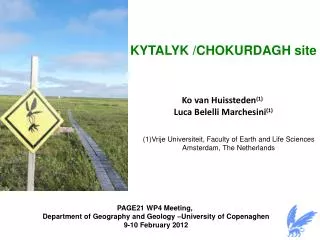
KYTALYK /CHOKURDAGH site. Ko van Huissteden (1) Luca Belelli Marchesini (1). (1) Vrije Universiteit , Faculty of Earth and Life Sciences Amsterdam, The Netherlands . PAGE21 WP4 Meeting, Department of Geography and Geology –University of Copenaghen 9-10 February 2012.

E N D
KYTALYK /CHOKURDAGH site • Ko van Huissteden(1) • Luca BelelliMarchesini(1) (1)VrijeUniversiteit, Faculty of Earth and Life Sciences Amsterdam, The Netherlands PAGE21 WP4 Meeting, Department of Geography and Geology –University of Copenaghen 9-10 February 2012
PAGE21 observation sites in Siberian tundra Cherskii, continuous tundra Kytalyk, continuous tundra Samoylov Island, continuous tundra Nadym, discontinuous boreal forest Vorkuta, discontinuous boreal forest
Kytalyk research station (70o 49’ 45’’N; 147o 29’ 39’’E) Kytalyk Yakutsk Kytalyk Kytalyk Yakutsk Chokhurdakh Quite a remote site!! Equipment (and researchers) travel: by airplane from Yakutsk to ChokurdakhAirport (1239 Km) FromChokurdakh to destinationbyboat (~3hrs), despite air distanceonly 30 km.
Kytalyksite: main features Cold continental climate Mean annual air T: -10.5oC Air T range: [-25,-45]oC winter [+5,+25]oC summer Growing season limited to July and August Vegetation: graminoid tussock tundra (Walker et al., 2005) (tussock-sedge, dwarf shrub, moss tundra) 'Yedoma': organic-rich (about 2% carbon by mass) Pleistocene-age loess permafrost with ice content of 50–90% by volume. Active thawlakes
drained thaw lakes 'ice complex’ hills floodplain Kytalyklandscape spatial variability Lakes: 20% of area Dry tundra on 'ice complex' hills and plateaus active layer 20 - 40 cm River floodplain, active layer > 40 cm Dry/wet tundra on drained thaw lake bottom active layer 20-40 cm active layer tickest on wet locations
Ecosystem scale fluxes: NEE and surface energy Micrometeorological (Eddy Covariance) measurements of: CO2 and energy turbulent fluxes (H, LE) (relevant for WP2) operated since 2003 with maximum duration from early spring (April) to late autumn ( end of September) CO2 vertical profile measurements added in 2008 Location: thaw lake bottom * start of measurements x end of measurements (Parmentier et al. JGR 2011)
Measured variables • Meteo tower: • wind profile, • air temperature and humidity • upward, downward PAR radiation • net radiation (LW+SW) • rain • atm. pressure • Eddy covariance tower: • 3D wind speed • sonic temperature • CO2 ,H2O molar densities • CH4with laser spectroscopy • Soil temperature profiles (20 sensors) • Soil heat flux (4 replicates) • Deeper borehole: 6 m, since 2010, operated by Hokkaido University (Go Iwahana / Atsuko Sugimoto)
Ecosystem scale methane fluxes Thaw lake flux tower (#1)CH4 eddy covariance measurements started in 2008 but… 2010: inoperable methane analyzer due to power supply failure2011: few good quality data in due hardware communication problems Gill R3-50 Sonic anemometer DLT-100 Cavity Ringdown Laser Los Gatos Research LI7500 CO2/H2O IRGA scroll pump power supply: 180 kg 5 kW diesel generator wind generators solar panels data logging EC tower (#2) for CO2/H2O/CH4 fluxes installed over the river floodplain in June 2011 LI7700 open path analyzer failure- no methane fluxes data collected yet.
Chamber based measurements CO2, CH4, N2O Chambers (opaque, transparent) +photo-acoustic multi gas analyzer (INNOVA) 1-6 week(s) summer campaigns since 2004 Location: thaw lake bottom, river plain Leaf photosynthesis measurements flux chamber transects 2010 Wet / dry tundra transect • Floodplain transect • Ice-rich Pleistocene deposits with mass wasting (down slope movement)
CH4emission outside the growing season Mastepanov et al., 2009 (Nature): tundra in northern Greenland has high CH4 emission in the autumnescape from the stored CH4 during freezing? Not measured so far because of logistical difficulties in Kytalyk
Lookingforwardto start.. • Involved scientific staff: • Ko van Huissteden(PI); j.van.huissteden@vu.nl • Luca BelelliMarchesini (post doc) ; l.belellimarcheini@vu.nl • Angela Gallagher (PhD)*; angela.gallagher@vu.nl • Artem Budishchev (PhD)*; artem.budishchev@vu.nl • *cooperation with WageningenUniversity in manipulative experiments on vegetation/active layer.