GPS Waypoint Navigation System Guide
240 likes | 355 Views
Learn how to use GPS waypoints effectively for navigation. Understand the importance of routes, waypoints, and wayfinding to ensure safe and efficient travel. Discover how to enter, verify, and edit waypoints on your GPS device.

GPS Waypoint Navigation System Guide
E N D
Presentation Transcript
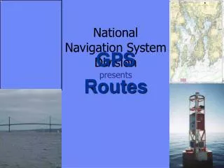
NationalNavigation System Division presents GPS Routes
A waypoint (WPT or WP) is a designated location with geographic Coordinates—a Fix.
A group of waypoints, linked together in a logical sequence on a GPS, is called a “route.”
Entering Waypoints • Enter in name/icon. • Enter LAT/LON. • Enter message (not recommended) • Waypoint number. (Keep it simple) • Menu of waypoint options at bottom. • Bearing andDistance 0001
GPS Position Page Time
Verifying your present position as a waypoint WPT 4 • Use a simple numbering system. • Do not place your position on top of the Aid.Risk of collision! • Validate every waypoint before using it as a permanent waypoint in a route. WPT 3 WPT 2 WPT 1
Waypoints are used extensively in GPS navigation: • As boundaries between voyage segments – LEGS. • To mark turning points, destinations, and aids to navigation. • To mark hazards to navigation.
Waypoint Use Rock WPT 4 Mark the boundaries between legs. WPT 3 WPT 2 WPT 1
GPS receivers enable waypoints to be entered and stored in various ways. • A sequence of waypoints can define a planned route. • Most GPS receivers store routes as well as waypoints.
Select waypoints that can be easily verified by other methods--visual fixes, soundings, radar, etc. NEVERrely on one means of navigation.
WPT 02 • It is important to check your chart before establishing WPTs. • If your course crosses an island, the GPS receiver will direct you to navigate over this hazard. WPT 01
Why create a route? WP 4 • Routes are lists of sequential waypoints. • GPS can automatically advance you to the next waypoint. • Routes can be reversed to retrace your original track. • Routes keep you from wandering into danger and shorten the distance that you travel. WP 3 WP 2 WP 1
WP 4 Editing Routes • GPS receivers should allow you to delete, move, or append waypoints. • In this case: • WPT 2 will be deleted and moved. • WPT 3 will be changed. • WPT 4 will be added. WPT 3 WPT 2 WPT 3 WPT 2 WPT 1
ROUTE Navigation WPT 2 • Used by boats under power when they have to stay in a channel or follow an exact course line • Useful functions: • Cross Track Error (XTE) • Course To Steer (CRS) • Time To Go (TTG) • Automatic course change at next waypoint (WPT) • Total distance to end of leg (DTG) • Total time to end of route. WPT 1
WP 3 C 225 D 2.4 WP 2 C 224 D 3.1 WP 1 ANIMATION
Highway Page on GPS Added line showing vessel direction 095º T Next waypoint Difference between line and the center of the road is XTE (Cross Track Error) Turn to starboard to go to next waypoint
GPS Route Page Display • Perspective view of upcoming waypoints • Shows if you are heading for next waypoint • Customized data fields not needed.
Arrival Alarm Sounds whenever the boat penetrates an adjustable ring around a waypoint. Initiates new heading data for the next leg in your route. Note that waypoint is positioned just off the ATON not on top of it. 1/2 M Alarm Sounds