Download
1 / 22
220 likes | 359 Views
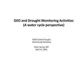
GEO and Drought Monitoring Activities (A water cycle perspective). NASA Global Drought Monitoring Workshop Silver Spring, MD April 12, 2001. The Primary Framework: GEOSS: A Global, Coordinated, Comprehensive and Sustained System of Observing Systems. Relevant Facts:

E N D
GEO and Drought Monitoring Activities (A water cycle perspective) NASA Global Drought Monitoring Workshop Silver Spring, MD April 12, 2001
The Primary Framework: GEOSS: A Global, Coordinated, Comprehensive and Sustained System of Observing Systems • Relevant Facts: • The Group on Earth Observations (GEO) consists of • ~85 nations and ~60 international organizations which have • agreed to work together to build the GEOSS. • GEO implements the GEOSS work plan through the best • efforts of its community. Targets Tasks Sub Tasks The Water Target By 2015, produce comprehensive sets of data, information products and Services to support decision-making for efficient management of the world's water resources, based on coordinated, sustained observations of the water cycle on multiple scales.
In 2008, the Integrated Global Water Cycle Observations theme of IGOS-P became the IGWCO Community of Practice within the GEO framework
IGWCO COP supports three water tasks in the 2009-2011 Work Plan • Water Cycle Target: By 2015, produce comprehensive sets of data, and information products and services to support decision-making for efficient management of the world's water resources, based on coordinated, sustained observations of the water cycle on multiple scales. Task WA-08-01 stimulates the development of new WC products Feedback Task WA-06-02 addresses the use of these data for assessments and early warning Task WA-06-07 disseminates data products and decisions support systems to the world Feedback
Impacts from Drought GEO Task WA-06-02b Co- Leads: Canada, USA and WCRP Tracking and analyzing impacts from drought (including feedbacks such as soil drying) will provide a tangible and practical demonstration of the value of integrated water cycle observations by developing a full and operational data cycle of environmental information from “producer-to-consumer” / “source to sink,” and exploring the application of data products in the Water and Agriculture societal benefit areas.
Drought Impacts are tracked nationally because: • They establish an impacts baseline for monitoring • Climate change, policy change effects, landscape modification, etc • They direct relief in effective ways • They allow directed preparatory actions to be undertaken to reduce vulnerability in advance of the next drought • They are a basis for “ground truthing” indices • They provide a basis for quantifying drought losses • They provide information for estimating environmental consequences of drought. • (They could provide the same benefits if tracked globally) (from M. Svaboda)
Impact of drought on Manitoba Hydro Operations (System wide runoff) Future Work • Internal risk assessment & sensitivity analyses of more severe drought • The 2003 to 2005 period represents the single most significant transition from system-wide drought to flood in history • Climate change or variability?
Drought Impacts (CWB) Yield 5-Yr Avg = 33.8 bu/acre Production 5-Yr Avg = 13.9 MT Area 5-Yr Avg = 15.0 mln/acres (Ash, 2008)
Lessons learned about impact studies and drought monitoring from NDMC 1) Both impacts and monitoring aspects of drought must be looked at simultaneously to understand the scope of drought. 2) In order to provide more comprehensive drought monitoring a broad categorization is needed. 3) To meet the needs of governments special overlays are often needed (portray information by constituency). 4) Drought reporting creates opportunities for “citizen science”.
Drought in Europe: The Portuguese Condition Water erosion in EU 115 million ha (12% total area) Wind erosion in EU 42 million ha (4% total area) Organic C in european soils (0-30 cm), in relation with soil erosion (Source: European Commission, 2004. Reports of the Technical Working Groups, II) GEO-DRI Drought Monitoring Workshop May 10-11, 2010, Winnipeg, Manitoba (Canada)
DRI provides a prototype of ways in which results from research projects with finite duration can be integrated into GEOSS DRI data legacy system has brought data sets together to produce an analysis systems that will allow users to identify the characteristics of the drought over the region during the 1999-2005 time period.
Leading User Interactions • WMO - User applications • Science Community – WCRP, UNESCO,. • Experts in drought monitoring programs • Agricultural sector from producers to agribusiness • Government policy makers deciding on drought aid. • Water resource managers • User workshops and Table Top Drought Preparedness simulations have been held with many of these groups.
Prototype Regional Drought Early Warning Test Beds GEO Task WA-06-02dCo- Leads: USA, WMO, and CanadaChad McNutt, Roger Pulwarty, Mike Brewer Explore expanding the concepts of the North American Drought Monitor and the drought portal through prototyping drought early warning test bed activities in specific international river basins, such as on the US-Canada border, basins in Central America and the Caribbean, the Mediterranean, and other drought-sensitive regions.
Recent Advances in Drought Monitoring • The Standardized Precipitation Index (SPI) has been adopted as a global index for monitoring drought. • Two NIDIS testbeds have been implemented and the third (CA) is being implemented. • Workshops have been held in Licoln Nebraska (December 2009), Asheville NC (April 2010) and Winnipeg Canada (May 2010) to address drought issues, • A preliminary Global Drought Early Warning System, a Clearing House for drought information has been established in conjunction with the NIDIS portal.
Future Activities in Drought Monitoring • A comprehensive user manual for the SPI should be developed • Two working groups with global representatives and UN Agencies and Research Institutions will be established to comprehensive indices to characterize agricultural and hydrological droughts. • A study of drought indices in different regions of the USA and Canada will be undertaken (Canada/ US GEO)
GEOSS Asian Water Cycle Initiative (AWCI)19 Member Countries 18 River Basins for Initial Demonstration Mongolia Uzbekistan Japan Korea Pakistan China China Nepal Bhutan India Bangladesh Myanmar Vietnam Myanmar Laos Philippines Thailand Cambodia Sri Lanka Malaysia Malaysia Indonesia
Conclusion from the Second African Water Cycle Coordination Initiative (AfWCCI) Symposium (Feb. 2011, Ethiopia) The AfWCCI plans to launch two studies in Transboundary African River Basins to explore how the application of GEO principles could benefit the management of River Basins where there is usually limited access to data and information services.
A GEO Water Cycle Workshop for the Americas was held in Lima Peru at ‘CONIDA’ (the Peru ‘National Aerospace & Development Commission’), Nov. 30 to Dec. 4, 2009 Some Workshop Outcomes: 1) Adynamic web site has been developed for listing of data sets & services, project summaries with interactive capabilities. 2) Launched a “Coaliciónpara la InformaciónEspacial e Hidrológica en Latinoamérica y el Caribe” (‘CIEHLYC’). Includes reps from Argentina, Mexico, Columbia, Haiti, Brazil, USA & Canada. Petition to GEO in the Americas to be a formal Working Group. 3) A ‘Water Cycle Federation of America’ to help integrate existing projects and develop new projects and initiatives. Issues identified including floods, droughts, glacier retreat & climate impacts. SeaWiFS Productivity MODIS Land Cover Change La Plata Basin Area Flooding
The Water SBA in the new 2012-2015 Work Plan (proposed) • DS-01 Disaster Risk Reduction and Early Warning • DS-04 Ocean Monitoring, Forecasting and Resources Management • DS-05 Integrated Water-Cycle Information
DS-01 Disaster Risk Reduction and Early Warning Deliverables: 1. Disaster management systems (e.g. deliver space data to those affected by natural or man-made disasters; integrate baseline geographic information, and reference maps with real-time data from satellite or in-situ platforms into online Graphical User Interface and Decision Support System tools; develop collaborative, distribute management systems to collect, store, analyze, visualize and disseminate crucial data and information for vulnerability and risk assessment) 2. Sustainable and integrated geohazards risk assessment (e.g. promote retrieval and systematic access to remote sensing & in-situ data in selected regional areas exposed to geological threats (“Supersites”); improve the global coordination of seismographic networks; support global vulnerability modelling and mapping) 3. A global flood monitoring and early warning system (e.g. integrate regional flood information in a comprehensive framework (visualization in near real time); couple hydrological and Numerical Weather Prediction models) 4. A global drought information system (e.g. integrate regional drought information (indices and impact indicators) in a comprehensive framework (composite index and maps)) 5. A global wildland fire warning system (e.g. develop improved fire-weather and fire-behavior prediction capabilities, analysis tools and response-support through satellite and in-situ sensors, vegetation models and risk-assessment models) 6. A global tsunami early warning system (e.g. develop mechanisms for real-time data sharing including seismic and sea-level (deep ocean and tide-gauge data) broadcasting systems and emergency plans). To be implemented in connection with DS-04 (Ocean Monitoring)
Summary: Plans for GEO global drought monitoring in the 2012-2015 GEO Work Plan are still under development. Recommendations from this workshop have potential to contribute to this work plan task.