Download
1 / 1
10 likes | 114 Views
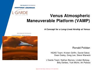
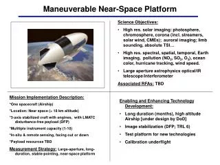
This concept entails a near-space platform for solar, Earth, and astrophysical imaging with a focus on high-resolution data acquisition and technology development. The platform houses advanced instruments for solar photosphere, Earth pollution monitoring, and large-aperture astrophysics observations. It operates in near-space (>18 km altitude) with a stabilized craft, offering long-duration stable pointing for detailed data collection.

E N D
Concept graphic Maneuverable Near-Space Platform • Science Objectives: • High res. solar imaging: photosphere, chromosphere, corona (incl. streamers, solar wind, CMEs); auroral imaging; limb sounding, absolute TSI… • High res. spectral, spatial, temporal, Earth imaging, pollution (NO2, SO2, O3), ocean color, hurricane tracking, wind speed. • Large aperture astrophysics optical/IR telescope/interferometer • Associated RFAs: TBD Mission Implementation Description: *One spacecraft (Airship) *Location: Near space (> 18 km altitude) *3-axis stabilized craft with engines, with LMATC disturbance-free payload (DFP) *Mulitiple instrument capacity (1-10) *In-situ & remote sensing, facing out or down *Payload resources TBD Measurement Strategy:Large-aperture, long-duration, stable-pointing, near-space platform • Enabling and Enhancing Technology Development: • Long duration (months), high altitude Airship [under design by DoD] • Image stabilization (DFP; TRL 6) • Test platform for new technologies • Calibration underflight