Download
1 / 22
220 likes | 236 Views
HydroShare enables collaborative data sharing and modeling for better hydrologic forecasting. It facilitates sharing time series, geographic data, and models used by hydrologists. Join the community at hydroshare.org!

E N D
Share and Publish Your Data and Models with HydroShare David Tarboton, Ray Idaszak, Jeffery Horsburgh, Dan Ames, Jon Goodall, Larry Band, Venkatesh Merwade, Alva Couch, Rick Hooper, David Maidment, Pabitra Dash, Michael Stealey, Hong Yi, Tian Gan, Tony Castronova, Brian Miles, Zhiyu Li, Mohamed Morsy, Shaowen Wang, Yan Liu USU, RENCI, BYU, UNC, UVA, CUAHSI, Tufts, Texas, Purdue, Caktus, NCSA http://www.hydroshare.org OCI-1148453 OCI-1148090 2012-2017
Motivation • Advancing Hydrologic Understanding • requires integration of information from multiple sources • is data and computationally intensive • requires collaboration and working as a team/community Analysis Grand challenge (NRC 2001): Better hydrologic forecasting that quantifies effects and consequences of land surface change on hydrologic processes and conditions Data Models Floods and Droughts
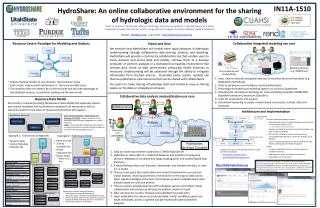
Web Based Collaboration Environment www.hydroshare.org Enable more rapid advances in hydrologic understanding through collaborative data sharing, analysis and modeling
Data and models used by hydrologists are diverse… • Time series • Geographic rasters • Geographic features • Multidimensional space/time • Model programs • Model instances • … http://www.usgs.gov http://www.unidata.ucar.edu http://www.esri.com From Jeff Horsburgh
At its heart, HydroShare is a system for sharing Resources and Collaborating • Files and sets of files structured to represent a hydrologic process, model, or element in the hydrologic environment • Standard data models enhance interoperability and support functionality “hydro value added” • Tools (Web apps) that act on resources to visualize, modify and create new resources • Encode standard/best practices • Access control and sharing model
Architecture • Web software to operate on content you have access to (Apps) • Extensibility • Organize and annotate your content • Manage access HydroShare Apps Django website API Actions on Resources Resource exploration OAuth API API Anyone can set up a server/app platform (software service) to operate on HydroShare resources through iRODS and API iRODS “Network File System” Distributed file storage SWATShare (Hubzero) CyberGIS Unidata - THREDDS, Hyrax Landlab ? Parallels the paradigm for how PC’s are used CyberGIS Data Store HydroShare Data Store
HydroShare Functionality • Sharing and publication of data (DOI) • Social discovery and added value • Model sharing • Model input data preparation • Model execution • Visualization and analysis (best of practice tools) Collaboration, Reproducibility, Credit, Transparency Clearing your desk! • Server/Cloud Computation • Platform independence • Big data • Reproducibility • Reduce needs for software installation and configuration
Clearing your desk. The trend towards network (cloud) computing. Can we deliver Hydrologic Research and Analysis functionality as a service over the web? Data Sources Server Software as a Service Functions and Tools Users Based on slide from Norm Jones
http://apps.hydroshare.org supports web based visualization and analysis working with HydroShare Resources
Hydrologic Terrain Analysis (TauDEM) Pit Removal Raw DEM Flow Related Terrain Information Flow Field Watersheds are the most basic hydrologic landscape elements http://hydrology.usu.edu/taudem
Ridge sr sr pr pr vr vr Point of interest Stream ps ps vs vs ss ss hr hr hs hs TauDEM generalized terrain flow surfaces Distance to stream (vertical) Decaying accumulation Dinfinity contributing area Distance Down and Distance Up
Using TauDEM today requires • Expertise in Hydrologic DEM analysis • The software • ArcGIS licenses (for ArcGIS plugin) • The ability to install software • TauDEM command functions with MPI installation • Compilation for other platforms • Sufficient Hardware (RAM and Disk) • The data (uncompressed GeoTIFF, projected, consistent grid size and spatial reference)
TauDEM in CyberGIS http://gateway.cigi.illinois.edu/ Analysis submitted Analysis running Results data created Results Ready
An Example: TauDEM and Height above the Nearest Drainage (HAND) for flood inundation mapping • WRF + NOAH-MP + RAPID/SPRNT produce flows at reach scale • Need a way to obtain reach level hydraulic properties for inputs to these models • Need a way to map from reach scale stage to flood inundation depth • Exploit high resolution topography represented by a digital elevation model (DEM) Additional details are in: https://www.hydroshare.org/resource/f1d1d9b5b70f4174b650c899168f632a/
Height above the nearest drainage (HAND) flood mapping • Each stream reach has a water depth hw (e.g. from SPRNT) • Each stream reach has an ID • Each grid cell has the ID of the reach it connects to and the height above the nearest stream hs • Evaluate approximating inundation using hw-hs If(hw(id) > hs(id)) Inundation depth = hw(id) - hs(id) Else Inundation depth = 0
Reach based height above nearest drainage flood map example hw=9 ft hw=8 ft hw=11 ft hw=12 ft hw=14 ft hw=10 ft hw=15 ft
Terrain based derivation of “reach scale” hydraulic properties • A table with reach hydraulic parameters as keyed to hydrography • Derived from DEM or LIDAR For each Catchment For each height h Identify cells where hs < h Single Cell Plan Area =dx * dy Surface Area As Surface area Bed Area Approximates each cell as sloping plane L Wetted Bed Area Ab Volume = T V Volume T Cross Section Area A Depth h P Wetted Perimeter P T Top Width R Hydraulic Radius
Reach Hydraulic Properties Example 1 m inundation 3 m inundation
Terrain Approximated Reach Average Hydraulic Properties Hydraulic Radius Wetted Perimeter Cross-sectional Area Top Width Need to evaluate in Hydraulic Model (e.g. SPRNT)
HAND Conclusions • The height above nearest drainage approach suggested as way to rapidly approximate real time flood inundation • Includes an approach to approximate reach scale hydraulic properties • Need to evaluate versus more detailed (e.g. HEC-RAS) hydraulic model • Need to evaluate with HRT (LIDAR) vs general (NED) DEM as input
Summary • A new, web-based system for advancing model and data sharing • Access multiple types of hydrologic data using standards compliant data formats and interfaces • Flexible discovery functionality • Model sharing and execution • Facilitate and ease access to use of high performance computing • Social media and collaboration functionality • Links to other data and modeling systems
Thanks to the HydroShare team! • USU • RENCI/UNC • CUAHSI • BYU • Tufts • UVA • Texas • Purdue • SDSC • Caktus http://www.hydroshare.org OCI-1148453 OCI-1148090 2012-2017