Download
1 / 51
530 likes | 570 Views
Learn about NASA's NPP & NPOESS missions, the VIIRS sensor suite, and operational/research data products. Discover how VIIRS extends previous measurement series and supports ongoing environmental monitoring efforts.

E N D
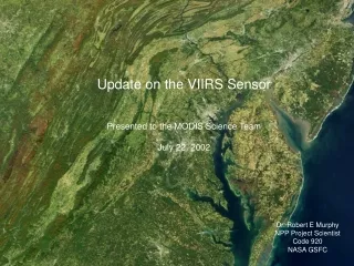
Update on the VIIRS Sensor Presented to the MODIS Science Team July 22, 2002 Dr. Robert E Murphy NPP Project Scientist Code 920 NASA GSFC
What is NPP? • NPP is a “bridging mission” that provides for the continuation of measurement series initiated with EOS Terra & Aqua for NASA’s global change research • Climate change • Global carbon cycle • Global water cycle • NPP provides risk reduction for the National Polar-Orbiting Operational Environmental Satellite System (NPOESS) which will continue these measurements into the indefinite future • NPP is a joint program of NASA and the Integrated Program Office (IPO), the tri-agency activity that is responsible for NPOESS
METOP NPOESS METOP NPOESS 0530 1330 0930 Local Equatorial Crossing Time NPOESS What is the NPOES Mission? Mission Provide a national, operational, polar-orbiting environmental capability Achieve National Performance Review savings by converging DoD and NOAA polar satellite programs Incorporate new technologies from NASA and others Incorporate, where appropriate, International Cooperation (EUMETSAT)
WindSat/Coriolis EOS-Terra NPP EOS-Aqua Satellite Transition Schedule(9 March 2001)Slopes indicate 10-90% need (NPOESS GAP 5b) Projected End of Life based on 50% Need CY 99 00 01 02 03 04 05 06 07 08 09 10 11 12 13 14 15 16 17 18 0530 F18 F20 F16 C3 NPOESS DMSP 0730 - 1030 F17 F15 F19 C1 or C2 NPOESS NPOESS DMSP M POES METOP Local Equatorial Crossing Time 1330 N’ N L (16) C2 or C1 NPOESS POES Earliest Need to back-up launch S/C Deliveries Earliest Availability
NPP Sensors • The Visible Infrared Imaging Spectroradiometer Suite (VIIRS) extends measurement series initiated by MODIS on EOS Terra & Aqua • Design is evolutionary from MODIS • The Cross-track Infrared Sounder (CrIS) continues measurement series initiated by AIRS on EOS Aqua • Utilizes a Michelson interferometer in contrast to AIRS, which is a spectrometer • The Advanced Technology Microwave Sounder (ATMS) continues the measurement series initiated by the AMSU on NOAA-15 • MMIC Technology used to reduce mass, power & volume • An Instrument of Opportunity is under consideration • Aerosol Polarimeter Sensor • CERES • OMPS • SAGE III • Code S payload • Decision August 2002
NPP & NPOESS Orbits • NPP has 824 km Sun synchronous orbit • 10:30 AM descending node • 98.74° inclination • Mimics Terra ground track repeat • 16 day ground-track repeat • Swath width 0f 3,000 Km (±56.06°) • NPOESS has 833 km Sun synchronous orbits • All 3 satellites will carry a VIIRS • 09:30 descending node • 13:30 ascending node • 17:30 ascending node • Swath width of 3,000 km (±56.06°)
Operational & Research Data Products • The operational system (NPOESS) will produce Environmental Data Records (EDR’s) of geophysical products in less than 90 minutes from acquisition • Timeliness requirement limits accuracy & consistency that can be obtained • Yesterday’s weather is of limited use • NASA’s program requires maximum accuracy and consistency over many years • Timeliness is not an issue • NASA will produce similar geophysical products in the form of Climate Data Records (CDR’s)
Visible Infrared Imaging Radiometer Suite (VIIRS) • Purpose: Global observations of land, ocean, & atmosphere parameters at high temporal resolution (~ daily) • Predecessor Instruments: AVHRR, OLS, MODIS, SeaWiFS • Management: Integrated Program Office • Status:Phase C/D (Raytheon) • Approach: Multi-spectral scanning radiometer (22 bands between 0.4 m and 12 m) 12-bit quantization • Swath width: 3000 km • Changes to specifics of band dynamic ranges, bandpasses & band centers negotiated • Consideration of adding 6.7 micrometer water vapor band to FM3 & later models • CDR Completed March 2002
Separately Mounted Electronics Module Solar Diffuser FPIE Blackbody Half-angle Mirror Cryoradiator Cold FPA Dewar Assembly 3-Mirror Anastigmat All reflective Rotating telescope 4-Mirror Anastigmat All Reflective Aft Optics Imager Visible Infrared Imaging Spectroradiometer (VIIRS)
VIIRS Spectral Bands • 22 Bands • Subset of MODIS bands plus day-night panchromatic band • Two spatial resolutions • Imagery resolution bands: 370 m at nadir • Moderate resolution bands: 740 m at nadir • Features • 8 (Moderate) or 16 (Imagery) detectors per scan • Bands spatially nested • Some bands have dual gain • Maximize dynamic range without precision penalties • Constrained pixel growth with scan angle
Detector Aggregation Reduces Pixel Growth to 1060km To ~ To VIIRS Reduces Pixel Size Along Scan: Much Better HSR, SNR Toward Nadir AVHRR & MODIS “1 km” Bands: ~2x6km At Edge Vs. VIIRS 1.6x1.6 km At Edge Horizontal Sampling Interval to 1060km To ~ To Horizontal Sampling Interval Moderate and Imaging bands nest 2x2
Reduced Pixel Growth Along Scan Ratio of Off-nadir pixel to nadir pixel ~1500 km
Calibration • Stray light much better than MODIS • Driven by needs of the day-night (DNB) • Rotating telescope, extensive baffling reduces scattered light • V-grove blackbody similar to MODIS • Baffled to avoid Earth illumination • Emissivity of 0.9998 • Controlled to 290K by pulsed voltage • Heat to 315K • Solar Diffuser (SD) evolutionary from MODIS • 1 time door • New design eliminates “ripples” • Solar Diffuser Stability Monitor (SDSM) evolutionary from MODIS • 7 bands • Views 70% of SD area • Planning to use 2nd order polynomial for all bands • Characterization plan similar to MODIS • Lunar views possible
Some Issues • Dynamic range for fire is inadequate • Similar issue faced on MODIS • “Imagery” & SST are the two highest priority EDRs for the IPO • “MODIS compromise” not acceptable • Multi-band algorithmic solution may be possible • 645 nm band (I-1) dynamic range increased to avoid saturated pixels for imagery • Spectral requirements changed from center wavelength of 645nm (50 nm wide) to 640nm (80nm wide) • Modest compromise to VI work • 751 nm band (M-6) center wavelength changed from 751nm to 746nm • NASA geolocation requirement (200 m 3 s) not an IPO requirement • Margin is eroding to achieve this accuracy • Consideration being given to adding 6.7 micrometer band for FM3 & beyond
Fine Scale WV Depiction MODIS 1 km resolution reveals mountain waves
Algorithm Development Status (1 of 3)and Delivery of the V5 ATBDs EDR Final Baseline Adopted/Adapted/Developed ATBD# Imagery Energy Budget/Spectral Adapted Y2466 SST 4-Channel Skin--ATSR, MODIS Adapted (ATSR, Brown, Emery) Y2386 Air-mass classification Cirrus, aerosol mitigation Soil Moisture CMIS/VIIRS Data Fusion Adapted (Carlson) Y2387 Aerosol Optical Dark Pixel Method Adapted (Kaufman, Tanre, Vermote) Y2388 Thickness, Particle Developed radius (Vermote) Size, Effective Radius Suspended Matter Multiple Indices & Adapted Y2390 Dominant Type Cloud Base Height Cloud Property LUT Adapted (Hutchison, Wilheit) Y2391 Cloud Cover/Layers Clustering based on cloud properties Adapted Y2392 Cloud Effective UCLA Ice & Water Adapted (Ou, Liou) Y2393 Particle Size Cloud Top Height, UCLA Ice & Water IR Adapted (Ou, Liou) Y2395 Temp., Pressure
Algorithm Development Status (2 of 3) Albedo, Surface Bright surfaces: Linear regression Adapted (Liang) Y2398 Dark surfaces: MODIS kernel-driven Adapted (Strahler, Lucht, Schaaf) Land Sfc. Temp 4-Channel Land Cover Adapted Y2399 Vegetation Index NDVI, EVI Adapted (Tarpley, Deering, Huete) Y2400 FPAR, LAI, NPP, PSN Adapted (Running, Knyazikhin, Myneni) Snow Cover/Depth Spectral Mixture Adapted (Hall, Dozier) Y2401 and MODIS threshold Surface Type Decision Tree Adapted (Townshend, DeFries) Y2402 Fresh Water Ice Energy Budget/Spect. Mix. Adapted Y2404 Ice Surface Temp. Split Window Adapted Y2405 EDR/SDR Final Baseline Adopted/Adapted/Developed ATBD#
Algorithm Development Status (3 of 3) Net Heat Flux Regression/Neural/Bulk Adapted (Ruprecht, Liu) Y2407 OC/Chlorophyll Carder/MODIS Case 2 Adapted (Carder) Y2408 Regionally tuneable Ocean Atmos. Corr. Improved SeaWiFS Adapted (Gordon, Wang, Liu) Y2411 With full residual (IP) polarization handling Sea Ice Age/Edge Maximum Cross-Correlation Adapted (Emery) Y2409 Land Atmos. Corr. Radiative Transfer LUT (MODIS) Adapted (Vermote) Y2411 (Surface Reflectance) (IP) Cloud Mask Thresholding/Phase Adapted (MODIS/CLAVR, Stowe) Y2412 Precipitable Water Five-band TIR Adapted (Huang) Y3251 Active Fires Raytheon HSS/MODIS Adapted (HSS, Giglio/Justice/Kaufman) Y3252 (ARR) EDR Final Baseline Adopted/Adapted/Developed ATBD#
NRA Status • An NRA for an initial science team for NPP is nearing release • The team will assist NASA in preparing to use the operational system for long term climate research • Which EDRs can be used as CDRs? • What steps need to be taken to assure climate quality data? • Use simulations based on real and synthetic data sets • Provide insight into sensor characterization • A second science team selection will be made closer to the launch of NPP
Summary • MODIS quality measurements will be continued in the operational system (NPOESS) • VIIRS draws heavily on its MODIS heritage • Some research capabilities (e.g. fluorescence, CO2 slicing bands) are not continued • Overall similar radiometric quality • Improved geometric resolution • Continued commitment to characterization and calibration • NASA science team to be competed soon
Back-Up Charts • Land Vis-NIR Bands • Ocean SWIR Bands • Atmosphere Vis-NIR Bands • Atmosphere SWIR Bands • Atmosphere MWIR Bands
Back-Up Charts • Land Vis-NIR Bands • Ocean SWIR Bands • Atmosphere Vis-NIR Bands • Atmosphere SWIR Bands • Atmosphere MWIR Bands
Back-Up Charts • Land Vis-NIR Bands • Ocean SWIR Bands • Atmosphere Vis-NIR Bands • Atmosphere SWIR Bands • Atmosphere MWIR Bands
Back-Up Charts • Land Vis-NIR Bands • Ocean SWIR Bands • Atmosphere Vis-NIR Bands • Atmosphere SWIR Bands • Atmosphere MWIR Bands
Back-Up Charts • Land Vis-NIR Bands • Ocean SWIR Bands • Atmosphere Vis-NIR Bands • Atmosphere SWIR Bands • Atmosphere MWIR Bands