Download
1 / 37
370 likes | 546 Views
North Dakota Full GIS Technical Committee Meeting. October 24, 2005. Agenda. Executive Committee Report Introductions Background Accomplishments, Current Work & Goals Hub Data Update Discussions State-wide data priorities Partnerships Conferences and Workshops Red River LIDAR update.

E N D
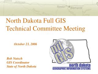
North Dakota Full GIS Technical Committee Meeting October 24, 2005
Agenda Executive Committee Report Introductions Background Accomplishments, Current Work & Goals Hub Data Update Discussions State-wide data priorities Partnerships Conferences and Workshops Red River LIDAR update
Background Last meeting November 16, 2004 Minutes: http://www.nd.gov/gis/about/gistechfull/minutes/ Executive Order 2001-06 specified: Executive GISTC – 7 agencies Full GISTC – state agencies, local federal agencies, business community
Executive GISTC Membership State Water Commission – Rod Bassler Dept. of Health – Ann Fritz Dept. of Transportation – Brian Bieber Game and Fish – Brian Hosek Geological Survey – Elroy Kadrmas Parks and Recreation – Chris Dirk Information Tech. Dept. – Bob Nutsch
Accomplishments • Core services continue to evolve: • Hub Explorer • Metadata Explorer • FTP • Web Services • Database is growing: 1600gb compared to 569gb in August 2004 • Rolled multiple Hub Explorers into one • Funding for 2005-2007
Accomplishments – GIS Hub Usage Data downloads: Since March 2004 49,500 downloads, totalling 3.7 terabytes Database: 35+ daily concurrent connections from state agency users Web applications: YTD averaging 60,000 hits per month
Accomplishments – General Coordinated Training – From February 2002 through June 2005, state agencies combined have saved nearly $52,000 in training costs alone. 120+ trained. The GIS Hub data on geodata.gov and nationalmap.gov Open Geospatial Consortium (OGC) Web Map Service (WMS) is available
Accomplishments – General • GIS software in schools – 20+ schools and 5 community colleges currently involved • NAIP 2003 is a reality • Signed MOU with Community GIS Technical Committee (CGISTC, led by Richland County) • ND GIS web site updated
Updated Web Site • Be sure to check out the other links: • About Us – Committees: minutes from GISTC meetings and other info • News – Past and recent news items • Resources: • Activities – links to other companies, organizations, etc. • Standards – state and federal • Training – certified ESRI training • Employment – ND GIS-related • Software & Tools – utilities and other things
Submit a GIS image! Updated Web Site
Accomplishments – Applications DOT – ‘quick map’ application Department of Health – internal application Game and Fish – updated Hub Explorer Parks and Recreation – hosting of NatureServe Biotics Department of Agriculture – groundwater pesticide sensitivity
Accomplishments – ND Conferences • Started out as GIS Day, transition to Users Conference beginning with 2005 • Registered attendance levels: • 2001: 40+ • 2002: 100 • 2003: 120 • 2004: 95 • 2005: 110
Current Work Merging the Geological Survey clearinghouse is still in progress Data: NAIP, aquifers, HUC, 24k hydro, National Geographic DRGs, NWI, SSURGO Apps: Rangeland Fire Index, Commerce Streamlined Sales Tax Replace Vision Document with Strategic Plan format
Goals – General • Work more closely with local & federal government, identify partnering opportunities • Server upgrades – ESRI software and hardware (ArcIMS and ArcSDE) • Web tools – enhance Hub Explorer • Expand WMS
Goals – General • Streamline data loading • Improved raster downloading • Involvement with National Spatial Data Infrastructure (NSDI) – standards, policies, technology, etc. to facilitate data sharing and data use • Sign NSDI agreement with USGS
Goals – Data • These are in addition to the on-going data projects • NAIP 2005 (1m) • Local data: • Bismarck-Mandan aerial photography • Cass County • Update 30-meter Level 1 DEMs and others as budget allows • Road centerlines – possible pilot
Goals (longer term) – Data • Geodetic survey layer • Cadastral • Additional local data from cities and counties • Other “framework” layers – more info after break
Hub Data – The Approach Overview of Process Submitted by a data steward Reviewed by Data Oversight Committee Pushed into production Set up for download and web services Resources Using the tools available at an agency Agency fits in the work as they can Outsourcing?
Hub Data – Current Projects Update Hydrologic Unit Boundary – Ann Fritz Aquifer update – Rod Bassler 24k hydrographic update – Rod Bassler NAIP – Brian Hosek
Finally… BREAK TIME !
Discussion – State-wide Data Priorities • Suggestions • Needs • Wants
Discussion – State-wide Data Priorities Suggestions from last year Physiographic regions Improved soil attributes Improved water attributes Outcrop mapping Coal/oil/other mineral resources Biology: endangered species habitat, weed & wildflower range, forest location & composition Weather: storm-prone areas, seasonal degree growing days Any others?
Discussion – State-wide Data Priorities • Executive GISTC Priorities • Road centerlines • Elevation – replace Level 1 DEMs first, state-wide in future • Continue acquiring NAIP • Framework layers
Framework Layers • Framework layers are part of the NSDI, more information at http://www.fgdc.gov/framework/framework.html • Framework layers are essential for emergency management, applications • Framework layers can include both federal and state categories
Discussion – State-wide Data Priorities • Now that we’ve looked at some ideas, what is the group’s data priorities for Executive GISTC? • First? • Second? • Third?
Discussion – Partnership Ideas • MOUs • Data sharing – mutual benefit • Data collection – communicate plans • Standards development • Metadata hosting – Cass County is doing this, who else is interested?
Future Users Conferences • Need your feedback and direction! • Frequency? Time of year? • Topics? • Duration? • Location: • Bismarck, other city, casino (logistics?) • Alternate with South Dakota?!
Other Workshops & Conferences • ND GIS Workshops • In the past: Remote Sensing, Mobile GIS • Future topics? • MidAmerica GIS Consortium (MAGIC) • $225 full registration • Every two years in Kansas City • Possible grant program • http://magicweb.kgs.ku.edu/
General Comments & Feedback • Suggestions to the executive GISTC? • Questions? • How can the Full GISTC be improved? • Etc.
Red River LIDAR Update Presentation by Wes Peck, UND Energy & Environmental Research Center
Thank You! For more information, please contact: Bob Nutsch, GIS Coordinator 701-328-3212 bnutsch@state.nd.us www.nd.gov/gis