Download

1 / 17
170 likes | 245 Views
Discover how geocaching can enhance learning through GPS technology, fostering student engagement and personalized instruction. Utilize geocaching to teach geography, directionality, latitude, and longitude. Create innovative lessons and activities tailored to diverse learners. Step into an exciting world of outdoor exploration to enrich educational experiences.

E N D
Eureka: Using Geocaching to Support Differentiation Dr. Barbara L. Branch Branch Consulting
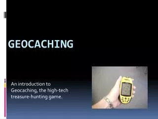
What is geocaching? Began in 2000 • Military satellites opened to the public • On May 3rd, someone hid a ‘cache’ in Oregon. It was visited twice within 3 days and logged in the log book once. • Mike Teague, the first to find it, built a web page to document the ‘caches. • Jeremy Irish, the current operator of the Geocaching website, expanded the idea and named it ‘geocaching’.
What is geocaching? • Individuals hide ‘caches’ or treasure boxes
What is geocaching? • They post latitude and longitude on the internet www.geocaching.com • Others locate the treasure using a GPS unit and log the visit • Sometimes the hunter trades treasures or leave treasures (called swag)
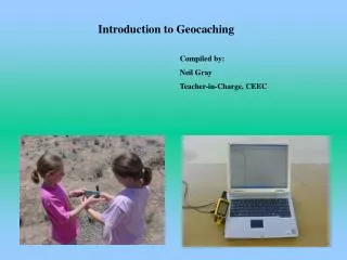
Getting Your Students Started You need a classroom or school set of 10-15 GPS Units & Compasses • Write a technology grant for $500 - $1000 • Tech Grants • Donors Choose.org • Garmin • etrex • GPS 60 • Compasses • Bruton
Getting Your Students Started • Teach latitude and longitude • Teach GPS Unit and compass use • Teach GPS • Teach geocaching vocabulary • Cache • Swag • FTF • DNF • Log • Waypoints • Geocoins
Getting Your Students Started • Teach the geocaching process • Get started with simple caches that are large enough to see without too much exploring (plastic glad storage containers) • Hide caches in your schoolyard or neighborhood park
Supporting Differentiation • Select a lesson or unit you want to differentiate • Select an activity or final project • Do the activity as a geocaching session • Hide the clues or questions in caches • Students learning about geography, directionality, latitude, and longitude • Tiering can be done by creating various levels of questions, activities, or information for each cache • Compacting can be done by providing different caches for different levels of students.
Supporting Differentiation • History • Explore historic sites, cemeteries, landmarks using GPS • Create a family vacation • Science • Plot various GPS locations along a local river or lake and evaluate water quality at each location • Use Google Earth to follow the Iditarod Race • Math • Find caches with objects to measure, record, and figure the average • Provide riddles or word problems at each cache
Is this worth the time? • Active learning • 10% vs 90% of retention • Stimulates students to search further and ask more questions • Gets kids and you outside and physically active • Students can share with their families and create a new healthy family activity • It’s fun