Download
1 / 12
120 likes | 294 Views
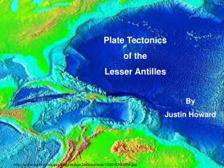
Plate Tectonics of the Lesser Antilles. By Justin Howard. http://www.ngdc.noaa.gov/mgg/image/2minsurface/1350/45N090W.jpg. Lesser Antilles. Location The chain of islands wrapped around the eastern end of the Caribbean Sea on the boundary with the Atlantic ocean. Islands

E N D
Plate Tectonics of the Lesser Antilles By Justin Howard http://www.ngdc.noaa.gov/mgg/image/2minsurface/1350/45N090W.jpg
Lesser Antilles • Location • The chain of islands wrapped around the eastern end of the Caribbean Sea on the boundary with the Atlantic ocean. • Islands • The US Virgin Islands, British Virgin Islands, Anguilla, Saint Kitts, Nevis, Antigua, Barbuda, Saint Vincent, Barbados, St. Lucia, Dominica, Guadeloupe, Montserrat, Grenadines, Grenada, Trinidad, Tobago, The Netherlands Antilles, the island off the coast of Venezuela, and Aruba. http://www.sitesatlas.com/Maps/Maps/309.htm
Tectonic Plates of Earth http://www.sitesatlas.com/Maps/Maps/309.htm • Tectonic Plate • A piece of the Earth’s lithosphere, or crust.
Plate Tectonics • The theory developed to explain the phenomena of continental drift. • The outermost part of the Earth’s interior is made up of two layers. • The Asthenosphere • The region located beneath the lithosphere between 100 and 700 Km below the surface. • The Lithosphere • The outermost solid shell of Earth between the uppermost layer of mantle and the crust. • Plate Boundaries • Transform Boundaries • The grinding of two plates along transform faults, where the rock fracture is caused by lateral movement of two surfaces. • Divergent Boundaries • The sliding of plates past each other. • Convergent Boundaries • The sliding of two plates toward each other and one is forced under the other.
Plate Boundaries http://www.wordiq.com/definition/Image:Tectonic_plate_boundaries.png
Plate Tectonics of the Lesser Antilles • Consists of Convergent boundaries where the Atlantic and Caribbean plates meet. • The rate of subduction is on average 1 inch per year. • Seventeen volcanoes have been active in the last 10,000 years, the Holocene, in the West Indies. • Active Volcanoes include: • Kick-Em-Jenny • Soufriere Hills http://www.mount-pelee.com/arcvolc.htm#
The chain of volcanoes present at the mid-oceanic ridge is a result of the subducted Cocos Plate beneath the west edge of the Caribbean Plate. http://volcano.und.nodak.edu/vwdocs/volc_images/north_america/west_indies.html
A Cross-Sectional View of the Lesser Antilles’ Convergent Boundary http://www.mount-pelee.com/arcvolc.htm#
Results of Tectonic Activity in the British Virgin Islands: Virgin Gorda Justin Howard
70 million years ago, during the Tertiary, magma accumulated on the lava layers of the Caribbean seabed forming huge sections of granite. Justin Howard
It wasn’t until 15-25 million years ago that the granite created under water was exposed by faulting and uplifting.That granite, pictured here, has since been weathered (largely by acid rain). This explains the rough, flaking surface. Justin Howard Justin Howard
Bibliography • Howard, Justin. Personal Photos, Virgin Gorda, BVI. 2004. • Press, Frank et al. Understanding the Earth. Freeman Press, New York, NY. 2004. • http://www.ngdc.noaa.gov/mgg/image/2minsurface/1350/45N090W.jpg • http://www.mount-pelee.com/arcvolc.htm# • http://www.sitesatlas.com/Maps/Maps/309.htm • http://www.wordiq.com/definition/Image:Tectonic_plate_boundaries.png • http://www.thebathsbvi.com/map.htm • http://volcano.und.nodak.edu/vwdocs/volc_images/north_america/west_indies.html


