Comprehensive Overview of Weather Forecasting: Techniques and Technologies
This chapter delves into the intricate blend of art and science that defines weather forecasting. It traces the history of the National Weather Service (NWS), highlighting its evolution from the Army Signal Corps to its current status within the NOAA. Key forecasting methods, including climatological predictions, persistence forecasts, and numerical modeling, are discussed in detail. The role of automated systems like ASOS and advanced modeling techniques, including ensemble forecasting, are examined. Additionally, the significance of weather maps and technological tools in accurate forecasting is emphasized.

Comprehensive Overview of Weather Forecasting: Techniques and Technologies
E N D
Presentation Transcript
Part 5. Human Activities Chapter 13 Weather Forecasting and Analysis
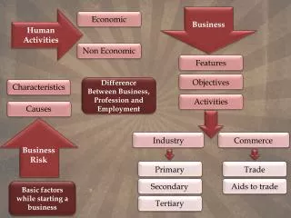
Introduction • Weather Forecasting – Both Art and Science • National Weather Service • Began as Army Signal Corps, then National Weather Bureau • Part of the National Oceanic and Atmospheric Agency (NOAA) • National Centers for Environmental Prediction (NCEP) • Automated Surface Observing Systems (ASOS) • Data acquisition and dissemination • World Meteorological Organization (WMO) • 170 member nations with 10,000 land stations, 7000 ships, 300 buoys, weather satellites, and 1000 weather balloons (twice daily)
Upper atmosphere • Radiosondes, rawinsondes A radiosonde launch
Forecasting methods • Climatological forecasts • Persistence forecasts • Analog approach • Numerical weather forecasting • Types of forecasts • Qualitative forecasts • Probability (PoP) forecasts • Quantitative forecasts
Numerical Modeling and Weather Forecasting (supercomputer-based forecasts) • Analysis phase -- create or update a computer code of a numerical model of the atmosphere • Numerical model -- mathematical model of atmospheric circulation and moisture; includes equations of motion, continuity, energy, etc. • Prediction phase • Start by inputting current and recent atmospheric conditions into the model/computer program • Solve equations to obtain prediction of future atmospheric conditions • Output maps and other prediction products • After some time elapses (hours or days), repeat the process with the latest current data
(a)-(c) = Three numerical models, (d) = Final forecast, (e) = Observed Precipitation forecast Observed precipitation Forecast represents some type of weighted average of the individual forecast maps
24-hr forecast skill for various NCEP models Forecast results from 1995. Forecasts of heavy precipitation were less accurate than forecast of light precipitation. Here, the EDAS model was most consistently accurate.
24-hr, 1-in. NCEP precipitation forecast skill average Forecast skill from 1983-1993 for manual forecasts. Winter precipitation forecasts were better than summer forecasts.
MOS Example Forecast skill is steadily improving with time.
Medium range forecasts (MRF) -- 72 hours to a few weeks • Several different numerical models are used to make medium range forecasts • Ensemble forecastingis a forecast in which the predictions from several different computer model forecasts are combined to form an ensemble average
A 10-day ensemble forecast of the 500 mb layer Lower forecast reliability is expected where the model forecasts disagree. Higher forecast reliability is expected where the model forecasts all agree.
Long range forecasts cover times from several weeks to several months or more • Use climatology, statistics, numerical modes, and subjective judgment • Usually involve coupled ocean-atmosphere models • Are produced in the USGS by NOAA’s Climate Prediction Center (CPC)
Weather Maps and Images • Forecasting done by experienced meteorologist • Examination and analysis of many weather charts and models • Surface maps • Large-scale features depicted • Pressure cells, winds, station models
Early morning 850 mb maps can be used to predict surface high air temperatures; the surface high temperature is usually about 27° higher than the early morning air temperature at 850 mb in summer (22° in spring and fall, 16° in winter).
700 mb maps can be used to help forecast cyclogensis and thunderstorm movement
500 mb maps help with forecasts of cyclone development and movement
300 mb and 200 mb maps show the locations of the jet stream and strong jets; these help determine Rossby wave movements
Convergence/divergence associated with jet streaks Slower moving air Faster moving air Slower moving air
Thermodynamic diagrams • Temperature and humidity values plotted • Indicates stability A Stuve diagram
Lifted index • Thunderstorm potential • Negative values indicative of thunderstorms • K-index • Indicates air mass thunderstorm potential • High positive values (> 15) indicate thunderstorm potential
End of Chapter 13Understanding Weather and Climate4th EditionEdward Aguado and James E. Burt