Download
1 / 23
230 likes | 252 Views
Learn about groundwater formation factors, wetland characteristics, aquifers, soil profiles, and the interplay between groundwater and surface water in diverse ecosystems. Discover the impact on biodiversity and global distribution.

E N D
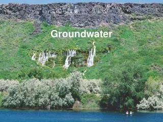
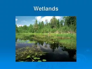
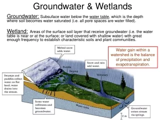
Groundwater & Wetlands Water gain within a watershed is the balance of precipitation and evapotranspiration. Groundwater: Subsuface water below the water table, which is the depth where soil becomes water saturated (i.e. all pore spaces are water filled). Wetland: Areas of the surface soil layer that receive groundwater (i.e. the water table is near or at the surface; or land covered with shallow water) with great enough frequency to establish characteristic soils and plant communities.
New Groundwater Formation • Intensity/duration of precipitation. • Vegetation cover and evapotranspiration. • Topography and recharge zones. (Infiltration rate is called recharge.) • Extent of vadose (unsaturated) Zone • Sheet flow (runoff) versus infiltration - Soil texture & permeability (courser the more infiltration) - Soil water content & holding capacity (high values may impede infiltration) / percolation
Composition results from the type of geological substrata (bedrock), weathering climate, age of development, vegetation type. Layers (horizons) are observed with depth, from more organics at the surface to less weathered bedrock fragments at depth. Soil Overview Profile of Soil Horizons: Soil Texture Triangle: Organics? 0.004-0.062 mm 0.004 mm 0.2 – 2 mm
Subsurface Habitats: = vadose zone / unsaturated = groundwater = Geologic substrata Aquifer = groundwater that is contiguous (connected) over an area. They may be unconfined from the surface, or confined from the surface by an impermeable or semi-permeable geologic strata (layer) called an aquitard.
High Recharge: (Storms; Flat terrain; High permeability) Porosity = amount of water held in a volume of sediment; fraction of sediment volume as pores and fractures; often relates to permeability but not always (e.g., biofilms; clays; disconnected channels).
Groundwater Flow • Permeability will greatly influence flow: • Finer & consolidated slower • Courser & unconsolidated faster • Channels faster • Darcey’s Law: flow rate in porous material increases with pressure and shorter flow path. • Tortuosity (length of flow path) • Pressure (hydraulic head) Which diagram illustrates a habitat with faster flow rate and why? Assume equal hydraulic head.
Hydraulic Head (Δh) & Gradient (HG) All three wells are in the groundwater. Explain the difference in “Artesian” flow.
Notice that rock more resistant to weathering dissolution remains as elevated features (hills & cliffs). Caves, waterfalls, cinotes, and vanishing streams are some features of the karst landscape.
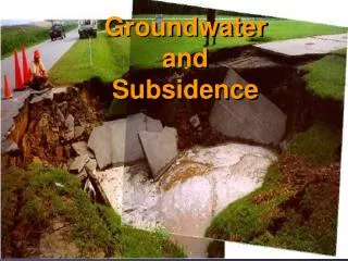
(Fig 4.5; Dodds, 2002) * Pumped wells can deplete groundwater. * There may be connections with seawater.
Groundwater Meets Surface Water Stream and lake hydrodynamics is influenced by ground water. How it is influenced depends on the water table level; hence, precipitation. Wet seasons when there’s a high water, groundwater may feed the stream in addition to runoff events. Dry seasons when the water table is low, sheet flow runoff may be the only source of stream flow, in which case the stream feeds (recharges) the groundwater. Wet season Dry Season
Zone of surface water (lakes or streams) and groundwater interaction
Groundwater & Hyporheic Life • Microbes Rule! (bacteria, fungi, protists) • Biofilms are fed by DOC. • Important microbial transformations of elements depending on oxygen supply. • Hyporheose: • Hyporheic Zone is an ecotone. • Biofilms my have characteristic of both. • Stream fauna may be throughout. • Unique fauna exists (dark adapted, Family Bogidiellidae). • Lots still to be discovered!
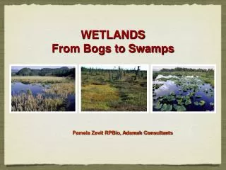
Wetlands • Characteristic hydric soil and hydrophytic vegetation as signs of frequent surface saturation or inundation. • Many types of wetlands: (Dodds, 2002; Table 4.3) • Salt-marshes and (temperate, seawater influence) • Mangrove forests (tropical, seawater influence) • Tidal & non-tidal freshwater marshes • Deepwater (cypress) swamps • Northern (bogs & tundra) wetlands • Riparian forests/wetlands • Man-made (rice paddies & bioremediation) • Function as nutrient and sediment traps; slow runoff and facilitate recharge; most are highly productive.
Global Distribution Depressional Peatland bog Coastal Mangrove (Matthews, 1993)
Wetland ecosystem types are based on hydrologic regime, climate, geomorphology, nutrient input and vegetation. (Dodds, 2002; Table 4.5) • Geomorphic: Peatlands; Coastal; Riverine; Depressional. • Hydrologic Regime: • Permanence, predictability (e.g. tidal), seasonality • Primary water source: • Precipitation; low throughput (ombrotrophic) • Riverine; potentially high throughput (minerotrophic) • Groundwater • Climate determines the balance of precipitation and evapotranspiration. (E.g., much less precipitation is required for tundra wetlands than that for a tropical savanna wetland.)
Human Impacts on Groundwaters; Streams and Wetlands • Groundwater or surface pumping: • agriculture • industry • drinking waters. • Clearing riparian forests & wetlands • Draining and filling for “development”. • Damming and flooding • Diversion channels for water supply.