Download
1 / 31
310 likes | 485 Views
MISR Products and Tools. “Life of an HDF-EOS Science Data Product. A gritty, behind-the-scenes exclusive!” Brian Rheingans and Kyle Miller MISR Instrument Team. MISR, EOS-Terra Instrument. Multi-angle Imaging Spectro-Radiometer 9 cameras, 4 spectral channels, pushbroom CCD.

E N D
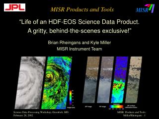
MISR Products and Tools “Life of an HDF-EOS Science Data Product. A gritty, behind-the-scenes exclusive!” Brian Rheingans and Kyle Miller MISR Instrument Team
MISR, EOS-Terra Instrument • Multi-angle Imaging Spectro-Radiometer • 9 cameras, 4 spectral channels, pushbroom CCD. • Continuous daylight swath acquisition. • 150 TB of HDF at the Langley DAAC. • ~50 product types, hundreds of fields. http://www-misr.jpl.nasa.gov
You Are Here Only 3% of the Length of One MISR Swath shown
MISR Swath • 400 km swath width. • Several product types > 2GB uncompressed. • HUGE extent of latitude/longitude. • Stringent science constraints on distortion and geolocation. • Ambitious algorithms. • Stringent size, and computing restraints. • HDF-EOS on HDF4
HDF-EOS Stacked-Block Grid • 180 blocks per path; fixed locations. • Same-size, rectangular in SOM. • Each block is compressed as a separate chunk. • HDF-EOS Grid meta describes top block. • Other blocks offset to follow ground track; part of MISR-unique ext. of HDF-EOS. • Foundation of 2 mil. Lines of science code
HDF-EOS File vs. Aligned Image Red Channel Grid SDS (180 Stacked Blocks) sample Sample dim SOM X: 10,000,000 m Y: 450,000 m ( path-specific) Line dim Block dimension • SOM coordinates of top-block corners part of • Grid metadata. • -Projection and orbital parameters part of Grid • Metadata • Offsets of each block from the one above part of • Stacked-block grid extension metadata.
Where does this pixel belong? • Lat/Lon not stored in product. • In the SDS pixel = (block, line, sample) • Conversion <-> SOM <-> Lat/Lon require: • Several different metadata reads. • Custom code to do some offset arithmetic. • HDF-EOS grid api and use of the GCTP map proj. lib. • Lots of Patience. • Described in the MISR Data Product Specification, Appendix A. • Or BIG ancillary dataset, OR Tools!
Mapping Data Users to Tools • Use only MISR-specific GUI tools: • If you are a MISR-centric scientist with nearly zero tolerance for anything digital. • If you are a curious individual who want to fiddle with MISR data or learn about MISR file structure. • Also use geotiff converters: • If you analyze a lot of MISR data. • If you like Photoshop, GIS tools and reprojections. • If you want to co-locate MISR images with other data. • Also use custom GIS converters: • If you want to do serious data analysis involving MISR science data values (vs images) and other data in a GIS environment. • Also use DPS doc and stacked-block grid api • If you must read lots of MISR data into your custom software and you possess some programming savvy • If you are a Tool Writer/Vendor.
Path/Orbit-based Web Browse Tool http://eosweb.larc.nasa.gov See images before Ordering them. Explore path, orbit And geographic Coverage. Browse images Are jpg and aren’t Full resolution.
How can I get at MISR Metadata easily? FORTRAN GUTS Tcl-Tk GUI USERS: Beginner who Wants to learn about MISR file structure. Expert when chasing A problem. • Displays HDF-EOS structures and all metadata easily. • Allows minor editing of the HDF-EOS file. • Performs some statistics on the data. • Can only visualize single un-assembled blocks.
MISRView USER: MISR-CENTRIC SCIENCE DATA ANALYST REQUIRES IDL !!! • Maps path/orbit to time and date • Assembles multiple MISR blocks • Reports Lat/Lon via static lookup table. • Displays true color MISR imagery • Can reproject MISR imagery • Perspective tool • Band slider tool • Scroll tool • Vector overlay tool
ERDAS Imagine 8.5 Custom import routines to convert MISR HDF-EOS files into Imagine files preserving geolocation via projection parameters. SGI Irix utilities for most MISR Grid and some MISR Swath files.
ERDAS Imagine – Mount Enta Perspective DEM Overlay
L1B2_to_geotiff Conversion Tool Convert MISR imagery into generic format readable by any preferred GIS tool: • tiff / geotiff format • Preserve geolocation / projection information • Reproject to any GCTP-supported projection • Facilitate subset and mosaic procedures.
L1B2_to_geotiff – Ross Ice Shelf SOM Path 51 Oribt 5089
L1B2_to_geotiff – Ross Ice Shelf SOM Path 50 Oribt 5220
L1B2_to_geotiff – Ross Ice Shelf Polar Stereographic Path 51 Oribt 5089
L1B2_to_geotiff – Ross Ice Shelf Polar Stereographic Path 50 Oribt 5220
US/Mexico Geographic Mosaic Courtesy Jim Knighton, JPL Multiple MISR Swaths were Reprojected with L1B2_to_geotiff Prior to custom Mosaic, cloud Removal and Equalizations.