Download
1 / 13
130 likes | 256 Views
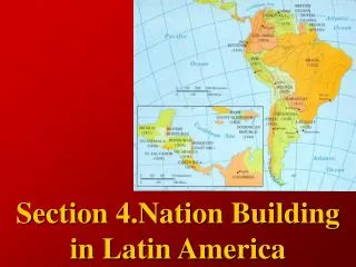
Economics & Trade in Latin America. Also see this in chapter 10, section 1. Sharp divisions between poor & rich (wealth gap) Why? Political, social and economic factors Physical geography. Agriculture.

E N D
Economics & Trade in Latin America Also see this in chapter 10, section 1
Sharp divisions between poor & rich (wealth gap) • Why? • Political, social and economic factors • Physical geography
Agriculture • ¾ people live in cities, but still rely on agriculture through exports, or the selling of farm products (bananas, sugarcane, coffee) to other countries • Farmland unevenly distributed: small group vs. large group • Rural farmers: campesinos (large group)
Agriculture • System of latifundia, minifundia breaking down • Why? • People migrating to cities as latifundia becoming more mechanized • Government: distributing lands more fairly • Formation of co-ops (combine minifundia) • Physical Geo cash crops • Cash crops: crops produced in large quantities to be sold/traded • Most grown on latifundia; benefit corporations • Coffee, bananas, sugarcane • Other countries raise cattle for export • Risks of just a few exports • Droughts, floods, volcanic eruptions • Example: Honduras (90% banana crop destroyed with Hurricane Mitch in 1998)
Industry • Most countries = developing countries, lack technology & development • Physical geography (rainforests, Andes) • Limited growth of industry • Political instability • How to overcome barriers: develop service industries (provide services, not necessarily specific goods) • Mexico: motor vehicles, processed foods • Brazil: iron, steel, cars, airplanes • expanding trade stronger economies!
Tourism: Pros & Cons Advantages: Income Create jobs Cruise ships anchor in port Hotels, restaurants, etc have opened Narrows the gap between the rich and poor Disadvantages: Congestion occurs Pollution increases Govts. Can run up debt building tourist attractions Owners may not live in country Tourism is a growth industry throughout Latin America
Maquiladoras • Definition: manufacturing plants along the Mexico-US border • American, Japanese firms have built these plants in the last 50 years • Both countries = industrialized, top builders (especially in ‘50s, US occupation in Japan) • Ciudad Juarez, Tijuana • Employs many Mexicans • Why? • Benefit US & Japanese corporations: allows them to hire low-cost labor & to produce duty-free exports • Offers country & people employment opportunities, investment income • Critics: damages environment, encourages low-paying & dangerous jobs, ignores labor & environmental laws
Trade & Eco • North American Free Trade Agreement (NAFTA) • 1992 • Mexico, US & Canada • Reduced trade restrictions, increased flow of goods, services & people among countries • After NAFTA: trade between countries increased 10-15% annually • Viewpoints on NAFTA • Americans fear loss of jobs to lower-paid Mexican workers • Mexico: NAFTA has helped us boost exports & create 1,000s of new jobs • Other countries seeing if NAFTA works • Foreign debt • Had to borrow from other countries to finance industrial development, threatened to default & had time lengthened to repay loans • more debt halt of needed programs in countries
Transportation • Building roads, etc. difficult • Not enough money to build projects through mountains, rainforests, deserts • Still have some good roads, though! • Pan-American Highway • Northern Mexico to Southern Chile • Trans-Andean Highway • Trans Amazonian Highway • 3,000 miles long, stretches from Atlantic to Peruvian border • Highway was rendered unstable, subject to inundation during heavy rains, blocking traffic & leaving crops to rot • Rail systems • Air travel helps overcome geographical barriers, offered in all LA capitals, most major cities
Communications • Newspapers, radio & TV offered, but may be censored by the government during political unrest • Telephones • Few have them in their phones, many countries cannot afford residential home phone service • Major cities: many people (especially young) have cell phone service • Computers • Not many people can afford personal computers • 1998: 34/1,000 Latin Americans owned a computer • Peru is helping people get online through public Internet centers
Spatial Inequality in Mexico City Unequal distribution of wealth or resources “haves”: middle & upper classes ¼ of city’s population Upper class: large landowners, leaders in business or government. Live on estates, hire working poor to serve as maids, gardeners & drivers Middle class: houses or apartment buildings, many work in education, business or government, can afford certain luxuries (telephones in homes) “have nots”: lower class Usually recent migrants to the city, live in slums (some made of cardboard) without electricity Jobs as maids, gardeners, cooks, diswashers, construction workers Long hours for little pay, travel long distances Working poor: working-class neighborhoods closer to the center of town, living conditions a little better than poorest class Tenements, apartment buildings Electricity but lack running water