Download
1 / 61
610 likes | 699 Views
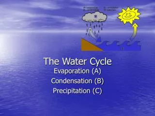
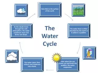
Explore assessment of water cycle in regional climate simulation through error evaluation and conclusions drawn from 10-year RCM simulations. Analyze bias, bias score, and precipitation patterns using SOM and trajectory separation. Investigate water balance analysis, sources of error, and evapotranspiration error in regional climate modeling. Acknowledgment to funding sources and importance of wetlands in the region.

E N D
Assessing the Water Cycle in Regional Climate Simulation W. J. Gutowski, Jr. Iowa State University with thanks to: F. Otieno, Z. Pan, R. W. Arritt, E. S. Takle SASAS (September 2001)
Outline • 10-yr RCM simulations • Precipitation analysis • Error evaluation • Conclusions: Sources of error? SASAS (September 2001)
Observations • Precipitation • VEMAP - monthly; 0.5˚ x 0.5˚ • Higgins et al. - hourly; 2˚ x 2.5˚ • Circulation – NCEP/NCAR reanalysis • Precipitable water – NCEP/NCAR reanalysis • Runoff - UNH 0.5˚ climatology
Outline • 10-yr RCM simulations • Precipitation analysis • Error evaluation • Conclusions: Sources of error? SASAS (September 2001)
Diagnoses • Bias: average difference • Bias Score: intensity “spectrum” • SOM: pattern difference
Precip.Bias by Month & Location -2 0 2 4 [mm/d]
Season’s Bias by Year ~ south-central US ~ (“Fall” = Sep-Oct-Nov, etc.)
Bias Score by Location Threshold = 1 mm/d (“Score” ~ relative exceeding of threshold)
Bias Score by Location Threshold = 2 mm/d (“Score” ~ relative exceeding of threshold)
Bias Score by Location Threshold = 4 mm/d (“Score” ~ relative exceeding of threshold)
Bias Score by Month ~ south-central US ~ (“Score” ~ relative exceeding of threshold)
Self-Organizing Maps • Set of maps • Show characteristic data structures • Trained to distribution of data • Give 2-D projection of higher order • map space • Are approximately continuous
SOM: Major Dimensions 1 “warm” 2 “cold” 0 [mm/mo] 100 200
SOM Trajectories RegCM VEMAP J-J-A
SOM Trajectories RegCM VEMAP J-J-A RegCM D-J-F VEMAP D-J-F
SOM: Major Dimensions 2 “cold” 0 [mm/mo] 100 200
Outline • 10-yr RCM simulations • Precipitation analysis • Error evaluation • Conclusions: Sources of error? SASAS (September 2001)
500 hPa Heights & Bias Sep-Oct-Nov [m]
500 hPa Bandpass Variance & Bias Sep-Oct-Nov [m2]
Precipitable Water & Bias Sep-Oct-Nov [kg-m-2]
Water Balance Analysis From terrestrial balance: Evapotranspiration error Observed runoff Model output Precipitation error
Water Balance Analysis From terrestrial balance: Evapotranspiration error Subsurface storage Observed runoff Model output Precipitation error
Water Balance Analysis From atmospheric balance: Vapor convergence error Evapotranspiration error Precipitation error
Water Balance Analysis For Sep-Oct-Nov:
Water Balance Analysis For Sep-Oct-Nov: • Plausible values? • model’s root-zone storage: => -0.5 mm/d • (P-E)m - Ro: => -0.1 mm/d
Outline • 10-yr RCM simulations • Precipitation analysis • Error evaluation • Conclusions: Sources of error? SASAS (September 2001)
Evapotranspiration error from: • Temperature error? SASAS (September 2001)
Daily Max. Temperature RegCM2 Difference VEMAP -12.5 - 2.5 2.5 12.5 22.5 [oC]
Daily Min. Temperature RegCM2 Difference VEMAP -12.5 - 2.5 2.5 12.5 22.5 [oC]
Evapotranspiration error from: • Temperature error? Apparently no. • Surface moisture error? SASAS (September 2001)
The region has substantial wetlands: SASAS (September 2001)
The region has substantial wetlands: • Not resolved by 60 km grid. • Large source of water? SASAS (September 2001)
Acknowledgments • Primary Funding: U.S. National Oceanic and Atmospheric Administration (NOAA) • Additional Support: Electric Power Research Institute (EPRI) SASAS (September 2001)
EXTRA SLIDES
RegCM2 Bias VEMAP JAN JUL - 4 -2 0 +2 +4 +6 [mm/d]