Download
1 / 1
10 likes | 168 Views
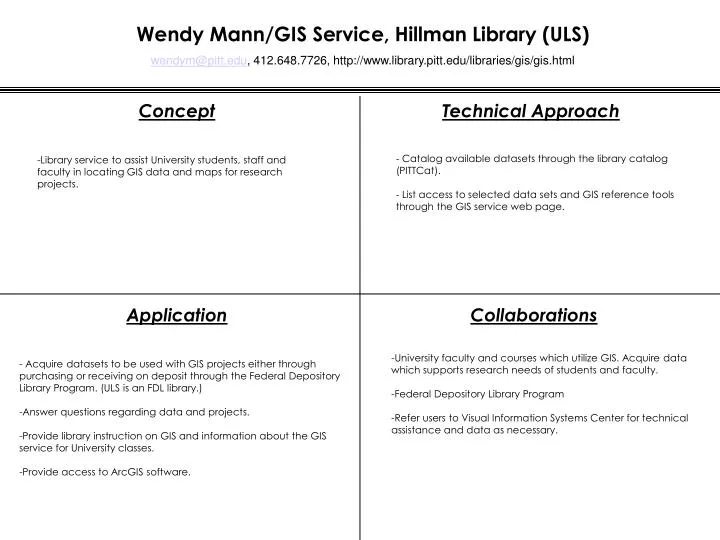
Wendy Mann/GIS Service, Hillman Library (ULS) wendym@pitt.edu , 412.648.7726, http://www.library.pitt.edu/libraries/gis/gis.html. Concept. Technical Approach. - Catalog available datasets through the library catalog (PITTCat). - List access to selected data sets and GIS reference tools

E N D
Wendy Mann/GIS Service, Hillman Library (ULS) wendym@pitt.edu, 412.648.7726, http://www.library.pitt.edu/libraries/gis/gis.html Concept Technical Approach - Catalog available datasets through the library catalog (PITTCat). - List access to selected data sets and GIS reference tools through the GIS service web page. • Library service to assist University students, staff and faculty in locating GIS data and maps for research projects. Application Collaborations • University faculty and courses which utilize GIS. Acquire data which supports research needs of students and faculty. • Federal Depository Library Program • Refer users to Visual Information Systems Center for technical assistance and data as necessary. • - Acquire datasets to be used with GIS projects either through purchasing or receiving on deposit through the Federal Depository Library Program. (ULS is an FDL library.) • Answer questions regarding data and projects. • Provide library instruction on GIS and information about the GIS service for University classes. • Provide access to ArcGIS software.