Download
1 / 27
270 likes | 422 Views
Applying Geodesy Data to Societally Important Questions in Undergraduate Courses. The webinar begins at: 12 pm PT | 1 pm MT | 2 pm CT | 3 pm ET For audio, call: 1-800-704-9804 (or 1-404-920-6604 for international) Access Code: 4855996 Press *6 to mute and unmute

E N D
Applying Geodesy Data to Societally Important Questions in Undergraduate Courses The webinar begins at: 12 pm PT | 1 pm MT | 2 pm CT | 3 pm ET For audio, call: 1-800-704-9804 (or 1-404-920-6604 for international) Access Code: 4855996 Press *6 to mute and unmute Please do not use speaker phone setting when you talk. Headset and landline are best for sound quality.
Webinar leader Beth Pratt-Sitaula UNAVCO* Education Specialist and GETSI Project Co-PI *UNAVCO is NSF’s Geodetic Facility dedicated to providing research and educational support for GPS, strain meters, InSAR, and terrestrial lidar. The non-profit is governed by a consortium of >100 member universities.
Webinar Format • Presentation (~35 minutes) • Geodesy & its applications • GETSI Project • Existing geodesy teaching resources • Discussion (~35 minutes) • Most valuable future module topics to address • Types of curricular items of greatest value • Other geodesy teaching resources you know of • Questions
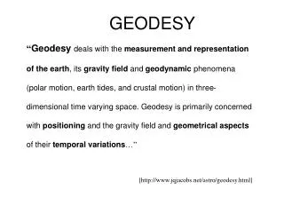
Geodesy is… …the science ofaccurately measuring the Earth’ssize, shape, orientation, mass distribution and the variations of these with time. Traditional geodesy: Precise positioning of points on the surface of the Earth Modern geodesy: A toolbox of techniques to better measure the Earth wikipedia.org 5
Unpacking the Geodesy Toolbox • GPS (Global Positioning System) • InSAR (Interferometric synthetic aperture radar) • LiDAR (Light detecting and ranging) • Strain meters, tiltmeters, creep meters • Gravity measurements • Sea level altimetry • GPS (Global Positioning System) • InSAR (Interferometric synthetic aperture radar) • LiDAR (Light detecting and ranging) • Strain meters, tiltmeters, creep meters • Gravity measurements • Sea level altimetry usgs.gov http://photojournal.jpl.nasa.gov/catalog/PIA00557 www.jpl.nasa.gov http://facility.unavco.org/data/maps/GPSVelocityViewer/GPSVelocityViewer.html http://www.iris.edu/ http://www.nasa.gov/topics/earth/features/graceImg20091214.html
Velocity from InSAR Geodesy applications GPS & Earthquake Early Warning System • Plate tectonics • Motions and mechanisms • Hazard monitoring • Volcanic, earthquake, landslide • Ice dynamics • Mass changes, velocity • Water resources • Surface/ground water, subsidence, sea level • Plate tectonics • Motions and mechanisms • Hazard monitoring • Volcanic, earthquake, landslide • Ice dynamics • Mass changes, velocity • Water resources • Surface/ground water, subsidence, sea level Ice mass loss from GRACE (Gravity Recovery and Climate Experiment) Groundwater storage changes 2003-2012 (GRACE) Permission from Sean Swenson (colorado.edu) Global Mean Sea Level from satellite altimetry Permission from Twila Moon (uw.edu) GPS stations show upward movement climate.nasa.gov Florida wetlands water level changes from InSAR sealevel.colorado.edu http://www.iris.edu/ serc.carleton.edu Permission from Mike Bevis (osu.edu) facility.unavco.org landslides.usgs.gov
Why Geodesy for Students? • Topics align well with Earth Science and Climate Literacy Principles • Real world applications are shown to increase interest and learning • Data analysis can increase critical thinking skills and quantitative skills • Measurement are on a human timescale • Earth science majors are often not learning about these critical research techniques
GETSI Project Overview Mission: Develop and disseminate teaching and learning materials that feature geodesy data applied to critical societal issues such as climate change, water resource management, and natural hazards • Funded by NSF’s Transforming Undergraduate Education in STEM Type I grant • Collaborators – UNAVCO, Mt San Antonio College, and Indiana University in partnership with SERC and NAGT. • Will develop four modules (~2 weeks each) • Two Intro-level – Two Majors-level
GETSI Project Modules • Module development and assessment following model of SERC’s InTeGrate Project • Year 1 module topics • Intro Ice mass and sea level changeBecca Walker (co-PI) & Leigh Stearns (co-author) • Majors Active tectonics and hazards using InSAR and LiDAR dataBruce Douglas (co-PI) & Gareth Funning (co-author) • Year 2 – tell us what you would like to see
GETSI Project Involvement (with stipend) • Two module co-authors in Year 2 ($7500; over ~15 months) • Five beta-testers for each module ($200-500 depending on involvement level) • Technical experts for some modules ($200-500 depending on involvement level) Everyone from this webinar will receive announcements when we solicit for the above but contact me (prattsitaula@unavco.org) if you have particular interests.
Existing Geodesy Teaching Resources Handout with URLs of relevant sites is on webinar homepage http://serc.carleton.edu/getsi/workshops/charette/Jan10.html Or google “sercgetsi” and navigate to Workshops.
General Geodesy Resources • GETSI’s website on SERC – will be the portal for teaching materials access
General Geodesy Resources • UNAVCO’s Data for Educators
General Geodesy Resources • SERC’s Cutting Edge “Teaching Geodesy” site
Using GPS to determine infinitesimal strain • Module for structural geology courses
GPS and Intro level resources • Activity: Earthquake hazard and GPS data in Cascadia
InSAR Teaching Resources • InSAR interactive tool • Supporting teaching resources
LiDAR Teaching Resources • OpenTopography’sLandform Catalog • Tutorial on creating GoogleEarth format LiDAR images from any data set in OpenTopography
Canopy Height (ft) Airbourne LiDAR
TLS Teaching Resources • Terrestrial Lasar Scanning (TLS) at undergraduate field camps
Discussion Format • I will pose some questions • Start by raising your hand to speak or typing in Chat • Use *6 to unmute yourself and talk (then mute again) If needed, I may call on people to make sure a variety are heard from.
Discussion What topics would you like to see modules address and why? • Hazards • Volcanic, earthquakes, landslides… • Climate change • Ice mass changes, ice velocity, sea level… • Water resources • Ground water mass, surface water… Particular data types? What course? What level?
Discussion What types of teaching resources do you adapt/adopt most? • Instructor notes/technical background info • “Prepared” data sets for students use • Accessible data portals • Lab/class activities • Homework • Presentations/animations • Assessments (rubrics, criteria) • Other? Helpful formats? Could you see doing full two weeks material? Course or level difference?
Discussion Do you already teach about or using geodesy data? Other resources we should know about? Successes? Pitfalls?
Discussion Comments/suggestions? Questions? • About GETSI? • About existing resources?
In Conclusion • THANK YOU • Contact me with questions or comments prattsitaula@unavco.org • Please fill out evaluation form • This webinar filled, so we opened another with the same content for January 31. • Please let potentially interested colleagues know • Google “sercgetsi” and then go to “Workshops”