Download
1 / 25
250 likes | 404 Views
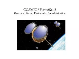
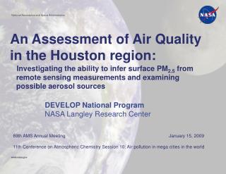
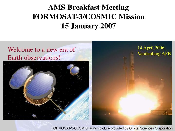
AMS Breakfast Meeting FORMOSAT-3/COSMIC Mission 15 January 2007. 14 April 2006 Vandenberg AFB. Welcome to a new era of Earth observations!. FORMOSAT-3/COSMIC launch picture provided by Orbital Sciences Corporation. Global Coverage - 2500 Daily Soundings by early 2007 - all weather!.

E N D
AMS Breakfast Meeting FORMOSAT-3/COSMIC Mission 15 January 2007 14 April 2006 Vandenberg AFB Welcome to a new era of Earth observations! FORMOSAT-3/COSMIC launch picture provided by Orbital Sciences Corporation
Global Coverage - 2500 Daily Soundings by early 2007 - all weather! • Red - Daily average Radiosondes • Green - Daily FORMOSAT-3/COSMIC Soundings
Free access to data Free and Open Data Access • Data user registration website: • http://tacc.cwb.gov.tw/en/service/policy.htm • or via • http://www.cosmic.ucar.edu • http://tacc.cwb.gov.tw/en/index.htm • * Select the 'Sign Up ' link under • COSMIC • Accept data use agreement • * Enter information: • Name, Address, email, user_id, • Password, planned use of data • An email will be sent within 2-3 • business days to indicate • access has been granted. ~400 users have already registered
Early Results-Weather • Global coverage in all weather-sees through clouds! • Accurate vertical profiles of water vapor • Observing the atmospheric boundary layer • Improvement of weather forecast models • Hurricanes and Typhoons • Antarctica • Improved accuracy of global weather models
Vertical moisture profiles Vertical profiles of water vapor pressure from two COSMIC satellites on 8 July 2006 are shown (in gray and red). The location is 21S, 71W. The corresponding moisture profile from National Centers for Environmental Prediction (NCEP-NOAA) analysis is shown in green dots-line.
First atmospheric boundary layer measurements from space. Sharp boundary (ABL top) at ~ 2 km altitude
Assimilate this sounding only Low-level moisture change by assimilating GPS GPS all GPS 1 Fig. 8a
2006-08-27-12Z (102h forecast) Sat. IR No GPS GPS all GPS 1 Fig. 8b
Southern Hemisphere Forecast Improvements Sean Healey, ECMWF
Early impact experiments (T382) with COSMIC • Anomaly correlation as a function of forecast day for two different experiments: - E (assimilation of operational obs), - BND (E + COSMIC bending angle). • Only COSMIC observations available in operations have been used in BND. • Only COSMIC observations < 30 km • These results might have been impacted by the development stage of the GSI system Lidia Cucurull, JCSDA/UCAR
December 2006 data latency -profile arrival at UKMO (FM1 70% < 3h)
Blue = sea ice; Green = open water Diagnosis of errors in regional model forecasts over AntarcticaLow-level error statistics show influence of sea-ice representation
Data Quality Climate Space Weather
Deviation of pairs of RO soundings separated by less than 10 km
Precision of GPS RO soundings PPUTLS = Precision Parameter of Upper Troposphere and Lower Stratosphere, which is the mean absolute differences in the 10-20 km layer 0.02% difference in refractivity, which is equivalent of 0.05 C in temperature Fig. 5b
Fig. 12b One Month (Sep. 06) COSMIC-CHAMP Comparison: 76 pairs, within 2 degree & 90 min
Radio Occultation Temperature Record Data from three Missions
Can we use GPS RO data to calibrate other instrument ? a b c N15, N16 and N18 AMSU calibration against COSMIC
From presentation by Ludger Scherliess, Utah State University Comparisons during quiet and disturbed Conditions COSMIC #2 GAIM Quiet COSMIC #2 GAIM Storm Fig. 13a
Comparison of NmF2 and HmF2 between COSMIC and GAIM during Apr. 21-28, 2006 From presentation by Zhen Zeng, NCAR/HAO Good agreement of NmF2 between COSMIC and GAIM; Higher peak heights from GAIM than those from COSMIC Fig. 13b
Formosat-3/COSMIC Observations of Scintillations From presentation by Chin S. Lin, AFRL RED = COSMIC sat BLUE = GPS sat Fig. 16
TIP 135.6-nm passes 14 Sep 2006 FM1 FM3 FM6 0-24 UT (2100 LT) From presentation by Clayton Coker, NRL Fig. 17
Summary • FORMOSAT-3/COSMIC a successful Taiwan-U.S. project • FORMOSAT-3/COSMIC launched nearly on time and within budget (~$100M mission) • Cost-effective way of obtaining global atmospheric soundings in all weather • High accuracy, precision and vertical resolution demonstrated • Already positive impact on weather models + hurricane forecasting • Observations of tropical boundary layer from space for first time • Only observing system to provide information on ionosphere, stratosphere and troposphere • Expected to have major impact on climate monitoring-world’s most accurate, precise and stable thermometer! • Free and open exchange of data— ~400 users already