Download
1 / 90
950 likes | 1.22k Views
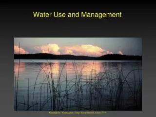
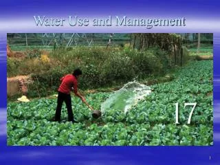
Water Use and Management . CHAPTER 17. What two factors are the most important in determining the availability of water in Northville?. Chapter Overview Questions. Why is water so important, how much freshwater is available to us, and how much of it are we using?

E N D
Water Use and Management CHAPTER 17
What two factors are the most important in determining the availability of water in Northville?
Chapter Overview Questions • Why is water so important, how much freshwater is available to us, and how much of it are we using? • What causes freshwater shortages, and what can be done about this problem? • What are the advantages and disadvantages of withdrawing groundwater? • What are the advantages and disadvantages of using dams and reservoirs to supply more water?
Chapter Overview Questions • What are the advantages and disadvantages of transferring large amounts of water from one place to another? • Can removing salt from seawater solve our water supply problems? • How can we waste less water? • How can we use the earth’s water more sustainably? • What causes flooding, and what can we do about it?
When did the Cuyahoga river catch fire? • 1868, 1883, 1887, 1912, 1922, 1936, 1941, 1948, 1952, and 1969.
Editorial: Lake Erie dead again? • Tributaries of Lake Erie aren't catching fire as they did a half-century ago. But by several important measures, the lake -- generally considered the bellwether for the health of the other four Great Lakes -- has declined to a point as bad as or worse than it has ever been. Detroit Free Press 10-16-2011 • By several important measures, Lake Erie, generally considered the bellwether for the health of the other Great Lakes, is at a point as bad as or worse than it's ever been.
WATER FACTS • We currently use more than half of the world’s reliable runoff of surface water and could be using 70-90% by 2025. • About 70% of the water we withdraw from rivers, lakes, and aquifers is not returned to these sources. • Irrigation is the biggest user of water (70%), followed by industries (20%) and cities and residences (10%).
WATER FACTS • About 41% of the world’s population lives in river basins that do not have enough freshwater. • Many parts of the world are experiencing: • Rivers running dry. • Lakes and seas shrinking. • Falling water tables from over pumped aquifers.
Hydrosphere: • All the H2O at or near the surface of the earth • Amount of H2O essentially constant and moves between different reservoirs • 100 million billion gallons move through hydrologic cycle annually
Water Resources • Hydrologic Cycle • Describes the circulation of water as it: • Evaporates from land, water, and organisms (transpires from plants) • Enters the atmosphere • Condenses and precipitates back to the Earth’s surfaces • Moves underground by infiltration or overland by runoff into rivers, lakes and seas
Hydrologic Cycle • Solar energy drives the hydrologic cycle by evaporating surface water. • Evaporation - changing liquid to a vapor below its boiling point • Sublimation - changing water between solid and gaseous states without ever becoming liquid • Freezer burn
Hydrologic Cycle • Humidity - amount of water vapor in the air • Saturation point - when a volume of air contains as much water vapor as it can hold at a given temperature • Relative humidity - amount of water vapor in the air expressed as a percentage of the maximum amount that can be held at that temperature
Hydrologic Cycle • Dew point - temperature at which condensation occurs for a given amount of water vapor • Condensation nuclei - tiny particles that facilitate condensation • Smoke, dust, sea salt, spores • A cloud is an accumulation of condensed water vapor in droplets or ice crystals. When droplets become large enough, gravity overcomes air currents and precipitation occurs.
Regions of Plenty and Regions of Deficit • Three principal factors control global water deficits and surpluses: • Global atmospheric circulation • Proximity to water sources - lake effect snow • Topography
Regions of Plenty and Regions of Deficit • Mountains act as cloud formers and rain catchers. • Air moves up the windward side of a mountain, pressure decreases, air cools. • Eventually saturation point is reached, and moisture in the air condenses. • Rain falls on the mountaintop. • Cool, dry air descends and warms, absorbing moisture from other sources (Rain shadow).
Major Water Compartments • Oceans • Together, oceans contain more than 97% of all liquid water in the world. • Contain 90% of world’s living biomass • Moderate earth’s temperature • Average residence time of water in the ocean is about 3,000 years
Major Water Compartments • 2. Glaciers, Ice, and Snow • 2.4% of world’s water is freshwater. • 90% in glaciers, ice caps, and snowfields • As recently as 18,000 years ago, one-third of continental landmass was covered by glacial ice sheets. • Now, Antarctic glaciers contain nearly 85% of all ice in the world. • Greenland, together with ice floating around the North Pole, is another 10%.
Major Water Compartments • 3. Groundwater • Second largest reservoir of fresh water 22% • Infiltration - process of water percolating through the soil and into fractures and permeable rocks • Zone of aeration - upper soil layers that hold both air and water • Zone of saturation - lower soil layers where all spaces are filled with water • Water table - top of zone of saturation
Groundwater • Aquifers - porous layers of sand, gravel, or rock lying below the water table • A good aquifer needs to be both porous and permeable • Artesian - Pressurized aquifer intersects the surface (water flows without pumping). • Recharge zones - area where water infiltrates into an aquifer • Recharge rate is often very slow. • In many areas groundwater is being removed faster than it can be replenished
Groundwater: Recharge • Effective recharge depends on how porous and permeable soil is • Porosity: Proportion of open space between soil particles higher porosity in well rounded, coarse grained rocks • Gravel : 25-45%, Clay: 45-55%, Sandstone: 5-30% • Permeability: how readily fluid passes through a material • Depends on the pore size and how well they are interconnected • Clay has high porosity but low permeabilty
Less porosity More porosity
Groundwater • Water table follows the topography but more gently • Intersection of water table and ground surface produces lakes, streams, spring (Iargo), wetlands… • Ground water flows from higher elevation to lower, from areas of lower use to higher use, from wet areas to dry areas.
Groundwater: Aquifers • Unconfined Aquifer: open to atmosphere e.g., overlain by permeable rocks and soils • Confined aquifer: sandwiched between aquicludes • Artesian System: Water rises above the level in aquifer because of hydrostatic pressure
Major Water Compartments • 4. Rivers and Streams • Precipitation that does not evaporate or infiltrate the ground runs off the surface, back toward the sea. • Best measure of water volume carried by a river is discharge • The amount of water that passes a fixed point in a given amount of time • Usually expressed as cubic feet per second
Major Water Compartments • 5. Lakes and Ponds • Ponds are generally considered small bodies of water shallow enough for rooted plants to grow over most of the bottom. • Lakes are inland depressions that hold standing fresh water year-round. • Unless emptied by an outlet stream both ponds and lakes will eventually fill with sediment.
Major Water Compartments • 6. Wetlands • Play a vital role in hydrologic cycle • Lush plant growth stabilizes soil and slows surface runoff, allowing more aquifer infiltration. • Disturbance reduces natural water-absorbing capacity, resulting in floods and erosion in wet periods, and less water flow the rest of the year. • Half of U.S. wetlands are gone.
Major Water Compartments • 7. The Atmosphere • Among the smallest water reservoirs • Contains < 0.001% of total water supply • Has most rapid turnover rate • Provides mechanism for distributing fresh water over landmasses and replenishing terrestrial reservoirs
What happens when we take water out of the ground? Lower water table – create cone of depression around a well Lower the regional water table by overlapping cones of depression
What happens when we take water out of the ground? • Compaction and subsidence • Soils compress & settle causing depressions • Building damage, collapse • Flooding and coastal erosion • Venice, Galveston/Houston (80 sq km permanently flooded), San Joaquin Valley (9m subsidence) • Pumping in water is no solution
What happens when we take water out of the ground? Land subsidence in San Joaquin Valley , California
Depleting Groundwater • Groundwater is the source of nearly 40% of fresh water in the U.S. • Heavy pumping can deplete an aquifer. • Ogallala Aquifer • Underlies 8 states between Texas and North Dakota • Wells have dried up, entire towns are being abandoned • Will take thousands of years to refill
There Will be Water: Ogallala future issues • Keystone XL pipeline over runs part of the aquifer. Canada to IL, OK, TX • T. Boone Pickens buys 68,000 acres in TX with H2O rights • Warren Buffet invests in Nalco/Ecolab and purchasing land over aquifers • Water = the new oil • Water for profit? Unconscionable?
The Gulf Coastal Plain Aquifer System • Underlie 290,000 sq. mi. from Texas to Florida, including offshore areas to the edge of the Continental Shelf. • Water withdrawals from the aquifer system have caused • lowering of water table • reduced discharges to wetlands • induced movement of saltwater into parts of aquifers that previously contained freshwater; • subsidence
Depleting Groundwater • Withdrawing large amounts of groundwater in a small area causes porous formations to collapse, resulting in subsidence (settling). • Sinkholes form when an underground channel or cavern collapses. Results in permanent loss of aquifer. • Saltwater intrusion can occur along coastlines where overuse of freshwater reservoirs draws the water table low enough to allow saltwater to intrude.
Other Effects of Groundwater Overpumping • Sinkholes form when the roof of an underground cavern collapses after being drained of groundwater.
Trade-Offs Withdrawing Groundwater Advantages Disadvantages Useful for drinking and irrigation Aquifer depletion from overpumping Sinking of land (subsidence) from overpumping Available year-round Exists almost everywhere Polluted aquifers for decades or centuries Renewable if not overpumped or contaminated Saltwater intrusion into drinking water supplies near coastal areas Reduced water flows into surface waters No evaporation losses Increased cost and contamination from deeper wells Cheaper to extract than most surface waters Fig. 14-7, p. 313