Geomagnetism
630 likes | 1.18k Views
Geomagnetism. The Earth’s Magnetic field. Magnetization of rocks. The Earth’s magnetic record. Proof of continental drift. © C Gary A. Glatzmaier University of California, Santa Cruz. Magnetism. Magnetic Force field:

Geomagnetism
E N D
Presentation Transcript
Geomagnetism The Earth’s Magnetic field. Magnetization of rocks The Earth’s magnetic record Proof of continental drift ©C Gary A. Glatzmaier University of California, Santa Cruz
Magnetism Magnetic Force field: The region around a magnetic object in which its magnetic forces act on other magnetic objects.
Magnetic field about a simple bar magnet: North pole attracts the south poles of magnetic objects within the field. South pole attracts the north pole of magnetic objects within the field. Magnetic field orientation: Parallel to the magnetic axis at the midpoint of the magnet. Curves strongly towards the poles.
Magnetic field strength: Strongest at the poles. Weakest at the midpoint.
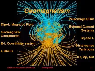
Earth’s Magnetic Field Generated by the convective motion the fluid outer core about the solid inner core. Geodynamo: the conversion, within the Earth, of mechanical energy (convection of metals) to electrical energy which produces the magnetic field. A magnetic field produced by such fluid motion is inherently unstable and not as uniform as about a simple bar magnet.
We can visualize the Earth’s magnetic field as being produced by a giant bar magnet within the Earth. What we call the “North geographic pole” corresponds to the “south pole” of the imaginary bar magnetic so that the north needle on a compass points towards the north geographic pole!
North and south poles are the points of intersection of the axis of the magnetic field and the surface of the Earth. The axis of the magnetic field is at a small angle to the axis of rotation: termed the magnetic declination. The magnetic poles moves about the geographic poles: termed secular variation in the magnetic pole position Angle of magnetic pole – angle of geographic pole= magnetic declination
If you know your longitude and latitude (43.1667°N/79.2500W for St. Catharines) you can calculate the local magnetic declination at: Changes in declination reflect secular variation in pole position over time. http://www.ngdc.noaa.gov/seg/geomag/jsp/Declination.jsp Due to the inherent instability of the field produced by the Geodynamo.
This link includes an animation showing the variation in the pole position in northern Canada since 1945.
Orientation (inclination) of the magnetic force field: Perpendicular to Earth surface at poles. Parallel to Earth surface at equator. Field points downward in the Northern Hemisphere. Field points upward in the Southern Hemisphere. Are Australian and Canadian compasses different?
Regular increase in the inclination of the Earth’s magenetic field from the Equator (0°latitude) to the poles (90° latitude).
Force field intensity varies from a maximum at the poles to a minimum at the equator.
Magnetization of rocks Remnant magnetic signature (RMS): Magnetic field generated by a rock due to the alignment of magnetic fields of rock forming minerals. "Remnant" because it formed at the time of crystallization and cooling (Igneous and Metamorphic Rocks) or deposition (Sedimentary Rocks). Preserves the direction and inclination of the Earth's magnetic field and is an indicator of field intensity.
RMS in Igneous and metamorphic rocks RMS develops as the rock cools and its temperature falls below the Curie Point. Curie Point: the temperature at which the magnetic fields develop in minerals (atomic arrangement becomes fixed). The Curie Point varies with different minerals but is typically around 580 degrees Celsius.
Above the Curie Point, atoms within crystals vibrate randomly and have no associated magnetic field.
Below the Curie Point the magnetic fields of the minerals act like tiny compass needles: they become aligned to the Earth's magnetic field.
The minerals themselves generate a small magnetic field (the rock's RMS). The RMS records the orientation and strength of the Earth's field at the time of cooling. The stronger the Earth's magnetic field, the stronger RMS. RMS is fixed unless the rock heats up to above the Curie Point at some future time.
RMS in sedimentary rocks Develops as fine grained sediment deposits from suspension in very quiet water (no currents). Individual grains have weak magnetism that causes them to become aligned to the Earth's magnetic field as they settle (like tiny compass needles). When the grains are deposited their RMS parallels the Earth's field. The stronger the Earth's magnetic field, the stronger the RMS.
RMS remains fixed as the sedimentary deposit becomes cemented to form a sedimentary rock. In a rock we can measure: 1. The strength of the RMS (a measure of the Earth's field strength when the rock formed). 2. The direction of the RMS (the direction to the Earth's magnetic poles at the time of rock formation). 3. The inclination of the RMS (the inclination of the Earth's field which reflects the latitude at which the rock formed).
Because different rocks were formed over a long period of time, they preserve a record of changes in the Earth's magnetic field! Magnetic Anomalies An outcome of the magnetization of rocks is that they can locally change the Earth’s magnetic field strength: increasing or decreasing the local strength due to strong or weak magnetization, respectively. E.g., an Iron Ore body with a strong normal magnetic field strength can significantly increase the local Earth field strength. Magnetic anomaly = local magnetic field strength - average magnetic field strength
Positive anomaly: magnetic field is locally stronger than average. Negative anomaly: magnetic field is weaker than average. Apparent Polar Wandering Based on the record of the pole positions from the RMS of rocks of various ages. Studies of RMS indicate that the position of the poles with respect to the location of the rocks has changed over time. This changing of pole position is termed Apparent Polar Wandering
The inclination of the RMS reflects the latitude of the sample at the time of crystallization. 30°downward, North of equator. 0°, at the equator. 30°upward, South of equator. Rock samples are taken from cores drilled into magnetized igneous rocks. The ages of the samples are determined and their RMS is measured.
Two possible interpretations: 1. That the poles are fixed and the landmass that was sampled moved towards the pole over time.
Two possible interpretations: 1. That the poles are fixed and the landmass that was sampled moved towards the pole over time. 2. That the landmass that was sampled was fixed and that the poles moved towards it over time. In the 1940s and 1950s the second interpretation was accepted; poles moved due to the inherent instability of the Geodynamo.
Wegener’s paleoclimatic evidence for past continent positions was attributed, by opponents, to changing positions of the poles and equator.
Similar records from India showed a change in position of the pole by almost 60 degrees over 180 million years.
Question: Did the poles move or did the continents on which the rocks are found moved? Runcorn and coworkers (1950s) Purpose: to test the hypothesis that the poles moved relative to fixed continents. Method: measured RMS from rocks on North America and Eurasia and plotted the polar path from samples spanning 500 million years.
Possible outcomes: 1. Pole paths coincide if the poles move with respect to fixed continents (the expected outcome). 2. Pole paths do NOT coincide if continents move with respect to fixed poles. Here are the results:
Outcome: that the paths did not match, therefore, movement or the poles was not occurring. However, when the continents were rotated together (as Wegener suggested) the paths did match. Therefore, poles were fixed and continents moved and were once combined to form a supercontinent. Just as Alfred Wegener had predicted! Even this evidence wasn’t enough to convince the geological community that the continents moved.
Polar reversals ·RMS of rocks only a few thousand years different in age indicates poles in reverse positions (e.g., north pole in the south, south pole in the north).
Suggests that poles reverse periodically. Normal Polarity: poles as they are today. Reverse Polarity: poles in reverse position compared to today. Such reversals are attributed to variation in convection in the outer core.
The data can also be interpreted to describe the details of a reversal: Intensity rises to earlier level; inclination rises to original angle but reversed. Inclination angle decreases rapidly and intensity drops to near 0. Inclination constant but intensity decreasing with time.
A reversal takes a total of 10 to 20 thousand years*. *The last reversal took 1000 years at the equator but 10,000 years at midlatitudes. Actual “flipping” of the poles takes only 1000-2000 years. The field is lost as the intensity drops to 0; it comes back with flipped poles.
Polar reversal animation Yellow = north pole. Blue = south pole. Animation from : http://www.psc.edu/science/Glatzmaier/glatzmaier.html (click here to access this site)
Due to the inherent instability of the geodynamo. Over long periods of geologic time the poles have reversed thousands of times. Certain periods of geologic time are dominated by normal or reversed polarity whereas others are periods of mixed polarity. We live in a period when polarity is reversing, on average, every 250,000 years. Over the past 600 million years the time between reversals varied from 5,000 years to 50 million years.
Is the Earth’s magnetic field polarity currently reversing? The last polar reversal took place nearly 800,000 years ago. We are overdue given the average time between reversals over the past several millions of years.
Evidence for a decline in magnetic field intensity: 6.4% reduction in intensity Over 100 years.
Extrapolating the current trend to the future suggests that the field intensity will reach zero in approximately 1500 years (i.e., the poles will reverse).
The “magnetosphere” shields the Earth from high energy particles from the Sun. Do polar reversals pose a threat to life on Earth?
Magnetosphere animation As the intensity of the field decreases through a reversal the magnetosphere becomes less and less effective in reducing solar radiation. Earth’s atmosphere also acts as a shield to such particles. There is no evidence that the loss of the magnetosphere leads to harm to any life on Earth.
Sea Floor Stripes Fred Vine*, then a graduate student, discovered this phenomenon and it led to the widespread acceptance of Plate Tectonics. *Vine, F.J., and Matthews, D.H., 1963. Magnetic anomalies over oceanic ridges, Nature 199, pp. 947-949. Arose from studies of magnetic anomalies on the sea floor. Measurements of magnetic field strength were made across a segment of the Oceanic Ridge.
Oceanic Ridge: A chain of undersea volcanoes that extends for 65,000 km around the world, reaching heights of 3 km above the surrounding sea floor.
The Oceanic Ridge had been discovered earlier in the century and was found to be a chain of undersea volcanoes. In 1960, Harry Hess (a geology Professor who had been a submarine base commander during WWII) proposed that the Ridge was the site where new seafloor crust was forming, pushing older crust away from it.
Vine and co-workers discovered a pattern of magnetic anomalies across the Ridge and extending away from it on either side. From the USGS. This pattern is referred to as “Sea Floor Stripes”
Across the oceanic ridges are anomalies that parallel the ridge axes: alternating positive and negative magnetic anomalies.