Download
1 / 15
160 likes | 461 Views
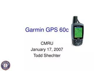
Garmin GPS 60c. CMRU January 17, 2007 Todd Shechter. Agenda. Intro to GPS Typical functions Downloading to Computer Practice time Figuring out one’s stride distance 3 different GPS/map/compass courses. Intro to GPS. Garmin 60c, 3 units.

E N D
Garmin GPS 60c CMRU January 17, 2007 Todd Shechter
Agenda • Intro to GPS • Typical functions • Downloading to Computer • Practice time • Figuring out one’s stride distance • 3 different GPS/map/compass courses
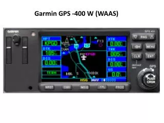
Intro to GPS • Garmin 60c, 3 units. • Page Key - cycles between screens, or on screen hides keyboard • Find - to show list of Waypoints • Mark - mark current spot with a Waypoint • Quit - cancel/back out • Menu - give options for current screen, press twice for Main Menu • Zoom - zooms in/out of map on screen • Power - press briefly for backlight, press and hold to power off • Rocker - used to navigate on screen or maps
Intro - back side • 2x AA Batteries • USB port • External antenna port • External power/data port
Unit startup • Needs 3 (of 24) satellites to provide position • Try for a clear spot, no/little tree cover
WAAS(Wide Area Augmentation System) • Series of 25 ground reference stations that help augment position data for GPS units in North America only • Originally designed by FAA to correct GPS signals • Improves accuracy up to 5x better, can provide accuracy of 3 meters 95% of the time • WAAS availability is denoted by the small D on the satellite strength bar
CMRU loaded maps • Highly detailed Topo maps installed of all Oregon and Northern California • Need to zoom in to 2mi to start seeing useful terrain data • Menu “Turn Declutter On” will show only creeks/rivers, topo lines - not every point of interest • Drag mouse over map for exact point and elevation
Task - Track tool • Acts as a bread crumb trail • Select “Tracks” from Main Menu • Clear Track Log prior to search • Turn “on” • Save/name track when finished. Will show distance traveled. Waypoints at beginning/end • Leave Track Log “off” when not using this feature • Track will appear on built-in map
Task - Mark a Waypoint • Press and release “Mark” • Edit name field (top) • “OK” • Consider different flags/symbols
Task - project a waypoint • Used to project distance/elevation to a point from a given spot on a map - by inputting bearing/distance • Select an item from the Find Menu • Press Menu, select “Project Waypoint” • Enter distance/bearing
Tasks - Navigate to a coordinate • “Mark” button • Edit Location/name • Select “OK” • Type of Marker • Then “Find” again, select Waypoint, and “Go To”
Navigate to a coordinate - 2 • Press “Page” to the Compass Page - has bearing ring and a compass ring • Press “Page” to view Map Page and monitor progress • Press “Page” again to go to Trip Computer page for travel data • Doesn’t show exact bearing of travel (anyone know how?) • Consider using compass to assist
Change Units(UTM <-> Lat/Long) Main Menu --> Setup --> Unit Setup