Download
1 / 24
280 likes | 488 Views
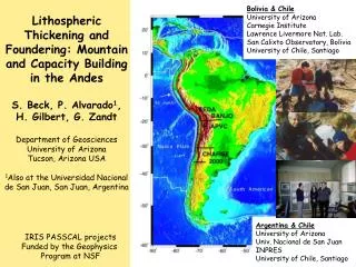
Bolivia & Chile University of Arizona Carnegie Institute Lawrence Livermore Nat. Lab. San Calixto Observatory, Bolivia University of Chile, Santiago. Lithospheric Thickening and Foundering: Mountain and Capacity Building in the Andes S. Beck, P. Alvarado 1 , H. Gilbert, G. Zandt

E N D
Bolivia & Chile University of Arizona Carnegie Institute Lawrence Livermore Nat. Lab. San Calixto Observatory, Bolivia University of Chile, Santiago Lithospheric Thickening and Foundering: Mountain and Capacity Building in the Andes S. Beck, P. Alvarado1, H. Gilbert, G. Zandt Department of Geosciences University of Arizona Tucson, Arizona USA 1Also at the Universidad Nacional de San Juan, San Juan, Argentina Argentina & Chile University of Arizona Univ. Nacional de San Juan INPRES University of Chile, Santiago IRIS PASSCAL projects Funded by the Geophysics Program at NSF
Earthquake & Tsunami Hazards in South America Local seismic networks focus on earthquake & tsunami hazards. Both intra- and inter-plate destructive earthquakes & tsunamis. Chile 1960 - largest earthquake ever recorded. Numerous deadly earthquakes: Peru 1970 - 65,000 Chile 1939 - 30,000 Gap? Gap
IRIS PASSCAL SeismicDeployments in South America Proposed Research Mountain building processes Plate boundary processes Lithospheric removal Flat slab subduction Ridge subduction Volcanic arc & magmatic processes Seismogenic zone Lithospheric structure Continental formation & accretion
Central Andean Plateau • Normal dipping slab • Active arc • Fold & thrust belt with 300-450 km of total shortening • Thick weak crust • Heterogeneous mantle wedge • South-central Andes • Accreted terranes • Flat slab geometry, Arc shut off 8 Ma • Active basement cored uplifts • Fold & thrust belt • Cold dry mantle wedge • Active arc South of 33°S Altiplano Western Cordillera, Bolivia Chile Border Active Arc High Cordillera above flat slab
Questions • What is the relative importance in mountain building of lithospheric shortening versus lithospheric removal? • How important is subduction erosion and/or continental subduction in modifying the upper plate and/or mantle wedge? • Are continental arcs and back-arcs sites of significant continental destruction rather than addition? • Observations • Central Andes 300-450 km of crustal shortening (McQuarrie, 2002; Kley and Monaldi, 1998) suggest a significant amount of lithosphere has been removed as the Brazilian craton subducted. • Paleoelevation indicate the Altiplano region has uplifted 2.5-3.5 km in the last 10 Ma (Garzione et al., 2006) suggesting rapid large scale lithospheric removal. • Seismic studies in the central Altiplano show heterogeneous upper mantle suggestive of piecemeal, rather than wholesale, lithospheric removal. • Seismic studies show variable composition lower crust (felsic quartz-rich lower crust versus partially ecologitized lower crust). • Seismic tomography studies show regions of low Vp/Vs mantle material that may indicate a contribution of subducted continental crustal material.
Central Andes • 300-450 km of total crustal shortening (McQuarrie, 2002). • Paleoelevation studies suggest rapid uplift between 10 and 6.8 Ma (Garzione et al., 2006). • Much of the shortening was prior to 10 Ma - how do you keep the eleva-tion < 1 km until 10 Ma? Paleoelevation estimates from oxygen isotopes in carbonates (shaded gray) Garzione et al., 2006. Paleoleaf physiognomy (red bar), from Gregory-Wodzicki et al., 1998).
Crust • Northern & central Altiplano has thick, weak, felsic quartz rich crust. No evidence of high velocity lower crust. • Is the lack of high velocity lower crust due to modification during mountain building or inherited? • Southern Altiplano shows hints of higher velocity lower crust.
E-W Cross-section of Stacked Receiver Functions ALVZ Moho Common Conversion Point (CCP) stacked receiver functions for the E-W BANJO transect. Positive arrivals are shown as red (increase in velocity) and negative arrivals (decrease in velocity) are shown as blue.
N-S Cross-section of Stacked Receiver Functions APMB ALVZ Moho Vp/Vs= 1.75 Vp/Vs= 1.8? Change in crustal character at 20°S
Central Andes P-wave velocities from travel time tomography • Upper mantle is heterogeneous and consistent with piecemeal removal. • Paleoelavation studies (Garzione et al, 2006 & Gregory-Wodzicki et al., 1998) suggest 2.5-3.5 km of uplift in the last 10Ma. Modified from Beck and Zandt 2002
Regional Seismic Tomography for Vp/Vs From Myers et al, 1998 • High Vp/Vs (1.82-1.86, red/pink) under the arc and part of the Altiplano. • Low Vp/Vs (1.72-1.76, blue/green). • Low Vp/Vs may indicate subduction of continental material (Brazilian craton). • 300-400 km of Brazilian lithosphere has been removed.
The Central Andes were built by underthrusting of the foreland lithosphere, accretion and shortening of felsic crust into the thickened orogenic wedge, and piecemeal removal of the subducted foreland mantle lithosphere. 100’s of kms of mantle lithosphere have been recycled into the mantle.
South Central Andes Flat Slab (30°S) Juan Fernandez Ridge - hot spot track Subduction Erosion of continental margin Frontal Cordillera - high Cordillera, volcanic arc shut off 6-8 Ma Precordillera - fold & thrust belt, 65-75% shortening Sierras Pampeanas - basement cored uplifts, 10-15% shortening, <5Ma. Terraines Chilenia terrane Cuyania composite terrane Pampia terrane Rio del la Plata craton Active arc (36°S) -Andesitic arc volcanism & Quaternary basaltic back arc volcanism JFR Volcano CHARGE Stations U. Chile/INPRES
Inter-station Pn Analysis We used 9 earthquakes that occurred offshore to analyze inter-station Pn arrivals along the northern CHARGE transect. We find crust thicker (50-55 km) than expected from the elevations in the western Sierras Pampeanas (Cuyania terrain). How do we explain the low elevations in the WSP? High density lower crust? From Fromm et al., 2004
W-E Cross-section of Stacked Receiver Functions at 30.5°S W E Moho 100 Km Cross section of Common Conversion Point (CCP) stacked receiver functions for the northern CHARGE transect. Positive arrivals are shown as red (increase in velocity) and negative arrivals (decrease in velocity) are shown as blue. From Gilbert et al., (2006).
High velocity lower crust from regional waveform modeling Cuyania terrane has a higher velocity lower crust consistent with the receiver function studies. Consistent with partially ecologitized lower crust? Alvarado et al., 2006
South-central Andes regional travel time tomography Low Vp/Vs seismic anomaly above the flat slab has a trend similar to the JFR. Is it related to subduction erosion transporting continental material from the trench and trapping it above the flat slab? JFR Vp and Vs Red/yellow = slow blue/purple = fast Red/yellow = high Vp/Vs blue/purple = low Vp/Vs Wagner et al., 2005; Wagner et al., in preparation
Combining tomography and RF results at 30.5°S • Summary • Changes in crustal properties in the Sierra Pampeanas correlate with terranes. • Cuyania terrane has 50-55 km thick crust with Vp/Vs=1.8 and partial ecologite (high velocity) lower crust. • The flat slab prevents lithospheric removal. • Subduction erosion of the continental margin resulted in a 50 km eastward migration of the margin since 7 Ma and could contribute to the low Vp/Vs anomaly. From Gilbert et al, 2006
Summary • The central and south-central Andes show different stages of crustal shortening, lithospheric removal, and crustal modification. • The central Andes backarc: • Central Altiplano has felsic quart-rich crust. In contrast, southern Altiplano & Puna may have higher velocity lower crust. • Heterogeneous upper mantle suggest piecemeal lithospheric removal and modification of the crust. • Low Vp/Vs material in the mantle may indicate subduction of the Brazilian craton. • Tectonic shortening may drive lithospheric removal. • The south-central Andes (30°S) backarc: • Cuyania terrane has a weak Moho conversion amplitude and high velocity lower crust consistent with partial eclogitization. The flat slab geometry prevents lithospheric removal. • Large amounts of subduction erosion of the continental margin (due to the subduction of the JFR) may contribute to the low Vp/Vs anomaly above the flat slab.
Capacity Building Difficulties • South American Universities/Local Seismic Networks • Different goals. • Local seismic networks need to locate earthquakes in near real time - so can’t wait for PASSCAL data that might not show up for months. • Often difficult to go back and relocate earthquakes due to lack of time and resources. • Some local collaborators are not be set up to use broadband data - some local networks use triggered not continuous recording. • Difficulties in integrating PASSCAL and local network data. • Educational Issues • Training is often sporadic as PIs come and go quickly (especially with declining budgets and increased costs). • In country computers are often not adequate for large PASSCAL data sets/software packages. • Difficult for in country students to get data from the DMC as they are not familiar with data retrieval methods.
Capacity Building Opportunities • Educational & Science Opportunities • Work to help with archiving local data to make a useful combined data set for everyone. • Improved lithospheric-scale seismic velocity models that can be easily used in earthquake location programs. • Help in-country seismologists obtain funding to build their seismology program. • Include projects on local seismicity, historic earthquakes & tsunamis when possible. • Build student/faculty exchange programs (weeks to months). • Recruit new graduate students that might go back to help build seismology programs in Latin America. • Joint classes and/or workshops in-country. • Provide training at the PASSCAL center on broadband instrumentation. • Help promote collaboration between Latin America countries.
SIG Capacity Building in Latin America How can we better integrate PASSCAL deployments with local seismic networks? How can we enhance both the science and educational collaborations of PASSCAL projects in Latin America? How can we get more permanent and temporary broadband seismic station coverage in Latin America and make the data available? How can IRIS and individual PIs contribute to improved earthquake & tsunami hazards in Latin America ? Should we consider a more coordinated international approach to collaborations in Latin America and if so what can IRIS do to facilitate this?
Seismic Crustal Properties Correlate with Terranes Regional Waveform Modeling High Cordillera (flat slab) th ~ 60 km Vp ~ 6.6 km/s, Vp/Vs ~ 1.85 Active Arc th ~ 45 km Vp ~ 5.8 km/s Vp/Vs ~ 1.80 Cuyania th ~ 50 km Vp ~ 6.4 km/s , Vp/Vs ~ 1.80 Pampia th ~ 35 km Vp ~ 5.9 km/s, Vp/Vs ~ 1.70 Alvarado et al, (2006) Slab contours from Anderson et al., 2006;