Download
1 / 1
10 likes | 119 Views
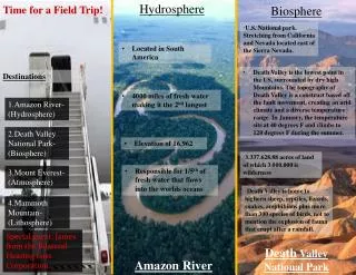
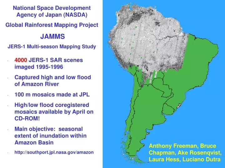
National Space Development Agency of Japan (NASDA) Global Rainforest Mapping Project JAMMS JERS-1 Multi-season Mapping Study. 4000 JERS-1 SAR scenes imaged 1995-1996 Captured high and low flood of Amazon River 100 m mosaics made at JPL

E N D
National Space Development Agency of Japan (NASDA) Global Rainforest Mapping Project JAMMS JERS-1 Multi-season Mapping Study • 4000 JERS-1 SAR scenes imaged 1995-1996 • Captured high and low flood of Amazon River • 100 m mosaics made at JPL • High/low flood coregistered mosaics available by April on CD-ROM! • Main objective: seasonal extent of inundation within Amazon Basin • http://southport.jpl.nasa.gov/amazon Anthony Freeman, Bruce Chapman, Ake Rosenqvist, Laura Hess, Luciano Dutra