Download
1 / 46
460 likes | 640 Views
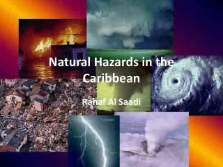
Climate change induced natural hazards in the Caribbean. Mr. Rafi Ahmad. The University of the West Indies, Mona The Caribbean Community Climate Change Centre CONFERENCE CLIMATE CHANGE IMPACTS ON THE CARIBBEAN 15-17 June 2007. NATURAL HAZARDS IN THE CARIBBEAN AND CLIMATE CHANGE RAFI AHMAD

E N D
Climate change induced natural hazards in the Caribbean Mr. Rafi Ahmad
The University of the West Indies, MonaThe Caribbean Community Climate Change CentreCONFERENCE CLIMATE CHANGE IMPACTS ON THE CARIBBEAN15-17 June 2007 NATURAL HAZARDS IN THE CARIBBEAN AND CLIMATE CHANGE RAFI AHMAD rafi.ahmad@uwimona.edu.jm Affiliations: Unit for Disaster Studies http://www.mona.uwi.edu.jm/uds/ Department of Geography and Geology MONA GEOINFORMATICS INSTITUTE http://www.monainformatixltd.com The University of the West Indies at Mona
This presentation focuses on • the physical Caribbean • the active processes which have shaped the Caribbean lands • hazards and disasters • climate change and natural hazards Message CLIMATE CHANGE DOES NOT CAUSE DISASTERS, BUT EXACERBATE HAZARDS
WE PICK ONE OF THE ISLANDS TO APPRECIATE INTRA-ISLAND WORKINGS
VITAL STATISTICS OF JAMAICA • LAND AREA: 1083, 000Ha • HIGHLANDS RELIEF: 300 TO > 2,000m, WITH SLOPES >200m : 870,000Ha (ABOUT 80%) • MAXIMUM LENGTH/WIDTH: 235 Km/35 TO 82 Km • COASTLINE: 1,022Km
TOTAL LENGTH OF MAJOR RIVERS AND STREAMS (blue line method):4, 560 kmDRAINAGE DENSITY:2.375km of WATERCOURSE/km2LONGEST COURSE: 27Km POPULATION DENSITY: • 2,293/1000 Ha POPULATION WITHIN 5KM OF COAST: • 1.3 MILLION PERSONS Population within 1km of coast: • 500,000 persons
ROADS: New highways not includedTotal Length = 18,197 kmDensity: 1.7 km/km2 Roads within 1km of coast: 714kmRailway: Total length = 293 km WATER RESOURCES • Highly fractured bedrock creates porosity and permeability for rainfall to infiltrate bedrock. • Historical data suggest that the availability and distribution of water is subject to severe to moderate impact of natural hazard processes.
RAINFALL: Hurricanes, tropical storms and cold fronts Limestone Plateau with Hills • Average annual rainfall between 125 and 375 cm. • Limestone aquifers provide 96% of the groundwater: 3,294 Mm3 yr-1.; Springs common • Hillslopes are decorated with historic and new landslide scarps. Landslide deposits have created debris fans at the base of hill slopes. Uplands-Mountainous Terrain • Average annual rainfall between 190 and 700 cm; orographic rainfall pattern • Hillslopes are decorated with historic and new landslide scarps. Landslide deposits have created debris fans at the base of hill slopes. • Act as basement aquicludes (water-excluding rocks that have little or no porosity or permeability): provide 666 Mm3 yr-1 of water as surface run-off. Springs common. Coastal Plains and Marshlands • Alluvium aquifers provide 4% of the groundwater: 124 Mm3 yr-1. Springs. • Average annual rainfall about 190 cm. All of the major population/tourist centres of Jamaica are coastal settlements located on debris and alluvial fans on the mouths of water courses
NATURAL HAZARDS • 1. HURRICANES Jamaica lies within the track of Atlantic hurricane belt and tropical storms and cold fronts. Hazards include: • Wind damage, • Rainfall induced landslides, • Riverine sediment floods and water floods. • Entire coastline of Jamaica is exposed to coastal flooding related to storm surge and tsunami hazard.
2.LANDSLIDE SUSCEPTIBILITY Landslide triggers are earthquakes (> M 4.0) and/ or precipitation (200-300mm/24 hr). • Submarine landslides following the earthquakes in1692 and 1907 caused localized tsunamis) • Limestone Plateau with Hills Moderate to high • Uplands-Mountainous Terrain Very high • Coastal Plains and Marshlands Low • land-water interface is subject to submarine landslides/mass movements, for example, destruction of Port Royal by an earthquake in 1692; breakage of submarine communication cables following the earthquakes in 1907 (M6.5) and 1993 (M5,4) .
3.FLOODING POTENTIALAll the major population and tourist centres of Jamaica are coastal settlements located on debris and alluvial fans on the mouths of water courses. A) RIVERINE FLOODING • Limestone Plateau with Hills • Moderate to high; Alluvial fan flooding. • Flooding processes in the small and steep watersheds of Jamaica range from debris flows-mudflows-debris floods and mud floods-water floods. • Debris floods and Mud floods occur after every significant rainfall (200-300mm/24 hr). Uplands-Mountainous Terrain • Very high, Alluvial fan flooding. • Flooding processes in the small and steep watersheds of Jamaica range from debris flows-mudflows-debris floods and mud floods-water floods. • Debris floods and Mud floods occur after every significant rainfall (200-300mm/24 hr). Coastal Plains and Marshlands • Very high; subject to both coastal and riverine flooding. Alluvial fan flooding (B)COASTAL FLOODING • Entire coastline of Jamaica is exposed to Tsunami and storm surge hazard.
FLOOD PRONE COMMUNITIES IN JAMAICA ARE LOCATED ON ALLUVIAL FANS AT THE MOUTHS OF RIVERS. EXAMPLES: Harbour View, Kingston, Ocho Rios, Yallahs fan.FLOODING IN JAMAICA IS GENERALLY A CASE OF ALLUVIAL FAN FLOODING. Map source: Water Resources Authority, Jamaica.
EARLY WARNINGRAINFALL INTENSITY-DURATION THRESHOLD FOR SHALLOW LANDSLIDES IN EASTERN JAMAICA:Using data for 19 storms, 1951-2002, a threshold relation between rainfall intensity-duration and landsliding was established
4.SEISMIC HAZARDground shaking; landslides; liquefaction; tsunami Limestone Plateau with Hills • Moderate to high, depending on location. Uplands-Mountainous Terrain • Moderate to high, depending on location. Coastal Plains and Marshlands • High; some areas subject to liquefaction. Tsunami hazard
5. LAND DEGRADATION IS PRIMARILY CONTROLLED BY LANDSLIDE-RELATED EROSION RATES IN HILLY TERRAIN Limestone Plateau with Hills • Moderate to high. • Approximate area affected: 685,000 ha Uplands-Mountainous Terrain • Very high. • Approximate area affected: 250,000 ha • Coastal Plains and Marshlands • Low to moderate. • Approximate area affected: 120,000 ha
Natural Hazards Profile of Jamaica: EARTHQUAKES:Zone 3 : MMI VIII Probable maximum intensity (Modified Mercalli Intensity Scale) with an exceedance probability of 10% in 50 years (equivalent to a “return period” of 475 years) for medium sub-soil conditions.Kingston: Large city with “Mexico City effect” TSUNAMI AND STORM SURGES: ENTIRE COASTLINE IS EXPOSED TO TSUNAMI AND STORM SURGE HAZARD TROPICAL STORMS TRACKS: • Probable maximum intensity (SS: Saffir-Simpson hurricane scale) with an exceedance probability of 10% in 10 years (equivalent to a “return period” of 100 years) • Zone 4: SS 4 (210-249 km/hr)
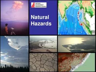
POTENTIALLY HAZARDOUS NATURAL PHENOMENA AND PROCESSES IN THE CARIBBEANMULTIPLE HAZARD SCENARIOLarge-scale wildfires are not reported in the small island states. ATMOSPHERIC • Hurricanes Tropical storms Tornadoes • Rainfall • Lightning • Hailstorms • Bolides • Temperature changes
SEISMIC • Fault ruptures • Ground shaking • Liquefaction • Land Uplift and Subsidence • Landslides • Tsunami • Seiches
VOLCANIC • Lava flows • Mudflows • Pyroclastic flows • Projectiles and lateral blasts • Tephra (ash, cinders, lapilli) • Gases
GEOLOGIC/HYDROLOGIC • Landslides • Debris Flows • Mud Flows • Submarine slides • Subsidence • Mud Volcanism
HYDROLOGIC • River flooding • Erosion and sedimentation • Desertification • Salinization • Drought • Coastal flooding(Storm surge, Tsunami) • Sea-level rise
The Caribbean region’s environmental problems include: Hazards induced by climate change: • landslides, • flooding (coastal flooding and river flooding), • hurricanes ( winds exceeding 118km/hr, heavy rainfall, storm surge) • desertification, erosion and sedimentation, salinization • degradation of coral reefs
From: CDB and CARICOM, 2004; Benn, 2004 in ECLAC, 2005 • River-basin degradation • Deforestation • Waste disposal • Loss of habitat and biodiversity • Pollution of freshwater, coastlands and the atmosphere
Hydro-meteorological disasters in Latin America and the Caribbean, 1990-2004; ECLAC,2005www.eclac.cl/publicaciones/xml/0/21540/lcg2331.pdf
CLIMATE CHANGE AND HAZARDSThe Intergovernmental Panel on Climate Change has published The Physical Science Basis of projections and likely scenarios on climate change on 2 February 2007, AR4http://ipcc-wg1.ucar.edu/wg1/wg1-report.html How would climate change possibly manifest itself on active natural processes affecting the small island states of the Caribbean is not definite
The sizes of the individual islands are not large enough to have significant shifts in the intra-island rainfall distribution patternsLarge-scale rate changes would be expected in view of anomalous sea surface temperatures and changes in wind shear patterns.
However, there are a couple of likely scenarios that may be speculated. • Any significant (whatever that is) sea level rise will affect the littoral drift along the coast with some changes to the location and seasonal change to beaches due to increased or decreased sediment nourishment
There also would be a change in the coastal areas subject to storm surge during hurricanes or other major tropical storms; probably a greater run-up is likely. • There may also be an increase in the sea cliff retreat where wave action becomes more effective due to sea level rise or higher energy associated with hurricanes and tropical storms.
Rising sea level would affect the base level of major streams, in that incision of river valleys might slow and some slope processes might change as a result. This is likely to be a complex interaction especially if the number and/or power of hurricanes and tropical storms increase.
The greater delivery of sediment to the valleys from rainfall-induced landslides may result in greater aggradation in these valleys where down cutting is less. Flooding events and areas affected by flooding in the future may very well change due to the base level changes, greater rainfall and increased sediment deposition.
CHALLENGES FOR DISASTER REDUCTION From: Report of the Subcommittee on disaster reduction, 2005
1. Provide Hazard and Disaster Information Where and When it is Needed. Improve data collection to increase understanding of the ways in which hazards evolve. Create standards for sharing, storing, and analyzing data. 2. Understand the Natural Processes That Produce Hazards. Improve models and visualization techniques.
Create resilient structures and infrastructure systems using advanced building technologies.Support structural advances with effective nonstructural mitigation. Quantify the monetary benefits of disaster mitigation using economicmodeling. 3. Develop Hazard Mitigation Strategies and Technologies.
4. Recognize and Reduce Vulnerability of Interdependent Critical Infrastructure. Develop science and technology to prevent cascading failures in public infrastructure systems. Enhance the ability to protect public health before and after a hazard event.
5. Assess Disaster Resilience Using Standard Methods. • Support intelligent community planning and investment strategies and protect natural resources with comprehensive risk assessments. • Assess the resilience of the natural and human environment. • Learn from each hazard event.
6. Promote Risk-Wise Behavior. • Raise public awareness of local hazards. • Warn people with consistent, accessible, and actionable messages and a national all-hazards emergency communication system. • Develop policies that promote risk-wise behavior and are based in social science research.