Download
1 / 20
200 likes | 222 Views
This progress update provides an overview of the South West Strategic Regional Coastal Monitoring Programme, including updates on waves and tides, topographic beach surveys, bathymetric surveys, aerial photography, LiDAR surveys, and habitat mapping.

E N D
SOUTH WEST STRATEGIC REGIONALCOASTAL MONITORING PROGRAMME PROGRESS UPDATE SIMON HUMPHRY PROJECT ENGINEER TEIGNBRIDGE DISTRICT COUNCIL
PARTNERS PARTNERS
Teignbridge District Council Managing contracts for the Waves & Tides, Topographic Beach Surveys, Bathymetric Surveys Martin Hutchings Regional Coordinator - 01626 215848 Simon Humphry Project Engineer - 01626 215819
Channel Coastal Observatory Management, Maintenance and installation of the Wavebuoy and Tidegauge Network Working in partnership with South East Coastal monitoring Programme Travis Mason
Environment Agency Management of the, Aerial Photography, LiDAR Surveys, Habitat Mapping Keith Nursey EA Contract Manager Angela Proctor EA Contract Manager Lyn JenkinsEA Contract Manager West Bay Plymouth Hoe
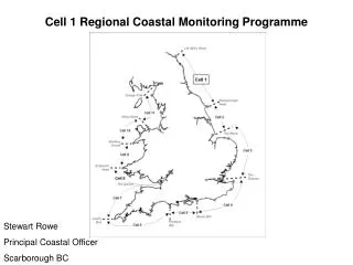
PLYMOUTH COASTAL OBSERVATORY South Devon & Dorset SMP Group Nathan Sykes – 01752 586156 North Devon & Somerset SMP Group Emerald McLoughlin – 01752 586155 Cornwall & Isles of Scilly SMP Group Gemma Kaye – 01752 586153 Porthleven Dawlish
TOPOGRAPHIC BEACH SURVEYS Work packages originally let as 5 contracts 1 additional contract let this year between Sand Point and Aust for the programme extension Base line survey for additional contract now complete and due to be uploaded onto the website. All interims surveys for Spring 2009 are complete and on the website Interims for autumn 2009 due to commence shortly Please call PCO if you feel that a post storm survey is required in your area
BATHYMETRIC SURVEYS Work packages originally let as 8 Contracts 2 of these contracts are full Multi Beam Surveys in partnership with the MCA 7 Contracts now complete 1 contracts data submitted waiting approval 1 Contract delayed due to consultant struggling with weather conditions 1 additional contract let this year between Sand Point and Seven Beach
WAVES & TIDES Working in partnership with SE Programme 7 Wavebuoys originally deployed around SW coastline 3 Additional Wavebuoys recently deployed at Bideford Bay, Looe Bay and Weston Bay 2 WaveRadar Tidegauges & Met Stations Real time data for all Wavebuoys and Tidegauges is available on the website Possible Tidegauge at Port Isaac Cornwall
LiDAR • Survey work let as one contract for South West to Geomatics • Most sensitive/vulnerable areas to be flown every year • Some areas to be flown every other year • Least sensitive/vulnerable areas to be flown once every 5 years • 3 flying seasons now complete • The 4th years flying commenced in early September this year and now is 60% complete • All LiDAR survey work is now complete for the programme extension
AERIAL PHOTOGRAPHY One contract for the South West let to Blom Aerofilms 100% of the base line data set has now been collected Approximately 25% of the south west coastline has been flown for a second time The first delivery of data for this years flying season has been received for quality control Cloud cover over the past 3 summers has caused delays to the programme Looking to extend the flying season to maximise use of good weather Aerial photography for the programme extension is now complete
ECOLOGICAL MAPPING Habitat mapping data has been delivered for the following areas; North Devon South Cornwall South Devon South East Devon West Dorset