Geography Essentials: Maps and More
210 likes | 234 Views
Learn about map essentials and geographic patterns. Explore elements of maps, lines of latitude and longitude, prime meridian, hemispheres, scale, political maps, and map creation. Engage in activities like research, questioning, and map-making for practical understanding.

Geography Essentials: Maps and More
E N D
Presentation Transcript
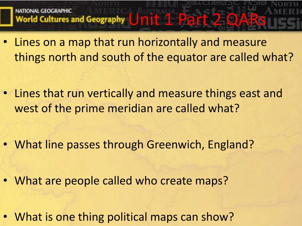
Unit 1 Part 2 QARs • Lines on a map that run horizontally and measure things north and south of the equator are called what? • Lines that run vertically and measure things east and west of the prime meridian are called what? • What line passes through Greenwich, England? • What are people called who create maps? • What is one thing political maps can show?
Bellringer • Copy down the world regions from page 17 in your NOTES (Not daily work). You only need to copy down the names and ONE country associated with that region. Example: Region A (North America)- United States.* You can use this on the test.
Geography Unit—1 Part—2 Pgs.— 18-24
End Before—Guess the Lesson
Learning Goals • ALCOS #1:Describe the world in spatial terms using maps and other geographic representations, tools, and technologies. • Goal: Tell me the essentials of maps and how they show geographic patterns.
End Read—Pgs. 18-19 • Read through “Elements of a Map” then STOP. • Graphic Organizer *KWL* (Before reading, write down ONE thing you already know about the topic above. Also, write down ONE thing you hope to learn more about. After you read, list ONE thing you learned from reading the pages above.) • Internet Researcher (Look up “Geographic Maps” on your phone using Google and find a website with ONE key fact pertaining to “Geographic Maps”. Also, list the URL or website address.) • Questioner (Create three questions that could be used on a test from the information you read, your questions can be any type of question, but you must include the answers.) • Answer questions on page 19, write questions and answers.
A 3-D representation of the world is called a globe. • A 2-D representation of the world is called a map. • Lines of latitude run horizontally, parallel to the equator that runs across the center of the Earth. • Lines of longitude run vertically from the North Pole to the South Pole. The prime meridian passes through Greenwich, England and is 0 degrees similar to the equator.
End QARs • Lines on a map that run horizontally and measure things north and south of the equator are called what? • Lines that run vertically and measure things east and west of the prime meridian are called what? • What line passes through Greenwich, England?
End Read—Pgs. 20-21 • Read through “Map Scale” then STOP. • Coding the Text • Pick 3 symbols and find information matching the meaning of the symbol. Answer questions on page 21, write questions and answers.
A map’s scale shows how much distances on Earth is shown on the map.
End QARs • How is distance between places shown on a map?
End Read—Pg. 23 • Read through “Political and Physical Maps” then STOP. • Create a Map (Using your phone/computer, look up your address and make a very basic map detailing the fastest route from school to your house. Include road names, the mileage, and time it takes to travel between places.) • Answer questions on page 23, write questions and answers.
Map makers, or cartographers, make maps to show different things. • Political maps show things such as borders between countries, physical maps show things such as elevation.
End QARs • What are people called who create maps? • What is one thing political maps show?
QAR Answers • Lines on a map that run horizontally and measure things north and south of the equator are called what? • Latitude • Lines that run vertically and measure things east and west of the prime meridian are called what? • Longitude • What line passes through Greenwich, England? • Prime Meridian • What are people called who create maps? • Cartographers • What is one thing political maps can show? • Borders between countries
GPS Scavenger Hunt Instructions • Go to the website latlong.net. • On the next slide you will see 10 coordinates, you will need to use the above website to plug in the latitude and longitude to find the location. • You only need to find the city/state or city/country. Do NOT include districts, roads, or any other name or location.
GPS Scavenger Hunt • 1)Lat:55.755826 Long:37.617300 • 2)Lat:30.044420 Long:31.235712 • 3)Lat:34.699258 Long:-86.748332 • 4)Lat:21.306944 Long:-157.858333 • 5)Lat:-34.603684 Long:-58.381559 • 6)Lat:43.653226 Long:-79.383184 • 7)Lat: 51.507351 Long:-0.127758 • 8)Lat:-33.867487 Long:151.206990 • 9)Lat:39.904211 Long:116.407395 • 10)Lat:27.717245 Long:85.323960
Create Your Own • Using the latlong.net website, create your own 10 locations. • At the top of the website, click ‘Address to Lat Long’ and enter the location you want to use. • Copy and paste the coordinates on your paper for 11-20. • You can use individual locations (such as: Statue of Liberty), but you must state that in your location. • When complete, turn in all work to the box.