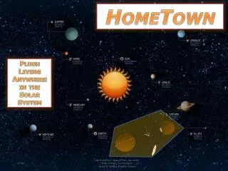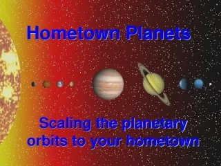
Hometown Planets
320 likes | 335 Views
Explore how to scale planetary orbits to your hometown to grasp distances between planets better using scale ratios and factors. Convert units, choose a scale factor, and create model map orbits using familiar units and objects.

Hometown Planets
E N D
Presentation Transcript
Hometown Planets Scaling the planetary orbits to your hometown
How far away are all of the planets? The solar system is so huge and the planets are such great distances apart that it is hard to get an idea of how “close” they really are to one another. What could we do to get a better idea of how close planets are to one another and to Earth? Change the distances to something we can relate to in everyday life! This is called scaling or scale modeling.
Scaling…like climbing a wall? • No silly! The scaling or scale modeling we are using is for adjusting distances to larger or smaller units in order to better view an object or distance. • Architects use this all of the time. Blueprints are a small scale version of what they are building. • So we can do the same thing by drawing a small scale version of the solar system.
Understanding Scale Ratios • All scale models use ratios. • A ratio is a comparison of two things. • For example, if I ask you for the ratio of oranges to apples that means I am asking you to compare how many of each fruit. What’s the ratio? • You have four oranges and five apples so the ratio of oranges to apples is four to five or 4:5.
Understanding Scale Ratios • In models the scale ratiois the comparison of the true distance to the distance on the model. • Write down an example of a scale ratio that you would see on a map. • 10 mi : 1 in (10 miles = 1 inch) • 25 km : 10 cm (25 kilometers = 10 centimeters) • Or anything else that is the true distance compared to the distance on the map
Understanding Scale Factors • In models the scale factoris how many times smaller the model is than the actual object or distance. • It is determined by dividing the actual distance by the distance on the model. • So, if the scale ratio was 30 in : 10 in then the scale factor would be 30 divided by 10 or 3. The model is three times smaller.
Understanding Scale Factors • How do you get the scale factor if the scale ratio was 5 ft = 2 in or 5 ft : 2 in? • To get the correct scale factor the units must be the SAME for both distances. • Conversion (unit change):5 ft× 12 in = 60 in 1 ft • Scale factor: 60 in = 30 2 in
Scaling Planetary Orbits to Hometown Distances • Here is a table of the planetary orbit distances. • The first step to make a planetary orbit model is to convert the units from km to mi. **Pluto is technically a dwarf planet, but we still like it!
Converting Units • Start with the units you have and end with the units you need! • We have km and need to get to mi. • This conversion is kind of tricky, so here are the units for the steps in between: 1.0 km × _____ m × ____ cm × 1.00 in × 1.0 ft × 1.0 mi = 1.0 km 1.0 m 2.54 cm __ in 5,280 ft • Since 1.0 km = 0.62137 mi(number A), multiplying the orbit distances by number A will convert km to mi. ? 1000 100 ? 0.62137 mi ? 12
Choosing A Scale Factor • To make sure that most of the planetary orbits are within our hometown area, set the largest orbit equal to 40 mi. • What is the scale ratio? • Pluto’s orbit : model distance • 3.67×10⁹mi : 40 mi = 3.67 × 10⁹mi = 9.17 × 10⁷ 40 mi • This number, 9.17 × 10⁷, is scale factor B. • Using the new planetary distances (in miles) divide by this number to correctly scale down the distances for the model.
Another Conversion… • Now the model orbits need to fit on a map. What is the unit we need to convert to? • We have mi and need to get to mm. • This one is easier than the last conversion because there is a scale bar on a map.
A map of Delcastle… What is the scale ratio (C) for this map? 40 mm : 5.0 mi 40 mm = 8 mm 5.0 mi mi • Find scale factor CFOR YOUR MAP!!! • Multiply the orbit distances by your scale factor C to correctly convert frommi to mm on your map.
Hometown Planet Maps • Map W: Scale ratio 46 mm : 1.0 mi • 46 mm ÷ 1.0 mi = 46 mm/mi • Map X: Scale ratio 57 mm : 5.0 mi • 57 mm ÷ 5.0 mi = 11.4 mm/mi • Map Y: Scale ratio 57 mm : 10.0 mi • 57 mm ÷ 10.0 mi = 5.7 mm/mi • Map Z: Scale ratio 38 mm : 25 mi • 38 mm ÷ 25 mi = 1.52 mm/mi
Mapping Hometown Planets • Plot the orbits using the planetary orbit distances scaled for your map and a compass. • Trace each orbit twice!! Sometimes the compass shifts while being used and could give an incorrect orbit. • Once the orbits are mapped, identify a well-known landmark for each planetary orbit.
Hometown Planet Maps • Map W: Inner Planets • Scale ratio 1.0 mi : 33 mm • Map X: Inner Planets + Jupiter • Scale ratio 5.0 mi : 40 mm • Map Y: Mars, Jupiter and Saturn • Scale ratio 10.0 mi : 40 mm • Map Z: Outer Planets • Scale ratio 25.0 mi : 27 mm
Here’s a map of Delcastle… Mars Mercury Delcastle Venus Earth
Still too small for the large orbits! Jupiter’s orbit barely fits on this map! Notice that all of the other inner planets’ orbits are squished in the center. What does this tell you about how far apart these planetary orbits are? Mercury Venus Earth Mars Jupiter
This is a little better… Jupiter Saturn Mars …but the orbits of Neptune, Uranus and Pluto are still out of range for this map.
Finally fit in Pluto, but where is Earth? On this map Earth’s orbit (and all of the other inner planets’ orbits) would be smaller than the black outline of the letter A marking Delcastle’s location! Uranus Neptune Saturn PLUTO
Mars Mercury Delcastle Venus Earth Map W
Mercury Venus Earth Mars Jupiter Map X
Jupiter Saturn Mars Map Y
Uranus On this map Earth’s orbit (and all of the other inner planets’ orbits) would be smaller than the black outline of the letter A!!! Neptune Saturn PLUTO Map Z