1 / 40

Louis Vermaak – DBCP XVIII – Martinique 14-18 October 2002

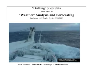
‘Drifting’ buoy data - their effect on ‘Weather’ Analysis and Forecasting Ian Hunter S A Weather Service 29/7/2002. Louis Vermaak – DBCP XVIII – Martinique 14-18 October 2002. South African Weather Service (SAWS) METAREA VII. Our marine environment ‘Fixed platform’ in situ observation sites

jcarrington
Download Presentation

Louis Vermaak – DBCP XVIII – Martinique 14-18 October 2002

An Image/Link below is provided (as is) to download presentation Download Policy: Content on the Website is provided to you AS IS for your information and personal use and may not be sold / licensed / shared on other websites without getting consent from its author. Content is provided to you AS IS for your information and personal use only. Download presentation by click this link. While downloading, if for some reason you are not able to download a presentation, the publisher may have deleted the file from their server. During download, if you can't get a presentation, the file might be deleted by the publisher.

E N D

Presentation Transcript


  1. ‘Drifting’ buoy data- their effect on‘Weather’ Analysis and ForecastingIan Hunter S A Weather Service 29/7/2002 Louis Vermaak – DBCP XVIII – Martinique 14-18 October 2002

  2. South African Weather Service (SAWS)METAREA VII • Our marine environment • ‘Fixed platform’ in situ observation sites • Remotely-sensed marine data • SAWS marine products/ activities • Drifters and some case studies • Comments

  3. SAWS – our Marine Environment

  4. Tropical cyclone ‘Eline’ 22 February 2000

  5. ‘Magdalena Oldendorff’ – icebound in METAREA VII

  6. Explosive cyclogenesis south-west of Cape Town

  7. Cut-off low generating heavy SE’ly swell

  8. Heavy SW’ly swell arrives at ‘The Dungeon’ south of Cape Town

  9. Warm Agulhas Current water penetrating the South Atlantic Courtesy OSIS Cape Town

  10. 10% + of world’s seaborne oil trafficrounds the Cape…. Courtesy : MRG Munich

  11. SAWS – our “Fixed Platforms”

  12. cf FA Platform central Agulhas Bank Courtesy MRG Munich

  13. A visitor to Marion Is (48° S) – March 2002

  14. Bouvet Is. Norwegian AWS v. important for wave forecast models

  15. SAWS AWS on South Thule, South Sandwich Islands - see ‘ship wave’ clouds, top left.

  16. Remotely-sensed Marine Data

  17. NOAA AVHRR data – Agulhas Current – 5 knots +

  18. MODUS – Terra – Gulf Stream even higher resolution ...

  19. Scatterometer winds ex QUICKSCAT – not always available

  20. QUICKSCAT sees the pack ice – June 2002

  21. SAWS – our Marine Products/ Activities

  22. SAWS Global Spectral Model (GSM)

  23. SAWS regional Eta model

  24. A few Marine Case Studies in METAREA VII

  25. Heavy, very long-period SW’ly swell to Agulhas Bank - semi-submersibles unprepared, go into resonance. Damage several $m.

  26. Tropical Cyclone Domoina visits the KwaZulu Natal Coast

  27. Meteosat 7 – 4 September 2001HmO 10m + off Cape Townwidespread coastal damage

  28. Explosive cyclogenesis 24 May 2002. Heavy swell -> coastal damage/ flooding

  29. Drifting buoy 17513, south-west of Cape Town

  30. August 2002

  31. Antarctic Mesoscale Prediction System model - AMPS

  32. Drifting buoy 71566 – important input for AMPS – wakes up !

  33. NOAA WAVEWATCH model – buoy data please !

  34. Concluding Comments :Marine DATALife blood – Bread & butter !

  35. Bouvet AWS data – received 8 hours later ...

  36. International cooperation versus NMS commercialisation

  37. SA Agulhas returning from Marion Is – August 1999 Photo : Brent Appel - SAWB

More Related