Download
1 / 20
220 likes | 258 Views
Learn about xGEOID17 models based on GRAV-D, satellite, and terrestrial gravity data. Details include editing processes and comparisons. Future work covers data improvement and error estimation.

E N D
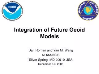
NGS Annual Experimental Geoid Models – xGEOID17: What is new and the results Wang YM1, S Holmes2, X Li3 and K. Ahlgren1 1 National Geodetic Survey, NOAA, USA 2 SGT Inc. USA 3 DST Inc. USA IAG-IASPEI 2017 Kobe | Japan | July 30 - August 5, 2017
GRAV-D and Next Vertical Datum Next vertical datum for North America will be based on a gravimetric geoid (SGEOID2022) by combining the latest satellite models, GRAV-D airborne gravity over the whole U.S.A. and terrestrial gravity data. Currently GRAV-D covers over 60% of the planned areas
xGEOID17 Experimental geoid (xGEOID) series has been computed annually since 2014 (http://beta.ngs.noaa.gov/GEOID/xGEOID/) xGEOID17 consists of two geoid models: - xGEOID17A: using all available data EXCLUDING GRAV-D - xGEOID17B: using all available data INCLUDING GRAV-D airborne gravity data All models are computed in an area between latitude 5˚ to 85˚; longitude 170˚ to 350˚ at 1’x1’ grid size.
Data used for xGEOID17 1. GOCO05S satellite gravity model 2. NGA 1,633,376 points terrestrial gravity data 3. NGS 135,290 points over land (supplemental / fill-in) 4. 3" digital elevation model (SRTM and ASTER) 5. GRAV-D airborne gravity data ~50% of CONUS (model B only) 6. Altimetric gravity anomaly DTU13 (1’ x 1’)
GRAV-D Data Editing/Adjustment GRAV-D data were edited by a) Removing block biases (relative to EGM2008) b) Removing line biases by using crossover adjustment c) Removing outliers, down-weighting suspect values in the gridding procedure
De-biasing terrestrial gravity data of small surveys - first trial in Iowa Split the gravity data in Iowa by survey Using the radial base functions to model survey biases and local gravity field The parameters are estimated in the least squares sense
Downward continuation of terrestrial gravity data Avoided using the g1 term for the gravity anomalies reduction. Continuation was done in an iterative way using the spherical harmonic analysis – only gravity data, no topography simulated gravity anomaly were used.
REF17A – EGM2008 Free-Air Disturbances (units in mGal)
xGEOID17A – xGEOID16A Geoid Height (units in m)
Summary 5 More GRAV-D surveys were included in xGEOID17 NGS terrestrial gravity data was mostly replaced by NGA data Data cleaning (de-biasing, editing) are important steps to improve the geoid Different downward continuation procedure produces large differences in mountainous areas. GPSL comparisons showed that the xGEOID17B should have a relative accuracy of ~1.4 cm along GSVS11 and GSVS14.
Future Work Further improvement in data cleaning (de-biasing), downward continuation, topographic correction Error estimation of gravity data and its propagation in the geoid Geoid computation for GSVS17 in Colorado Investigation of downward continuation effect using gravity data or gravity and topography combination Topographic effects on geoid computation Estimation of optimal weights for different data types