Download
1 / 42
440 likes | 744 Views
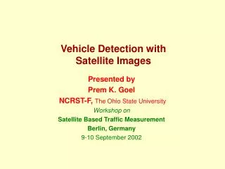
Vehicle Detection with Satellite Images. Presented by Prem K. Goel NCRST-F, The Ohio State University Workshop on Satellite Based Traffic Measurement Berlin, Germany 9-10 September 2002. Image Processing Algorithms: Performance Evaluation. Acknowledgment C. Merry, G. Sharma, F. Lu,

E N D
Vehicle Detection withSatellite Images Presented by Prem K. Goel NCRST-F, The Ohio State University Workshop on Satellite Based Traffic Measurement Berlin, Germany 9-10 September 2002
Image Processing Algorithms: Performance Evaluation Acknowledgment C. Merry, G. Sharma, F. Lu, M. McCord, Past students: P. Goel, and J. Gardar
Vehicle Identification in High Resolution Satellite Imagery • Infrequent Image Acquisition from satellites • Stereo Coverage May be Unavailable
1-m resolution image 8 or 11-bit data To detect and count vehicles Vehicle classes – cars and trucks No road detection Problem Statement
Pavement Background Image • Lack of stereo Images • Background (Pavement) Image • No Background • Background Based • Bayesian Background Transformation (BBT) • Principal Components (PCA) • Gradient Based
BBT Method: Flow Chart Highway Image (I) Background (B) Distributions of gray-levels in two classes Initial prior probabilities • Estimate probability of a pixel being stationary based on change from background Background Transform Estimate Distribution Parameters Update probabilities No Converged? Yes Threshold Clustering and other operations Vehicle Counts
Background (B) Roadway only Image (I) S = I + B D = |I – B| V1=Var2x2(S) V2=Var2x2(D) M2= Mean2x2(D) M1= Mean2x2(S) Principal Components Analysis PC Bands 1-4 Select PC Band. Threshold Binary Image Clustering and other operations Vehicle counts Principal Components (PCA) Method • PCA-based Method • Bands to capture texture and change • Re-orient bands
Segmented Highway Image (I) Calculate Gradient Image Threshold Morphological operations and Clustering Vehicle counts Gradient based method • Gradient Based Method • The ‘edge’ at vehicle boundaries • Gradient image = image with two classes • Threshold • try to incorporate spatial distribution of gray values
Final Outcome Original Image Binary Image
Simulated Images • No Method was best • Different method performed well for different images • Performance Evaluation on Real Images crucial
Real Image Test Cases • General Characteristics • Vehicles vs. pavement • pavement type, vehicle color, atmospheric conditions • Objects: Road signs, Lane markings • Road geometry • Traffic density
Thresholded Gradient Img Clustered Thresholded PC Band Clustered Image: I 75 – 1 • Main Characteristic • Pavement material transition
I 75 – 1 Probability Map Clustered Probability Map
Thresholded PC Band Clustered Thresholded Gradient Img Clustered Image: I 75 – 2 • Pavement material transition
I 75 – 2 Clustered Probability Map Probability Map
Thresholded PC Band Clustered Clustered Thresholded Gradient Img Image: I 270 – 1 • Pavement material transition • Overpass • Lane markings • Curved road segment
I 270 – 1 Clustered Probability Map Probability Map
Thresholded PC Band Clustered Thresholded Gradient Img Clustered Image: I 270 – 2 • Lane markings • Pavement material transition • Straight segment • Fairly dense traffic
I 270 – 2 Probability Map Clustered Probability Map
Thresholded PC Band Clustered Thresholded Gradient Img Clustered Image: I 70 – 1 • Lane markings • Sign board • Fairly dense traffic • Straight road segment
I 70 – 1 Probability Map Clustered Probability Map
PC Band Thresholded… Clustered Gradient Img Thresholded… Clustered Image: I 10 – 1 • Straight road segment • Median • Good vehicle vs. pavement contrast
I 10 – 1 Clustered Probability Map
Image: I 270 – 3 • Multiple pavement material transitions • Median • High traffic density
Thresholded PC Band Clustered Image: I 71 – 1 • Poor vehicle vs. pavement contrast • Illumination change • Overpass
I 71 – 1 Clustered Thresholded Gradient Img Clustered Probability Map
Image: I 70 – 2 • Cloud cover • Overpass • Pavement material transition
I 70 – 2 Thresholded PC Band Clustered
I 70 – 2 Thresholded Gradient Img Clustered
I 70 – 2 Clustered Probability Map Probability Map
Results Summary Summary: Errors of Omission and Commission • BBT and gradient method give numbers close to the real values • Large errors of omission and commission for PCA and gradient based method • Low omission and commission errors for BBT method
Future Needs • Methods Not Requiring Background • Post-processing • – sieving and clustering • Effort • Process