Download
1 / 5
120 likes | 355 Views
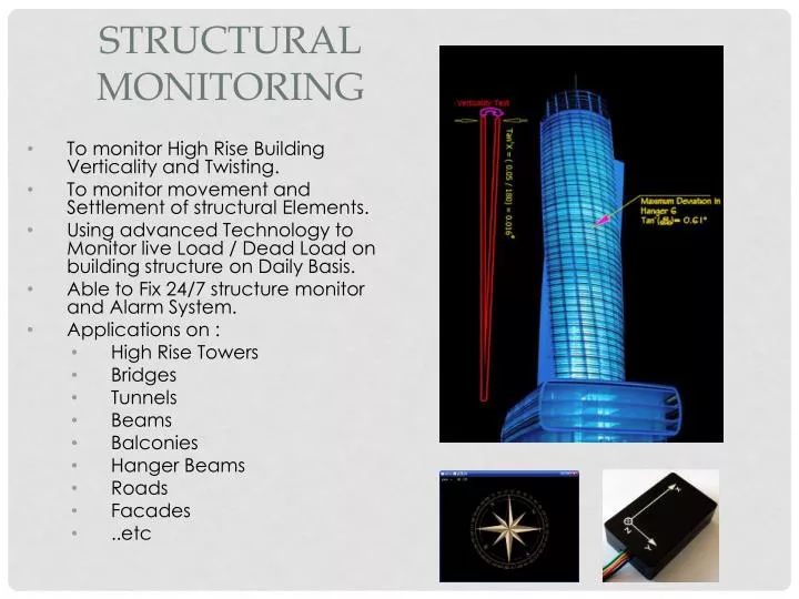
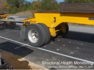
Structural Monitoring. To monitor High Rise Building Verticality and Twisting. To monitor movement and Settlement of structural Elements. Using advanced Technology to Monitor live Load / Dead Load on building structure on Daily Basis. Able to Fix 24/7 structure monitor and Alarm System.

E N D
Structural Monitoring • To monitor High Rise Building Verticality and Twisting. • To monitor movement and Settlement of structural Elements. • Using advanced Technology to Monitor live Load / Dead Load on building structure on Daily Basis. • Able to Fix 24/7 structure monitor and Alarm System. • Applications on : • High Rise Towers • Bridges • Tunnels • Beams • Balconies • Hanger Beams • Roads • Facades • ..etc
Plant Scanning & Modeling • Plant 3D Scanning For Oil and Gas Industry, Onshore and Offshore Platforms, mainly to serve the Stability and new As Built For Plants. • GEOTECH Is using a state of the Art technology to perform an accurate dimensional Plant models. • The Software is an important and impressive part of 3D data analysis. GEOTECH is using a variety of Software's to serve multi applications like : Cyclone, PDMS, Autodesk Plant, Autodesk Revit, Rhino …..etc. • The modeling team is well trained and continuously under skills upgrading Program. • We are following a high standards of HSE procedures and personnel training to save our persons and company vision. • Creating and/or verifying “As Built” documentation • Retrofit design engineering projects Constructability studies Fabrication and construction verification and analysis . • Capture accurate and complete As-built conditions • Fast and safe field collection with minimum disruption. • Highly productive modeling within familiar PDMS environment. • Enterprise class database client/server architecture available Load and process 3D laser scan data (Point Clouds) directly inside of PDMS • Clash check the point clouds against the PDMS design • Construct native as-built PDMS piping, equipment, and other catalog commodities from cloud points
UAV Survey An unmanned aerial vehicle (UAV), also known as a unmanned aircraft system (UAS), is a machine which functions either by the remote control of a navigator Used as remote sensing instrument to capture Ground Surface details on 500m Altitude. Exported Data used as GIS Based Ortho Photo WHAT IS IT? a. Complete aerial imaging system b. automatic image processing TO WHOM? Mapping, survey, consulting, plantation, mining and electricity grid companies and organizations • WHAT ARE THE OUTPUTS? • Orthorectifiedimage mosaic • Digital elevation model (contours) • 3D measurements, volumes • FOR WHAT? • Mapping and cartography • Natural resources management • Land use classification • Urban and rural planning • Disaster monitoring • Log yard inventories • Forestry • Mining • Agriculture • Urban mapping • Power lines and roads • Topographic mapping • Elevation models and contours
Macro Scanning WHAT IS IT? Micro 3D laser Scanning Services , with accuracy of 50 Microns, Used For Archeological Finding, Statues, Electronics, Manufacture Duplication and Mechanical Parts TO WHOM? Archeologist , Mechanical Designers, Manufacturing Designers, Precast Factories, Aerospace, vehicles body modification, Heritage Record. • WHAT ARE THE OUTPUTS? • .stl • .Iges • .Dxf • .Step • FOR WHAT? • Archeological and Museum Record • Statue Digital Record • Movie Making • Parts Manufacturing • Mechanical Inspection • Mechanical Design • Organic Structure
“Complete As-built Survey Solution” Engineering Design & Survey Specialist CONTACT US Walid Elhajj Buisness ManagerGEOTECH SURVEYING Dubai, UAE Tel. +971- 4-4208133 Fax. +971-4- 4208144Mobile : +971-50-3737753 E-mail: walid@geotechsurveying.com Website: www.geotechsurveying.com


![Global Trend & Forecast Structural Health Monitoring [2020]](https://cdn4.slideserve.com/7242416/slide1-dt.jpg)