Download
1 / 36
360 likes | 372 Views
Explore the characteristics of the CBD in Houston and analyze how well it fits the core-frame model. Collect data on land use, building height, people count, environmental quality, and traffic count to support your analysis.

E N D
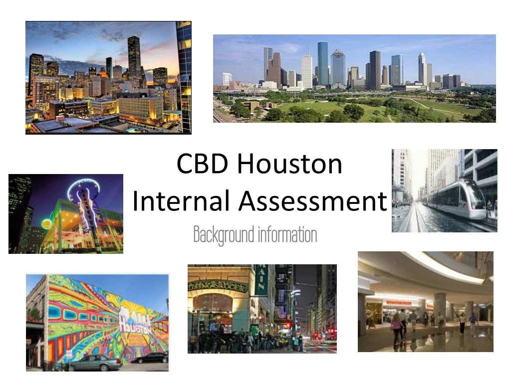
CBD Houston Internal Assessment Background information
What is the CBD? CBD = Central Business District. “The CBD is the commercial and economic core of a city. It is the heart of a city, the area most accessible to public transport, and the location with the highest land-values.” (Geography Course Companion, G. Nagel, p342 ) The main features of the CBD are (source: Geography, An Integrated Approach by David Waugh, p430):- Major retailing outlets- Offices- Tallest buildings due to high rent per square foot of land- Greatest concentration of pedestrians- Highest concentration of traffic- Highest land values- Most dynamic area This is essentially your key theory- how could we measure these things during data collection?
More CBD Characteristics Old Core - often narrow streets / historical core (e.g. The Backs in Cambridge/The Lanes in Brighton) - Very Accessible - due to the convergence of major rail and road routes (often find public transport meets here - e.g. railway stations / bus stations) - Traffic Restrictions are often in place to deal with the large numbers of traffic and ensure safety for the high numbers of pedestrians. - Often has a central Market square area - Very High Land Values - due to lack of space and competition for land - Little/ No Residential Land Use - due to high land-values there is usually no residential land-use apart from the possibility of some flats above shops - Multistorey buildings - due to high land values resulting in building up rather than out - Shops Offices and specialist buildings e.g. Banks, buildings societies etc. (need to be accessible and can afford the high land values) - Mainly National Chain stores (have high threshold population and can afford the high land-values associated with the CBD - e.g. M&S; WHS; Next etc) - High numbers of pedestrians- 2 daily rush hours (am and pm) - Many now have undercover shopping centres - Presence of public buildings / government buildings (e.g. Town Hall etc.) - museums / castles / historical buildings (e.g. museums / University buildings) - Entertainment - restaurants, clubs etc.
The Core-Frame Model: a land-use model for the CBD The CBD is the economic powerhouse of the city. It located at the central point of the city; with the highest land values and the best public access through both public and private transport networks. As a result, the CBD is the most dynamic (changeable) of the zones of the urban area. The Core-Frame Model describes the typical land-use of the CBD, including changes over time and space.
Core-frame model Core-frame model– is a land-use model that explains the typical pattern of land-use that might be found in the CBD of a town or city. The model identifies 5 possible land-use zones – the inner core, outer core, frame, zone of assimilation and zone of discard. The major parts are:Inner Core - the location rarely changes, because this area contains the best transport links. In this area, the highest order shops and highest profit office activities are found. PLVI (Peak Land Value Intersection) - The PLVI is the “highest rated, busiest, most accessible part of the city.” The area with the highest land value.Outer Core - these are similar activities to the Inner Core, but require more space e.g. cinemas, or are have lower profit levels e.g. non commercial office activities such as local government.Frame - this is the edge of the CBD. It includes the major transport terminals, and activities that directly support the CBD.Zone of Assimilation - an area that is relatively fluid and can move. This corresponds closely to the gentrification argument - an area of low quality becomes fashionable, resulting in an increase of income which can then extend the CBD in that direction.Zone of Discard - an area becomes run down, often due to a major employer closing down and/or a lack of investment in the urban infrastructure.
Fieldwork question “To what extent does Downtown Houston fit the core-frame CBD land-use model?”
If including this in your coursework introduction you should annotate it to explain its relevance to your enquiry Interpreting the core-frame model (predictions)
How will we collect data? Primary data? Secondary data?
Planning the data collection • Land-use mapping– Maryam, Max, Mary • Building height – Caelan, Giulia, Serena • People count/character perception – Arjun, Eugenie, Angela, Abril • Environmental quality/photos – Delia, Janire, Philipp • Traffic count – Josh, Alex, Dani
Sites Site 1: Chevron building 1400 Smith Street Site 2: Cathedral1111 St Joseph Pkwy, Houston, TX 77002Site 3: Toyota centre 1510 Polk St, Houston, TX 77002Site 4: Discovery Green Site 5: Minute Maid park- corner of Congress and Crawford Site 6: Prison District: Fannin and CrawfordSite 7: Chase tower: 600 Travis StSite 8: Green Street: 1201 Fannin St, Houston, TX 77002Site 9: City Hall: : 901 Bagby St Downtown, Houston, TX 77002
A 3D map of Houston’s Downtown from Google Maps – what patterns can you see here?
Some other supporting background theories (bid rent and distance decay). If using them make sure you can explain them!
If including this in your coursework introduction you need to make sure you can explain its relevance to your fieldwork question The bid rent theory This bid-rent theory explains one pattern of urban land-use that is also identified by Burgess' concentric ring model. Bid rent theory is a geographical theory that refers to how the price and demand on land changes as the distance towards the CBD (Central Business District) increases. The different land users all compete with one and other for the more accessible land. The amount that they are willing to pay is called Bid Rent. As a direct result of this, a pattern of concentric rings of land use develops. The diagram shows what various land-users are prepared and able to pay for good access to the CBD
Distance Decay principal PLVI – Peak land value intersection
If including this in your coursework introduction you need to make sure you can explain its relevance to your fieldwork question Distance decay • The CBD of a city will be the location of the PLVI. • This means is the highest rated, busiest and most accessible part of the city – meaning land prices are also the highest. • Secondary peaks also exist in urban areas. These are areas that are also very accessible and so highly rated e.g. Houston – the Medical Center, Energy Corridor, Galleria District are all secondary peaks. How would we know where the PLVI is? Where do you think it is in Houston?
Relationship to syllabus Syllabus link: Optional theme G: Urban environments: “The characteristics of urban places - land-use”.
Key terms Core-frame model- a graphic representation of the CBD split into three main zones of the core (centre), frame (edge) and area between (outer core). Land use - the activity and buildings occupying space e.g. offices, shops, restaurants. This can also refer to the type of offices and shops e.g. fashion outlets or banks. Internal structure- the spatial distribution of functions within the CBD. Footfall- the number of people walking past a particular location
Explaining Houston’s land-use patterns The doughnut effect related to Houston: • http://www.atributosurbanos.es/en/terms/doughnut-city
http://www.downtownhouston.org/site_media/uploads/attachments/2010-04-07/2B-Framework_pg_1-18.pdfhttp://www.downtownhouston.org/site_media/uploads/attachments/2010-04-07/2B-Framework_pg_1-18.pdf
Locational context for Houston- Discovery Green (regeneration/ zone of assimilation) The City of Houston, the Houston First Corporation, and Discovery Green Conservancy:“When people come here to visit, their vision and image of Houston is now changed because of this park.”History:The site that would eventually become Discovery Green was originally a high-end residential neighborhood back in the late 19th century, but by the end of the 20th century, it is become nothing more than two large parking lots.It cost the city of Houston approximately $57 million to acquire the 12 acres of land and another $125 million to build and landscape the project. The park opened to the public in 2008.Impact:Discovery Green has transform downtown Houston into a place to play, as well as work. Original attendance projections were ambitiously hopeful at 500,000 visitors a year, but Discovery Green was able to meet that goal in its first six months, and now draws more than 1.2 million visitors to over 600 annual free events.Economically, the park has spurred downtown development to the tune of $625 million with another $1 billion in future projects such as offices, hotels, and residential units. http://www.socialworkdegreeguide.com/30-inspiring-urban-renewal-projects/
http://www.academia.edu/4594523/Houston_Gentrification_and_The_METRO_Rail_Case_Study_of_EaDo_and_Third_Ward_Houstonhttp://www.academia.edu/4594523/Houston_Gentrification_and_The_METRO_Rail_Case_Study_of_EaDo_and_Third_Ward_Houston To attract the most innovative companies and talented individuals, Houston will need to grow into a more environmentally and aesthetically appealing urban destination’
Houston background reading… Houston: The Surprising Contender in America’s Urban Revival (based on the East side of Houston) • http://www.governing.com/topics/urban/gov-houston-urban-revival.html Bucking trends: Urban renewal revisited (based on Bayou Place) • http://www.downtownhouston.org/news/article/bucking-trends-urban-renewal-revisited/ Houston, we have a solution: Turning 'car city' into green city • http://www.cnn.com/2013/08/27/tech/houston-we-have-solution-spanjian/