Download
1 / 27
280 likes | 948 Views
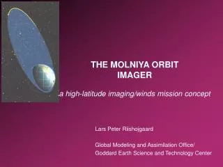
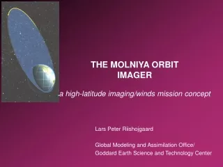
The Molniya Orbit Imager - a high-latitude quasi-geostationary satellite mission. Lars Peter Riishojgaard Joint Center for Satellite Data Assimilation. Mission highlights. High-latitude quasi-geostationary imager (“GOES to the pole”)

E N D
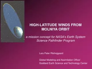
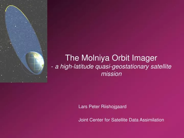
The Molniya Orbit Imager- a high-latitude quasi-geostationary satellite mission Lars Peter Riishojgaard Joint Center for Satellite Data Assimilation
Mission highlights • High-latitude quasi-geostationary imager (“GOES to the pole”) • Full Earth disc image every 15 minutes at 1 km (VIS channel) and 2 km (5 IR channels) horizontal resolution • High-latitude winds => improved weather forecasts (fewer busts) also at low latitudes • MODIS winds => better forecasts overall, hurricane landfall prediction • WMO recommendation on polar winds • Rapid repeat imaging data have applications in wide range of Earth science disciplines Arctic Imaging Workshop, NBI, August 20-21, 2008
Overview • Scientific rationale behind the mission • Why choose the Molniya orbit ? • How do we implement it? • Programmatic context, international collaboration Arctic Imaging Workshop, NBI, August 20-21, 2008
Why this mission? • Weather forecasts (global Numerical Weather Prediction products) have on average become very good => economic consequences of failure are large and growing • Reducing the severity and frequency of forecast busts high on NWS list of priorities • Busts over North America (mid-latitudes in general) often have high-latitude origins • General lack of high-latitude wind observations is among the most important shortcoming of the Global Observing System (GOS) Arctic Imaging Workshop, NBI, August 20-21, 2008
MODIS water vapor imagery (winds) animation courtesy of CIMSS Arctic Imaging Workshop, NBI, August 20-21, 2008
Status of satellite wind observations • No operational satellite wind measurements beyond 55-60 deg latitude • Experimental polar winds from MODIS; no operational follow-on planned • Data latency is problematic; 4 to 6 hours after real time • Image refresh rate problematic; 15 minutes is optimal, MODIS: ~100 minutes • No water vapor channel on NPOESS/VIIRS (until at least 2020) • Timetable for VIIRS in general is uncertain • Latitudinal coverage gap between MODIS and GEO winds • => Need for “geostationary-type” imagery over high-latitude regions; Molniya Orbit Imager is a good candidate Arctic Imaging Workshop, NBI, August 20-21, 2008
Molniya orbit characteristics • Highly eccentric Kepler orbit • Apogee height 39750 km (geostationary orbit height ~36000 km) • Perigee height ~600 km • Inclination 63.4 degrees • Orbital period ~11h 58m (half a sidereal day) • Location of apogee w.r.t. Earth is fixed and stable! • Platform in quasi-stationary imaging position near the apogee for about two thirds of the duration of the orbit • Used extensively by USSR and later Russia (to a lesser degree by the US) for communications purposes • First suggested for meteorological applications by Kidder and Vonder Haar (1990) Arctic Imaging Workshop, NBI, August 20-21, 2008
Why Molniya orbit? • Quasi-stationary perspective; ideal for feature tracking • Apogee height => GEO technology can be reused • Cost savings • Risk reduction • Best possible high-latitude coverage per satellite • Fully complements geostationary data; no LEO-like latitudinal coverage gap • Little time “wasted” over lower latitudes adequately seen from GEO • Simple ground segment; real-time dissemination can be achieved with a single primary ground station, as for GEO • Target is user delivery of calibrated and rectified images within less than 20 minutes and winds within less than 60 minutes of real time Arctic Imaging Workshop, NBI, August 20-21, 2008
Additional science applications(beyond satellite winds and NWP) • Sea ice (GSFC, MSC) • Age, temperature, motion, thickness, model validation • Temporal resolution will benefit operational applications, studies of polynyas, leads and marginal ice zone • Vegetation/forest fire monitoring (NESDIS, MSC) • Detection, intensity monitoring over Alaska, Canada, Siberia • Air quality applications over the Continental US (NOAA, EPA) • Volcanic eruptions; SO2, ash clouds (UMBC, USGS, OFCM) • NOAA, USGS interested in real-time monitoring capabilities for the Alaska Volcano Observatory for FAA/commercial aviation customers • Clouds, fog (NESDIS, UCPH) • Several cloud products planned by CIMSS • Temporal resolution enables e.g. contrail/cirrus studies Arctic Imaging Workshop, NBI, August 20-21, 2008
Additional science applications (II) • Polar weather (NWS, GSFC) • Operational monitoring of high-latitude weather • Development and life cycle of e.g. polar lows • Snow-cover and albedo monitoring (FMI) • Will benefit from temporal resolution primarily due to higher probability of clear-sky images • Regional water quality (HUT) • Dynamic phytoplankton and suspended solids mapping in the Baltic Sea • Surface radiation balance and SVAT models (UCPH) • Temporal resolution enables incorporation of the diurnal cycle in land-surface temperature, variability of aerosol loading and humidity in SVAT (Soil Vegetation Atmosphere Transfer) models Arctic Imaging Workshop, NBI, August 20-21, 2008
Mission level requirements • High temporal and spatial resolution imagery for all areas N of 60 degrees N for multitemporal applications and derived products • Full-disc view every 15 minutes within 60% of apogee • Special events rapid-scan capability: 1000 x 1000 km every 60 s • Horizontal resolution 1 km (VIS), 2 km (IR) at nadir from apogee • Nominal 3-year mission duration • Not technically difficult to meet or exceed • Proposal development originally targeted for NASA’s ESSP; opportunity never materialized • Real-time “operational” dissemination of images and derived products Arctic Imaging Workshop, NBI, August 20-21, 2008
Mission implementation studies • Overall Molniya Orbit Imager mission design based on • A series of concurrent engineering studies by the Integrated Design Capability at NASA’s Goddard Space Flight Center • A series of industry-funded studies (Ball Aerospace, Raytheon, SS/Loral, ITT Industries, Orbital Sciences, …) • Key IDC results: • Mission is technically feasible and classified as “low risk” • Total costs of three-year mission: ~$300M (with 30% margin) • Space segment • Instrument vendor (Raytheon) was selected for baseline mission • S/C proposals from four vendors were evaluated • Ground segment • NESDIS helped draft plans for data processing chain and indicated possibility of ground support (Fairbanks station) • Finland (FMI) has committed in principle to ground support (Sodankyla station; data processing) Arctic Imaging Workshop, NBI, August 20-21, 2008
MOI Spacecraft (IMDC flight configuration) Instrument Scan Control Instrument Cooler Control Instrument Sensor Module Instrument Main Electronics Arctic Imaging Workshop, NBI, August 20-21, 2008
Strong, broad-based community support • WMO recommendation (Alpbach 2004): • Operational satellite agencies are encouraged to investigate possibilities for ensuring a follow-on to the high-latitude winds from MODIS with improved timeliness • WMO Vision for the GOS in 2025 (R&D/pathfinders): “… Visible /IR imagers on satellites in highly elliptical orbit (HEO)” • Louis Uccellini, Director of NOAA/NCEP • “ … there is no question that the scientific rationale behind the Molniya mission is rock solid” • US Navy, NPOESS IPO, ECMWF, national weather services in a number of countries (e.g. UK, Germany, Netherlands, Nordic countries, Canada ) are behind this • Interest from a number of other science disciplines • Data from the Molniya Orbit Imager can be used to monitor sea ice, forest fires, volcanic eruptions, snow cover, water quality, etc. • Possibility of co-flying small scientific payload, e.g. Canadian/Finnish UV Aurora imager Arctic Imaging Workshop, NBI, August 20-21, 2008
Prospective partners • National science partners • NOAA/NESDIS; ground support, data processing, instrument • DoD (USAF, NRL/FNMOC); endorsement • International science partners • EUMETSAT; ground support • Finland (TEKES, FMI); ground support, space segment, launch • CSA/MSC; Canada launching own pre-Phase A Molniya study • Partners of opportunity • University of Calgary/FMI; secondary scientific payload: UV Aurora imager • CSA; high-latitude communications Arctic Imaging Workshop, NBI, August 20-21, 2008
International perspective • Canadian Space Agency and Environment Canada in pre-Phase A of two-satellite Molniya-like communications system • Russia developed “Arktika” mission proposal closely related to MOI • Being discussed in IGEOLAB context • FMI has attempted to initiate ESA pre-Phase A study for high-latitude imaging mission Arctic Imaging Workshop, NBI, August 20-21, 2008
International perspective (II) • High-latitude imaging mission realization could involve ring of countries surrounding the Arctic: Canada, Russia, Nordic countries, USA, … • Climate change => increased interest in Arctic region, both politically, economically and scientifically • Discussions taking place in the WMO IGEOLAB Highly Elliptical Orbit Working Group • HEO Working Group is CGMS-driven; not all parties interested in high-latitude imagery are members • HEO WG focuses on programmatics, not on requirements and applications • One role of Arctic Imaging Workshop is to gauge (and hopefully raise) the level of interest within the scientific community Arctic Imaging Workshop, NBI, August 20-21, 2008
Summary • Geostationary-class multipurpose imager in Molniya orbit; will complement the GEO system providing imagery and derived products (e.g. winds) to the pole • Additional data products supporting a wide variety of earth science applications • First (civilian) remote sensing mission in Molniya orbit • First high-temporal resolution imagery for regions N of 60 N • Mission ideally suited for national and international collaboration • Strong interest from Finland, Canada and several other countries Arctic Imaging Workshop, NBI, August 20-21, 2008