Download
1 / 51
510 likes | 945 Views
GPS - The Big Picture. 2004. Overview. Introduction - Show GPS Movie GPS and the Big Picture Accuracy Review of GPS Receiver Types Why the Garmin GPSMap76 Receiver. Show GPS Movie Movie is found on your CD < Presentations/GPSMovie Requires Acrobat Version 4 – on CD.

E N D
Overview • Introduction - Show GPS Movie • GPS and the Big Picture • Accuracy • Review of GPS Receiver Types • Why the Garmin GPSMap76 Receiver
Show GPS Movie • Movie is found on your CD <Presentations/GPSMovie Requires Acrobat Version 4 – on CD
Why do “Ologists” Need GPS? • Spatial location is a critical component in all field work
Why do Ologists Need GPS? • Field work is done outside in remote locations where map information could be out of date, too large of spatial scale • Ologists are retiring and locations of stuff are not being archived
What Can You Do With GPS? • Accurately and precisely record sites within 4 meters • 1m or better with other GPS • Navigate to locations pre-determined by others • Record the path you took and play it back later (make a map in the GIS)
GPS Myths • GPS does not work in the far north • Selective Availability will be turned back on • I Just turn my GPS on and never check settings - it just works!! • GPS is only a “Field” thing
Overview • Introduction - Show GPS Movie • GPS and the Big Picture • GPS Accuracy • Review of GPS Receiver Types • Why the Garmin GPSMap76 Receiver
GPS Data Collection GPS - The Big Picture Trails Glacier Moraines Streams
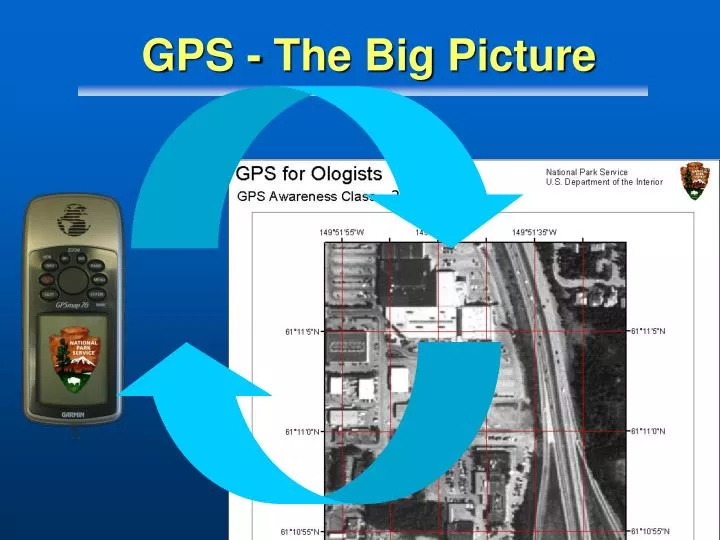
GPS - The Big Picture • GPS Data for Maps • Original Mapping • What’s out there? • Updating • Databases
You Are The Big Picture Archive of Park Stuff! Create/Obtain New Data Distribute Data To Parks Distribute To W W W
8 m How Accurate is GPS • Today… • GPS manufacturers quote about 50 ft (17m) • ...but were getting 26 ft (8m) fairly reliably with good sky Even Better!
Accuracy Comparisons – Open* 95% - XY Garmins Garmin V 3 m III Plus 4 m Map76 4 m *Test sites used on this slide: Garmin V(NPS Bakerville); Garmin III+/Map76 (MTDC)
Accuracy Comparisons – Open* 95% - XY Trimble Geo 3 2 m Geo XT 0.9 – 1.6 m Pro XR 0.6 m *Test sites used on this slide: Geo3 / GeoXT (1.6mMTDC); ProXR (Estacada). NOTE: GeoXT accuracy of 0.9 reported by NPS – Bakersville RT
GPS Under Canopy • Garmins17 – 20 meters • Trimble3 – 8 meters Watch Out
Putting It Another Way Which One?
Which Tool for the Job • Jobs for the Garmin • Jobs for the Trimble
Garmin Jobs • Bering Land Bridge - Drum Recovery and Disposal
Garmin Jobs • Aerial Mapping • Fire Perimeters • Airstrips • Animal locations
Garmin Jobs • Camp Sites • Using Photos to record site Conditions • Linking photos with location in GIS
Which Tool for the Job • Jobs for the Garmin • Jobs for the Trimble
Trimble Jobs • Utility Mapping
Location D Trimble Jobs • Multi-Feature Mapping • Soil sample sites • Tree Core Locations
Trimble Jobs • Trail Mapping / Condition
Which Tool For the Job • Summary • Garmin Jobs are for open country, “site locating”, simple maps • Trimble Jobs for GIS base mapping, feature rich environments and areas with difficult GPS conditions
Scale • Mode of Collection • Environment 25 acres 10 mile perim. • Quantity of Units • Moving Targets • Other Duties Unique Aspects of Ologist Mapping
Quick Review of GPS Types • Recreational Grade • Mapping / GIS Grade
Survey Grade • Boundaries, Precise Control Networks, Vertical Measurements Review of GPS Receiver Types
Quick Review of GPS Types • Recreational Grade • Navigation, Basic Mapping, Fun • Designed to Download into TOPO mapping programs – lightweight GIS
Quick Review of GPS Types • Mapping/GIS Grade • GIS Features and Attributes
PLGR’s • Retired PLGRS in April 2003 • Only 3 left in Alaska Parks • Software Improvements make PLGRs obsolete
Differential GPS (DGPS) • Differential GPS • A method of improving accuracy by adding a local reference station to augment information available from satellites • Provided by • Coast Guard Beacons (Realtime) • WAAS
DGPS - Coast Guard Beacons • Sounds great but… • Limited coverage • KEFJ, LACL, KATM, SE AK Coast Guard DGPS Beacons
DGPS - Satellite Based - Realtime • WAAS • 2 Equatorial satellites • Broadcast corrected signals • Designed for aircraft • Limited coverage in Alaska • poor under trees Theoretical WAAS Coverage
DGPS Review - Is it worth it? • For higher accuracy and precision - a must • Expect WAAS to increase broadcast area • Purchase WAAS in your next receiver and hope...
Decision Factors for the Ranger GPS Tool • Accuracy • Cost (hardware) • Nerd Factor Scale
Recreational Grade • Accuracy: 3meter - 7meter • Costs: $1500 - $150 • Nerd Factor: • Storage: hours worth of data • Strategy: waypoints, simple lines, polys
Mapping/GIS Grade • Accuracy: 1meter - 5meter • Costs: $10,000 - $3,000 • Nerd Factor: • Storage: days worth of data • Strategy: GIS update
Recreational Grade GPS Wins! • Reasonable accuracy for mapping large things • Low receiver cost • Low nerd scale • Strategy set to enhance navigation capabilities • Low attribution requirements
Overview • Introduction - Show GPS Movie • GPS and the Big Picture • GPS Accuracy • Review of GPS Receiver Types • Why the Garmin GPSMap76 Receiver
Recreational Grade GPS • Consumer Grade Manufacturers • Garmin • Recognized World Leader • High Support Lowrance Garmin Magellan
Garmin GPSMap 76 4 meters (open) • $400 • 12 Channel GPS WAAS enabled • 8 MB of Map memory* • 10,000 track points • 10 hours of battery life *Purchase of MapSource TOPO CD + $99
Garmin GPSMap 76 • Integrates well with GIS • DNR Garmin to ArcView is Fast and Efficient
Other Models (e.g. eTrex) • No time/date in comment field • No external antenna • No averaging Garmin GPSMap 76 • Unique Aspects • Antenna (Quadrifilar Helix) • It Floats • Averages waypoints • External Antenna capabilities
Limitations - Garmin GPSMap 76 • Weak Connection to External Antenna • Must hold UPRIGHT for best reception • Laying down on back produces poor data • Purchase a bracket if using in vehicles • Missing other features (Available in “S” Model: • Digital Compass • Altimeter
Where to Go For More INFO • NPS Intranet: • Cheatsheets and Guidelines • http://web/rgr/gps/tips.htm • Internet: • http://www.nps.gov/gis/gps/aksogps/ • GPS Toolkits • Your CD or • http://www.nps.gov/gis/gps/aksogps/
Where to Go For More INFO • GPS Toolkits
Summary • GPS allows precise positioning anywhere in Alaska • Recreational grade GPS satisfies... • Moderate accuracy's • Low costs in hardware, training • A Garmin allows for navigation and simple site marking jobs for many “Ologists”