Download
1 / 31
320 likes | 510 Views
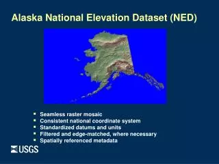
Status of the National Elevation Dataset and the National Lidar Initiative. Kris Verdin SAIC Center for Earth Resources Observation and Science (EROS) kverdin@usgs.gov. Presentation to the NHD Stewardship Conference April 26, 2007. The National Elevation Dataset (NED). NED Source Data.

E N D
Status of the National Elevation Dataset and the National Lidar Initiative Kris Verdin SAIC Center for Earth Resources Observation and Science (EROS) kverdin@usgs.gov Presentation to the NHD Stewardship Conference April 26, 2007
Current NED Development • Multi-resolution (nested layers) • 1-arc-second (~30 meters) • 1/3-arc-second (~10 meters) • 1/9-arc-second (~3 meters) • High resolution, “non-standard” source data • Lidar (grids, TINs, or points) • Photogrammetric (mass points and breaklines) • Cartographic (contours and hydrography) • IFSAR (grids)
1-arc-second source data 1/9-a-s source data 1/3-a-s source data 1-arc-second resolution 1/3-arc-second resolution 1/9-arc-second resolution (~30 meters) (~10 meters) (~3 meters)
Number of downloads (FY06): 166,142 (1”); 151,052 (1/3”); 2,121 (1/9”)
Multi-resolution NED: MT (DEM source) 1-arc-second 1/3-arc-second
Multi-resolution NED: LA (lidar source) 1-arc-second 1/3-arc-second 1/9-arc-second
Multi-resolution NED: WV (MPBL source) 1-arc-second (30 meters) 1/3-arc-second (10 meters) 1/9-arc-second (3 meters)
Spatial metadata reflects new high resolution source data MPBL-derived source data USGS 7.5’ DEM source tile Multi-resolution NED: spatially referenced metadata
NED: High-Resolution Data Integration • Completed: • Puget Sound and Mount St. Helens lidar • Bexar County, Texas (photogrammetric data) • North Carolina lidar (Phase 1) • Harris County (Houston), and Brownsville, TX lidar • Lincoln, NE lidar • West Virginia (photogrammetric data) • Louisiana lidar • Florida Everglades (survey data) • Coastal Mississippi lidar (Hancock, Harrison, Jackson counties) • Mobile County, AL lidar • Louisiana lidar (additional areas, and 1/9-arc-second NED) • In-work: • Puerto Rico lidar • Southwest Florida lidar • North Carolina (Phase 2) • Planned: • Alaska IFSAR; Southern California IFSAR • Lidar: Delaware, Maryland, Ohio, Pennsylvania
Absolute Vertical Accuracy Statistics of Errors (meters) vs. NGS GPS Benchmarks June 2003: RMSE = 2.33 m Dec. 2005: RMSE = 1.80 m 2,235 geodetic control points Improvement in vertical accuracy from integration of higher-resolution source data
CLICK • USGS Center for Lidar Information Coordination and Knowledge. • Virtual center, but housed at EROS. • To take advantage of existing lidar data and information for scientific (non-mapping) research needs nationwide. • Data will be processed and integrated into NED if not already done
Lidar in the USGS • Geology • Volcanoes • Earthquakes • Landslides • Coastal Erosion • Dune changes
Lidar in the USGS • Water • Floods • Storm Surge • Hurricanes • Tsunamis • Streamflow • Watersheds • Bathymetry • Riverbank Erosion
Lidar in the USGS • Biology • Forest Characteristics • Habitat Structure • Carbon/Biomass • Wildfire Fuel Models • Land Cover
Lidar in the USGS • Geography • Lidar Remote Sensing research • NASA Medium Altitude Collaboration • Interdisciplinary Studies • Emergency response
LIDAR Flow Raw Points Processing Bare Earth Research and Derivatives CLICK NED
http://lidar.cr.usgs.gov • Provide information and points-of-contact for people interested in using lidar in certain areas, or with certain agencies. • Identify USGS scientists, cartographers, and geographers who could help with someone’s lidar needs. • Provide information on where data exists, including metadata. • Geographical location as well as where it can be physically obtained, if not disseminated from EROS
National Lidar Initiative • There is a growing demand for a consistent national-level high resolution lidar collection • USGS is being looked to as the leader by all other agencies in planning and managing this potential effort • NLI strategy meeting held in Reston in February
Base Map Inputs for Floodplain Mapping NRCCommittee on Floodplain Mapping Technologies Board on Earth Sciences and Resources Division on Earth and Life Studies August 2006-January 2007
Elevation for the Nation Age of USGS topographic maps in the National Elevation Dataset (NED) • DATA AGE: • Terrain data in USGS topographic maps are on average 35 years old; • flood mapping requires data that are either collected or considered for updating within the last 7 years. • DATA ACCURACY: • RMSE of the terrain data in the current NED is 2.34 m (7.7 ft) and • FEMA requires for flood plain mapping data with RMSE of 18.5 cm (0.61 ft) or 2 ft equivalent contour accuracy in flat areas and 37 cm (1.22 ft) or 4 ft equivalent contour accuracy in rolling or hilly areas. • Existing data are thus ~ 1/10 as accurate and about 5 times older than needed for the flood mapping task.
Elevation for the Nation Slope map of the U.S. gives approximate scope of a national elevation program • Recommend elevation data at: • 2-foot equivalent contour accuracy for national ‘average’; • 1-foot equivalent contour accuracy for zero slope (red) areas; • 4-foot equivalent contour accuracy for mountainous or sparsely populated areas. • Lidar data can meet all of these accuracy standards 11% of the continental US and Alaska has zero slope in the current National Elevation Dataset, much of which is in high-risk, coastal flooding areas.
Recommendations 1. Elevation for the Nation should employ Light Detection and Ranging (lidar) as the primary technology for digital elevation data acquisition. Lidar is the technology most capable of producing the (bare-earth) elevation accuracy that meets FEMA’s requirements for national floodplain mapping in all terrain types. 2. A seamless nationwide elevation model produced with lidar has application beyond the FEMA Map Modernization program. As part of Elevation for the Nation, federal, state, and local mapping partners should have the option to request data that exceed minimum specifications if they pay the additional cost of data collection and processing required to achieve higher accuracies. 3. The new data collected in Elevation for the Nation should be disseminated to the public as part of an updated National Elevation Dataset.
Is a National Lidar Coverage Technically Feasible? • There are roughly 40 commercial lidar sensors operating in U.S. today • 20-25 instruments dedicated to project could collect U.S. in 2-6 years • Dependent on point density, derived products, accuracies, bare earth removal, weather, etc. • Such a project would prompt purchases of additional sensors
Fill in the gaps Reduced Cost Reduced Time - No standardized analysis - No consistent specifications - No temporal continuity Complete Collect - Increased Cost - Increased Time Standardized analysis Consistent specifications (Some) temporal continuity (SRTM) Two collection options
Pricing / Contracting • New contracting scheme has allowed for a reduced cost of lidar collections through USGS Geospatial Services Contract • Can get lidar for ½ of what it used to cost • Can’t change specs, but are at nominal 1.4 m posting density • Quotes: Oregon $4.2 million Washington: $3.8 million Idaho: $ 3.3 million • In response to an informal RFI, an estimate of $100 million for nationwide coverage (about 3x NAIP annual funding)
Summary • NED objective: • “best available” bare earth elevation data • public domain (free from licensing or redistribution restrictions) • Focus on integrating partner data: • High-resolution, high-accuracy • 1/9-arc-second and 1/3-arc second coverage • Produce quadrangle based DEMs only where partners require or where there is little or no interest in high-resolution data collection • Advocate for the “National Lidar Initiative”