Download
1 / 31
320 likes | 347 Views
Simulation platform to study landscape, land use, and wildlife dynamics in New Zealand. Analyze spatial and temporal changes, water quality and quantity, plant communities, and more.

E N D
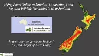
Using Alces Online to Simulate Landscape, Land Use, and Wildlife Dynamics in New Zealand Presentation to Landcare Research by Brad Stelfox of Alces Group
Thanks to Cecilia Arienti and Electra Kalaugher, Landcare Research
Where have we come from? What is our current condition? Where might we want to go? Landscape Simulator Flight Simulator What are the key opportunities What are the key risks and constraints Which land use trajectories are optimal?
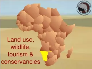
Where has ALCES been Used British Columbia Alberta Saskatchewan Manitoba Northwest Territories Ontario Paraguay Western Australia India (Akole Region) United States (Kenai, Alaska)
How can Alces assist Landcare Research Analyze and Map temporal and spatial changes in landscapes, watershed metrics, and wildlife habitat and populations Simulate changes in water use, quantity and quality Explore temporal and spatial changes in plant communities from climate change, forestry, deforestation, reforestation Explore consequences of land use trajectories on Social, Economic, and Environmental Indicators (triple bottom line) Identify spatial distribution of risk (flood, drought, climate change) Quantify alternative management and control strategies on populations and habitat of invasive species and their interactions with other species
Cloud-based Geographic Information System (GIS) Dynamic Landscape & Landuse Simulator
Land Uses Tracked in Alces Online Alces Online, Ninti One, and ILC
Natural Disturbances, Ecological Processes, and Monitoring Data Climate and Climate Change Carbon Pool Dynamics Hydrological Cycle Wildlife Habitat Natural Disturbance Regimes Wildlife Populations Plant Community Dynamics Landscape Metrics
Home Back Module Architecture of ALCES Control Switches For Projects where detailed and mechanistic sectoral models have already been constructed, ALCES can be informed (receive input) from the output from these models 1.4.2
Home Back Examples of Landscape Types (LTs) Control Switches Forage Crop Cereal Crop Landscape Types Hardwood Forest Native Prairie 1 2 3 4 5 6 7 8 9 10 11 12 13 14 15 16 17 18 19 20 Mixedwood Forest Alpine Shrublands Softwood Forest Foothills Glaciers Rivers and Streams Oilseed Crop 4.3 Fens and Bogs Rock Lakes and Ponds
Home Back Commodities Tracked in ALCES Control Switches Production or Harvest Types • Hardwood • Softwood • Oil • Gas • Coal • Electricity • Gold • Iron Ore • Diamonds • Pearls • Cereal Crop • Oilseed Crop • Forage Crop • Cattle • Sheep • Pigs • Tourist Activity Day • Person Existence Day Commodities 1 2 3 4 5 6 7 8 9 10 11 12 4.7
Softwood Biomass Hardwood Biomass m3/ha or Tonne/ha Down Woody Material Biomass Snag Biomass Herbaceous Biomass 0 20 40 60 80 100 120 140 160 180 200 Years since Disturbance (Fire, Logging, Insect Outbreaks)
How can “Systems Thinking” Assist in Sustainable Resource Management
Moving from Silos to Integrated Regional Planning Aboriginal Land Use Residential Agriculture Mining Transport Energy Forestry Tourism and Recreation Integrated Land Use and Landscape Planning Alces Online, Ninti One, and ILC
Enabling a “Systems” Discussion on Dynamics of Landscapes and Land Use Transportation Sector Livestock Sector Aboriginal Communities Tourism /Recreation Sector Environmental Community Local Government Authorities Crop Sector Mining Sector State Government Water Managers Fishing Community Forest Sector
Example of a Systems Approach to Interface of Urban Design, Recreation and EGS Shire Fiscal Sustainability Health Care Costs Key Policy Driver Flood & Drought Frequency and Magnitude Water Treatment Costs Building Cooling Costs GHG Emissions Body Mass Index Intermediate Factor Infrastructure Construction & Maint. Costs Calorie Output Key Indicator Area of CBD, Mixed Use, Mature Neighbourhoods and Suburbia Walk- ability Urban Growth Strategy Water Quality & Quantity Public Transportation ($ Const/Maint) Loss of Natural Landscapes Bio- diversity Vehicle Travel Distance Private Transportation ($ Const/Maint) Water & Nutrient Runoff Loss of Agricultural Lands Carbon Pool Dynamics Fuel Consumption Food Security GHG Emissions
Home Back Control Switches Forest Sector Impact Diagram Fraction of Forest that is Protected Economic Benefits -Employment -Royalties Landbase Metrics -Age Structure -Forest Core Area -Physiognomy -Linear Features -Connectivity Wildfire Insects Total Forest Landbase Biotic Carbon Merchantable Landbase Access -haul roads -inblock roads AAC Best Management Practices -Harvest & Regeneration Strategy -Silviculture -Rotation Age -Crossings -Road Reclamation -Old Growth Objectives Wildlife Popns Subjective Deletions -Riparian Buffers -Steep Slopes -Residual Green Trees -Adjacency Delay Habitat Key Driver Water Quality And Quantity Intermediate Factor Nutrients -Sediment -Organics -Nitrogen -Phosphorus Natural Indicator Economic Indicator 8.1.1
Narrative C Narrative B Narrative A Mid 1800’s 2017 Exploring Alternative Futures for Landscapes Comparing “What-If” Scenarios • Ecosystem Structure • Water Quality/Quantity • Economic Performance • Infrastructural Sustainability • Wildlife Populations • Food and Energy Security • Climate Change • Urban Design • Human Demography 2017 2065
An Integrated Approachto Resource Management Main Menu Water Supply Housing Water Quality Ground-water Age Income Connectivity Number Natural Plants Air Quality Health Ethnicity Wildlife Education Temperature Rainfall Water Soils Climate Change Elevation Mineral Oil / Gas Tourism Recreation Revenue Slope Asoect Oil and Gas Fishing AquaCul-ture Infra- structure Costs Flow-On Residential People Supply Chain Crops Livestock Forest Fiber Employ-ment GRP Mine Ore Royalties
The Spatial Grid Foundation of ALCES Online Within each cell, AO computes for each time step: • Landscape composition • How many m2 of hardwood forest, crops, … • Meteorology • Precipitation (annual, monthly) • Temperature (annual, monthly) • Water Yield and Flow • Footprint Composition • How many km or m2 of tracks, campsites, roads, wellsites, …. • Surface Water • How many m2 of ponds, lakes, reservoirs, …. • How many km of streams, rivers, …. • People • How many are in towns, acreages, farms, …. • Livestock • How many sheep, cattle, pigs, chickens, horses, … • Commodity Production • Tourism Activity Days, Crops, livestock, hydrocarbons, minerals, wood, ….
Using ALCES Online • A Computer • Access to the Internet • A Browser • Applications?
General Description of ALCES Online • Alces Online is a cloud-based web-delivered GIS for examining cumulative effects of land use, natural disturbance regimes and storing environmental, social and economic data. • It is designed to run on modern browsers and takes advantage of current technologies including: WebGL, Javascript, Python and the Django MVC development framework. • The core of the application is a geo database with many billions of data points that are used to perform analyses and calculations that are delivered to the client with interactive maps, charts, scatterplots, and tables. • Maps and charts are managed via REST queries from the client to the geo database and GIS server.