Download
1 / 64
640 likes | 787 Views
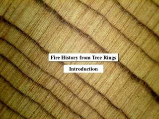
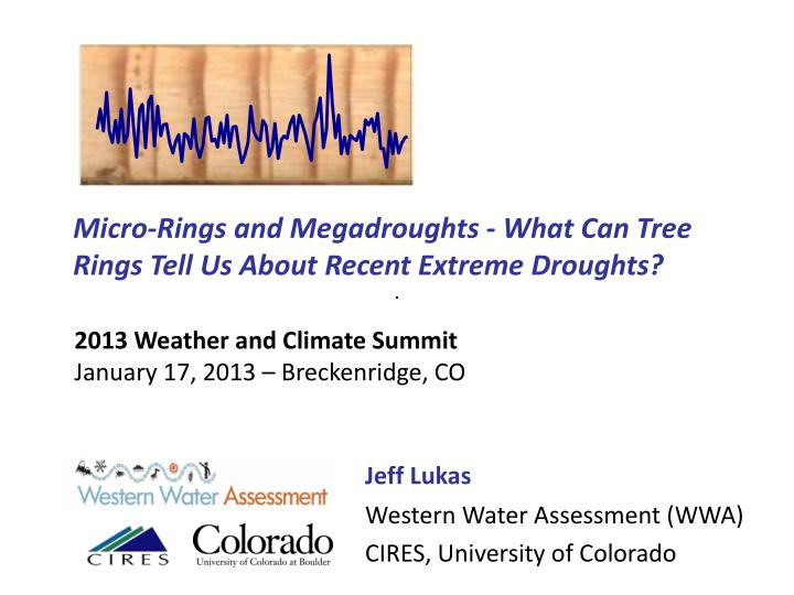
Micro-Rings and Megadroughts - What Can Tree Rings Tell Us About Recent Extreme Droughts?. 2013 Weather and Climate Summit January 17, 2013 – Breckenridge, CO. Jeff Lukas Western Water Assessment (WWA) CIRES, University of Colorado. WWA is part of the NOAA RISA program network.

E N D
Micro-Rings and Megadroughts - What Can Tree Rings Tell Us About Recent Extreme Droughts? 2013 Weather and Climate Summit January 17, 2013 – Breckenridge, CO Jeff Lukas Western Water Assessment (WWA) CIRES, University of Colorado
WWA is part of the NOAA RISA program network • 11 regional, university-based research programs • Help NOAA interface between climate science and society
Acknowledgements Overall:Connie Woodhouse (U. of Arizona) Other Collaborators:Steve Gray (USGS); Dave Meko, Dan Griffin, Henry Adams (U. of Arizona); Balaji Rajagopalan (U. of Colorado); Brad Udall, Joe Barsugli, Klaus Wolter (WWA); Robin Webb (NOAA); Bob Thompson, Lesleigh Anderson (USGS); Ben Harding (AMEC); Jim Prairie, S. Gangopadhyay (USBR); Roger Kjelgren, Tammy Rittenour, Eric Allen (Utah State); Matt Bekker (BYU); Ed Cook (Columbia U.) Agency Partners:US Bureau of Reclamation, Denver Water, Colorado River District, Northern Colorado Water Conservancy District, Rio Grande Water Conservation District, California Dept. of Water Resources, City of Westminster (CO), NM Interstate Stream Commission, Salt River Project (AZ), and others Funding:NOAA Climate Program Office: Western Water Assessment and Climate Change Data and Detection (GC02-046); Denver Water; USGS; US Bureau of Reclamation
6 Summer PDSI 4 2 0 -2 -4 -6 -8 2000 1250 1300 1350 1400 1450 1500 1550 1600 1650 1700 1750 1800 1850 1900 1950 Outline • How do tree rings record hydroclimatic variability? • How do recent extreme droughts compare with these records of paleo-variability? • What are megadroughts? • How might drought risk change in the future? 1977 1983
Drought: driven by precip deficit, exacerbated by heat Higher temperatures, more sunshine, lower humidity Precipitation deficit Reduced snowpack, groundwater recharge Increased ET Lower soil moisture More plant stress, drier fuels Earlier peak flow, Reduced streamflows and reservoir inflows Modified from National Drought Mitigation Center, U. Nebraska
Recent extreme drought: Three case studies • Colorado River Basin (2000-2012+) • Texas (2011) • US Heartland (2012+)
How can we get more context for “unprecedented” events? 800 ) t South Platte R., Colorado - annual streamflows e e 700 f - e r 600 c a 0 500 0 0 1 400 ( w 300 o l F l 200 a u 2002 n 100 n A 0 1915 1930 1945 1960 1975 1990 2005
Paleoclimatology: analysis and reconstruction of pre-instrumental climate, mainly using environmental proxies Ocean sediments Lake sediments Corals Ice cores Packrat middens (vegetation) Tree rings (Dendrochronology) Pollen Speleothems
Key attributes of tree rings as a paleo-proxy for climate and hydrology • Annual resolution • Absolute dating to calendar year • Long, continuous records • (200 to 10,000 yrs) • Widespread distribution • Straightforward translation into climate variables
The methods for using tree rings to examine past climate are not new Douglass, A. E. 1909. "Weather Cycles in the Growth of Trees." Monthly Weather Review, 37. • Schulman, E. 1942.A tree-ring history of runoff of the Colorado River, 1366-1941. Report to the Los Angeles Bureau of Power and Light.
Climate is typically the main factor limiting tree growth • At the highest elevations and latitudes: energy availability (warmth) • At lower elevations and mid-latitudes: moisture availability
Moisture availability varies greatly from year to year 24 22 20 18 Annual precipitation, in. 16 14 12 Annual precipitation, western Colorado 10 8 1900 1910 1920 1930 1940 1950 1960 1970 1980 1990 2000 2010
Douglas-fir, south-central CO 1977 1983 So, for most trees across the US:Dry conditions = Narrow ring Wet conditions = Wide ring This moisture signal integrates both precipitation and evapotranspiration
Annual growth often closely tracks annual moisture availability Western CO August-July Precipitation vs. Pinyon ring width (WIL 731) 26 0.8 1983 24 0.7 22 0.6 20 0.5 Ring Width (mm) Precipitation (in.) 18 0.4 16 0.3 14 0.2 12 0.1 10 0 1977 1930 1940 1950 1960 1970 1980 1990 2000
1900 1910 1920 1930 Same climate influences the growth of all trees at a site = cross-dating • Two Douglas-fir trees near Boulder, CO
1900 Same climate influences the growth of all trees at a site = cross-dating 1910 1920 1930 1925 1925 • Two Douglas-fir trees near Boulder, Colorado
Micro-ring: a really dry year 1900 1904 • Ponderosa pine near Pagosa Springs, Colorado Image: Peter Brown, Rocky Mountain Tree-Ring Research (http://www.rmtrr.org)
This moisture signal in trees can serve as proxy for multiple moisture-related variables Annual or seasonal precipitation Spring snow-water equivalent (SWE) Annual (water-year) streamflow Drought indices (PDSI, SPI)
Annual growth (ring-width) is not the only tree-ring indicator of climate • Stable isotopes of carbon (12C, 13C) reflect carbon assimilation and thus moisture status • Stable isotope of oxygen (18O) reflects temperature of the source water taken up by the tree • Density of latewood reflects summer warmth in energy-limited trees
Collecting moisture-sensitive tree-ring records (chronologies) • Dry sites, in nearly all cases • Stands of old conifers (pine, Douglas-fir, juniper, etc.), or long-lived hardwoods like oaks • Collect cores and cross sections from >15 trees (same species) • Cross-date and measure their rings, compile into a site chronology
Compilation of the site chronology enhances the common (hydroclimatic) signal Van Bibber site, near Golden, Colorado (ponderosa pine) Robust averaging Ring-width index
Green Mountain Reservoir (GMR) Douglas-fir chronology (588-2005) (north of Breckenridge) Living trees back to 1300s AD Dead wood back to 500s AD
Moisture-sensitive tree-ring chronologies developed at CU from 2000 to 2009 (INSTAAR Dendrochronology Lab)
Three pinyon pine chronologies in SW Colorado 1900s 2.0 1900s 1.5 MCP Tree-ring index 1.0 NMV GVR 0.5 0.0 1900 1910 1920 1930 1940 1950 1960 1970 1980 1990 2000 1800s 2.0 1800s 1.5 MCP Tree-ring index 1.0 NMV GVR 0.5 0.0 1800 1810 1820 1830 1840 1850 1860 1870 1880 1890 1900 1700s 2.0 1700s 1.5 MCP Tree-ring index 1.0 NMV GVR 0.5 0.0 1700 1710 1720 1730 1740 1750 1760 1770 1780 1790 1800
>1800 moisture-sensitive tree-ring chronologies across North America as of 2009 Figure: Cook et al. (2009), J. Quaternary Science
Generating tree-ring reconstructions Subset of tree-ring chronologies Observed hydroclimate record 30 25 20 annual flow, MAF 15 10 5 0 1900 1915 1930 1945 1960 1975 1990 2005 Best-fit statistical relationship between the tree rings and observations during overlap period 30 25 20 Annual Flow (MAF) 15 Tree-ring reconstruction of hydroclimate 10 5 0 1500 1600 1700 1800 1900 2000
Uncertainty in the reconstructions 1,000,000 800,000 600,000 Annual flow, acre-feet 400,000 200,000 0 1925 1935 1945 1955 1965 1975 1985 1995 2005 • A reconstruction is a plausible estimate of past climate • The distribution of model errors can be used to generate confidence intervals (gray bands, above) • But this doesn’t capture uncertainties originating from subjective modeling choices
Case #1: Colorado River Basin, 2000-2012 Breck Lees Ferry, AZ US Drought Monitor August 13, 2002
Colorado River Basin Drought (2000-2012+) • Record lowest observed precipitation over Upper Colorado Basin (since 1895) • 5-year period (2000-2004) • 10-year period (2000-2009) • 13-year period (2000-2012) US Drought Monitor August 13, 2002
Observed (naturalized) annual flow, Colorado River at Lees Ferry, AZ since 1906 30 25 20 Water Year Flow, MAF 15 10 2012 2002 5 0 1900 1910 1920 1930 1940 1950 1960 1970 1980 1990 2000 2010 • Record lowest streamflows in Upper Colorado Basin (since 1906): • 5-year period (2000-2004) • 10-year period (2000-2009) • 13-year period (2000-2012) Data: Reclamation (1906-2008); 2009-12 values estimated from preliminary Reclamation data
Tree-ring reconstructed and observed annual flow, Colorado River at Lees Ferry, AZ since 1906 R2 = 0.75 Figure and data: TreeFlow website, http://treeflow.info/upco/coloradoleesmeko.html Reference: Meko et al. 2007. Medieval Drought in the Upper Colorado River Basin, Geophysical Research Letters
30 25 20 Annual Flow, MAF 15 10 5 0 750 1000 1250 1500 1750 2000 Tree-ring reconstructed annual flows, Colorado River at Lees Ferry, AZ, 762-2005 2002 reconstructed flow 2002: in the lowest 10 reconstructed annual flows since 762 Figure and data: TreeFlow website, http://treeflow.info/upco/coloradoleesmeko.html Reference: Meko et al. 2007. Medieval Drought in the Upper Colorado River Basin, Geophysical Research Letters
20 19 18 17 16 Annual Flow, MAF 15 14 13 12 11 10 750 1000 1250 1500 1750 2000 Tree-ring reconstructed annual flows, Colorado River at Lees Ferry 762-2005, with 10-year running mean 2000-2009 mean observed flow
18 17 16 15 14 Annual Flow, MAF 13 12 11 10 750 1000 1250 1500 1750 2000 Water Year Tree-ring reconstructed annual flows, Colorado River at Lees Ferry 762-2005, with 20-year running mean Mid-1100s megadrought 46 dry years out of 57
Water managers around the US are using tree-ring reconstructions to assess and plan for future droughts • Colorado Water Conservation Board* • Denver Water • City of Boulder, Colorado* • New Mexico Interstate Stream Commission • Salt River Project, Arizona • California Department of Water Resources • Wyoming Water Development Commission • Utah Dept. of Water Resources • U.S. Bureau of Reclamation - Lower Colorado Region* • Oklahoma Water Resources Board • Georgia Soil and Water Conservation Commission • Suwanee and St. Johns Water Management Districts, Florida *in conjunction with climate change projections
Bureau of Reclamation: Powell & Mead Operations EIS, 2007 “Direct Paleo” sequence based on Meko Lees Ferry reconstruction (1130-1182) Modeled Lake Powell (orange) and Lake Mead (green) year-end elevations No power from Powell
TreeFlow web resource - western US paleo-streamflow • Access to data for over 60 flow reconstructions • Descriptions of applications • Technical workshop presentations • Resources and references • Colorado River Streamflow: A Paleo Perspective • http://treeflow.info
North America gridded summer Palmer Drought Index reconstructions – Ed Cook et al. (2004, 2008) <- 835 moisture-sensitive tree-ring chronologies <- 286 point reconstructions on a 2.5-degree grid Data: http://www.ncdc.noaa.gov/paleo/pdsi.html
Case #2: Texas Drought (2011) • Record lowest observed statewide 12-month precipitation (1895- ) (Sep 2010-Aug 2011) • Record lowest statewide summer (JJA) PDSI (1895- ) US Drought Monitor August 30, 2011
6 Reconstructed 4 Observed 2 0 Summer PDSI -2 -4 -6 -8 1900 1910 1920 1930 1940 1950 1960 1970 1980 1990 2000 2010 Tree-ring reconstructed and observed Texas summer PDSI, since 1900 R2 = 0.68 Observed Data: NOAA NCDC: http://www1.ncdc.noaa.gov/pub/data/cmb/sotc/drought/2012/13/uspctarea-wetdry-mod.txt Paleo Data: Cook et al. 2008: http://www.ncdc.noaa.gov/paleo/pdsi.html
Tree-ring reconstructed Texas summer PDSI since 1250 6 4 2 Summer PDSI 0 -2 -4 -6 2012 observed -8 1300 1400 1500 1600 1700 1800 1900 2000 Observed Data: NOAA NCDC: http://www1.ncdc.noaa.gov/pub/data/cmb/sotc/drought/2012/13/uspctarea-wetdry-mod.txt Paleo Data: Cook et al. 2008: http://www.ncdc.noaa.gov/paleo/pdsi.html
Tree-ring reconstructed statewide Texas summer PDSI since 1250 with 20-year running mean 2 1 Summer PDSI 0 -1 -2 1300 1400 1500 1600 1700 1800 1900 2000 • Late 1500s megadrought: 20 of 24 years with negative statewide PDSI Observed Data: NOAA NCDC: http://www1.ncdc.noaa.gov/pub/data/cmb/sotc/drought/2012/13/uspctarea-wetdry-mod.txt Paleo Data: Cook et al. 2008: http://www.ncdc.noaa.gov/paleo/pdsi.html
Case #3:US Heartland Drought (2012-) • Record lowest summer (JJA) precipitation in Wyoming and Nebraska (1895- ) • Highest % area of contiguous US in moderate or worse summer drought (PDSI) since 1934 • US Drought Monitor: highest % area of contiguous US in drought (1999 - ) • July - Warmest month on record for contiguous US (1895-) • 2012 – Warmest year on record for contiguous US US Drought Monitor July 24, 2012
Tree-ring reconstructed and observed percent area of contiguous US with summer PDSI <-2 since 1900 90 DRIER 1934 Observed 80 R2 = 0.80 Reconstructed 70 60 2012 50 Percent Area <-2 PDSI 40 30 20 10 0 1900 1910 1920 1930 1940 1950 1960 1970 1980 1990 2000 2010 Observed Data: NOAA NCDC: http://www1.ncdc.noaa.gov/pub/data/cmb/sotc/drought/2012/13/uspctarea-wetdry-mod.txt Paleo Data: Cook et al. 2008: http://www.ncdc.noaa.gov/paleo/pdsi.html Paleo Analysis: Eugene Wahl, NOAA NCDC Paleoclimatology Branch
80 70 60 50 40 Percent area PDSI <-2 30 20 10 0 1000 1100 1200 1300 1400 1500 1600 1700 1800 1900 2000 Tree-ring reconstructed percent area of contiguous US with PDSI <-2 since 1000 AD DRIER 2012 observed Paleo Data: Cook et al. 2008: http://www.ncdc.noaa.gov/paleo/pdsi.html Paleo Analysis: Eugene Wahl, NOAA NCDC Paleoclimatology Branch
Tree-ring reconstructed percent area of contiguous US with PDSI <-2 since 1000 AD, 20-year running mean DRIER 2012 observed Paleo Data: Cook et al. 2008: http://www.ncdc.noaa.gov/paleo/pdsi.html Paleo Analysis: Eugene Wahl, NOAA NCDC Paleoclimatology Branch