Download
1 / 25
250 likes | 418 Views
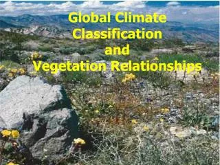
Vegetation classification on Prathong Island, Phang Nga , Thailand. Naiyana Srichai & Chanida Suwanprasit Faculty of Technology and Environment, Prince of Songkla University, Phuket Campus. APAN 33 rd Meeting 13-17 February 2012. Introduction.

E N D
Vegetation classification on PrathongIsland, PhangNga, Thailand NaiyanaSrichai & ChanidaSuwanprasit Faculty of Technology and Environment, Prince of Songkla University, Phuket Campus APAN 33rd Meeting 13-17 February 2012
Introduction • vegetation type study date back to the Nineteenth Century : ecologists, plant geographers, vegetation scientists • three major determinants of vegetation-competition, stress and disturbance (Grime, 1974)
Objectives • To classify vegetation on Prathong Island, PhangNga province, southern Thailand
Study area: Prathong Island, PhangNga THAILAND 7th biggest island 1.5 km off the coast Size : width 9.7 km length 15.4 km Area : 92 sq.km Unseen Thailand 2002 deer, hornbill, adjutant stork, green turtle, dugong
Source: Dept.of Marine and Coastal Resources, 2005 11 Mammals spp. 86 Reptilesspp. 137 Birds > 20 Freshwater animals
Koh Ra 19 households 109 people Pak Jok 87 households 134 people Koh Ra Tong Dab village 49 households 272 people ThaPaeyow 123 households 409 people KohPrathong Source: Dept.of Marine and Coastal Resources, 2005
Source: Dept.of Marine and Coastal Resources, 2005 Koh Ra and Prathong Size71,000 Rais or 92 sq.km Mangrove32% (green) Beach forest7% (orange) Swamp forest13% (pink) Tropical forest13% (KohRa,purple) Grassland 8% (yellow) Beach26 km (orange) Seagrass 4,550 Rais (blue) Coral43 Rais (lighter green)
Grassland Swamp forest Mangrove forest Beach forest
Tsunami 26 Dec. 2004Area affected : 18.55 % (6.25% agricultural,92.88% others)
Vegetation change after Tsunami Fragile land Salt tolerant tree invasion Casuarinaequisetifolia
Data set: THEOS Multispectral Achieved on 19 Jan 2009 Spatial Resolution 15 m
THEOS Spectral bands Band 0 (Blue) Band 1 (Green) Band 2 (Red) Band 3 (NIR)
Process Outline THEOS image 2009 Pre-image processing • Classes • Grassland • Beach forest • Mangrove forest • Wetland (swamp forest) • Water • Other Image Classification Maximum Likelihood (MLC) Support Vector Machines (SVMs) Vegetation Mapping
Support Vector Machines • SVMs : a supervised classifier, which requires training samples but SVMs are not relatively sensitive to training sample size (works with limited quantity and quality). • The SVM-based approach used a recursive procedure to generate prior probability estimates for known and unknown classes by adapting the Bayesian minimum-error decision rule (Mountrakis,et.at. 2011; Fauvel 2008).
Support vector machines (SVMs) : numerousapplications in remote sensing . 108 relevant papers, published in 2007-2010. (G.Mountrakis, JunghoIm, C.Ogole, 2011)
Unsupervised Classification: • K-Mean • 10 Classes
Classification Results MLC SVMs Grassland Swamp Forest Beach Forest Mangrove Forest Sand Water Other
RGB(0,1,2) SVMs MLC
Conclusions • SVM classifier compared to the more conventional maximum likelihood approach gave slightly better accuracy using THEOS image for class : swamp forest of Prathong Island.
Acknowledgement • Geo-Informatics and Space Technology Development Agency (Public Organization) • UniNet • Prince of Songkla University, Phuket campus
References: • Department of Marine and Coastal Resources. 2005. Strategies for sustainable development of Koh Ra and KohPrathong with people participation. Unpublished report. • Fauvel, M., Benediktsson, J.A., Chanussot, J., Sveinsson, J.R.. 2008. Spectral and Spatial Classification of Hyperspectral Data Using SVMs and Morphological Profiles. Geoscience and Remote Sensing, 46 (11), 3804 - 3814 • GiorgosMountrakis, JunghoIm, Caesar Ogole. 2011. Support vector machines in remote sensing: A review. ISPRS Journal of Photogrammetry and Remote Sensing, 66, 247–259. • Grime, J.P. 1974. Vegetation classification by reference to strategies. Nature, 250 (5461), 26-31.