Download
1 / 27
270 likes | 466 Views
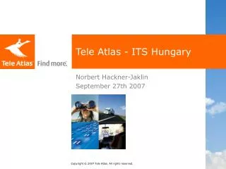
Tele Atlas - ITS Hungary. Norbert Hackner-Jaklin September 27th 2007. Agenda . Historical and financial background Requirements for today’s solutions The Tele Atlas Coverage Advantage The Tele Atlas Content Advantage Why partner with Tele Atlas?. Historical and financial background.

E N D
Tele Atlas - ITS Hungary Norbert Hackner-Jaklin September 27th 2007
Agenda • Historical and financial background • Requirements for today’s solutions • The Tele Atlas Coverage Advantage • The Tele Atlas Content Advantage • Why partner with Tele Atlas?
Tele Atlas Background • Global digital map and dynamic content provider • 2006 revenue – €264 million • 2,400+ full time staff and contract cartographers • Shipped almost 10 million maps in 2006
Tele Atlas Revenues in Euro Millions (Projected)
Today’s Solutions Require… • Fresher data, for greater accuracy • Complete coverage, in all global markets • Richer content, for a better user experience
Our AccuracyAdvantage • The world changes constantly • We use proven technologies and techniques to trackand anticipate change, rapidly process change Techniques and Technologies
Cars Drivers and testers Gov. Partner State DOT approves new highway Tele Atlas Partner Submits new street information Consumer Adds adjusted house number Mobile Mapping Vans Faster, more accurate Web Crawler Tools Zoning board approves new subdivision Satellite Image Shows a discrepancy Driven By Intelligence Drivers and Source Network Anticipate and Verify Change
A Superior Map Update ProcessUnique “Driven by Intelligence” Approach Vehicles Tele Atlas uses a fleet of survey vehicles to collect detailed road information, including our unique Mobile Mapping Vans Resources That data is supported with information from a global network of authoritative resources MapInsight The industry’s most innovative, efficient, and cost-effective method to collect and verify detailed road information
Tele Atlas Global Coverage Our Coverage Advantage New Coverage Areas
Tele Atlas MultiNetDelivers Comprehensive Functionality Guide Be guidedfrom A to B Generateaccurate and customizable routes in real time with clear, audible and/or visual instructions. Find Find what youare looking for Help end users easily link to the world through the map. Definitions Display See clearly whereyou are now Optimally visualize reality.
Tele Atlas Global Coverage Our Coverage Advantage Current coverage reflects availability of maps. Coverage and attribution detail varies from country to country.
Tele Atlas Connect™ Countries In Summary • Connect Country count includes countries where data is combined with Tele Atlas data (Turkey, Russia, Malaysia, Indonesia) • Connect countries contain at a minimum major road data; additional areas/territories are available with administrative boundary information only
A Full Range Of Enhancements EnhancedGuide • Speed Traps* • Dynamic Data • Phonemes Enhanced Find • Premium Points of Interest • Address Points • Locality Index Enhancements EnhancedDisplay • 2D City Maps • 3D Landmarks* • 3D Terrain Model* * Currently available in European data
Customer Service Arrival times Higher quality Efficiency Cut costs Increase productivity Health & Safety European regulations Avoid incidents Current situation requires changes • Increasing demand for mobility but … • Worsening congestion • High fuel prices • Poor quality services • Safety issues • Environmental damages • Isolation of some regions • Increasing Eastern European Competition Tracking & Security Asset monitoring Effective maintenance
Tele Atlas Logistics Europe • Height, weight, length and axle weight • Major and Interconnecting Network (MRNW & ICNW) • Local Street Network and Addresses • Truck specific preferred/ restricted traffic flow on segments in MRNW and ICNW
Why partner with Tele AtlasMeeting Partners’ Needs and Consumers’ Demands The Enabling Principle: • Fresher, richer, more accurate digital maps and local search content worldwide • Unwavering partner focus • Unmatched experience across multiple markets • Strong financial foundation
A Vision for TomorrowMeeting Partners’ Needs and Consumers’ Demands We create opportunities for our partners to enhance and extend their product offerings
Unmatched Experience Across Multiple Markets Enterprise/Public Sector InternetMapping ConsumerWireless PNAV Automotive
Thank you!Norbert Hackner-Jaklin norbert.hackner@teleatlas.com