Download
1 / 23
230 likes | 459 Views
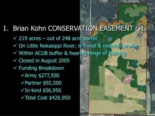
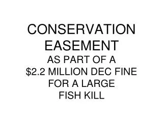
CONSERVATION EASEMENT AS PART OF A $2.2 MILLION DEC FINE FOR A LARGE FISH KILL. Result of Lagoon Breach 3,000,000 gallons spilled into the Black River 250,000+ fish killed Strongly scented tide moved through Watertown Water supplies shut down River activities shut down. NYS DEC Actions.

E N D
CONSERVATION EASEMENTAS PART OF A $2.2 MILLION DEC FINEFOR A LARGEFISH KILL
Result of Lagoon Breach3,000,000 gallons spilled into the Black River250,000+ fish killedStrongly scented tide moved through WatertownWater supplies shut downRiver activities shut down
NYS DEC Actions $2.2 Million Fine for Fish Kill (250,000 x $10 = $2.2 Million±) $1.5 Million = Environmental Contribution $700,000 = Cash or Equivalent
Environmental Contributions • $180,000 = Fishing Rights, Parking Areas and Paths to Black River • $1,320,000 = Development Rights
Development Rights • Lowville Area, Lewis County • Parent Property = 3,269.98 Ac. • Flood Plain included 602.90 Ac. • Base Acres for CE = 2,667.08 Ac. • Assumed NYS FPP Requirements • Land Valuation Only • Standard NYS FPP Ag CE Terms
Before Appraisal • Market Study • Frequency of Residential Land Sales • Size Ranges of Sales • Price Ranges for Size Ranges • Patterns of Land Purchases • Potential for Interior Subdivisions
Before Appraisal - HBU • Multiple Economic Units / Lots (81) • Size Mix Similar to Results of Market Study • All Roadfront Lots (no interior roads or utilities) • Considered Amenities
Before Appraisal - Valuation • Appraised All EUs as Individual Lots • Gross Value • Discounts for Subdivision, Marketing • Used Market Study As Basis • Net Value of Land
After Appraisal • Appraised Property as Single EU • 2,667.08-Ac. Tract of Farmland • Devoid of Development Rights • Ag-Related Development Permitted • Used Sales Approach • Surveys of CEs and ACEs • ICA – Ag Values of Soils + Other Retained Rights
Value of Development Rights • Difference of Before and After Appraisals • Total Difference > $1,320,000 • Acreage for AgCE Withdrawn Based on Owner’s Priority • Locations to Retain Development Rights • Deducted Difference of: • Discounted Value of EUs • Ag “After” Land Value