Hydric Soil Overview
Hydric Soil Overview. All information is based upon current deliberations and recommendations of the National Technical Committee for Hydric Soils (NTCHS) The NTCHS consists of members from NRCS, COE, EPA, FWS, BLM, FS, & 6 Universities. Objectives.

Hydric Soil Overview
E N D
Presentation Transcript
Hydric Soil Overview • All information is based upon current deliberations and recommendations of the National Technical Committee for Hydric Soils (NTCHS) • The NTCHS consists of members from NRCS, COE, EPA, FWS, BLM, FS, & 6 Universities M. Whited - 4/2000
Objectives • Define terms used and describe procedures specified by the official hydric soil definition and criteria. • Explain difference between definition, criteria, field indicators, and technical standard. • Explain controversial or ambiguous aspects. M. Whited - 4/2000
Introduction • Hydric soils are usually identified because wetlands are being delineated for government regulation. • They may also be identified for wetland restoration programs, CRP, etc • Hydric Soil identification is a process that involves both policy and science • “hydric soils are discrete boundaries on a natural continuum” • “jurisdictional wetlands are a psychological construct” • This short section introduces the concept of a hydric soil and associated terminology M. Whited - 4/2000
Hydric Soils M. Whited - 4/2000
Definition • “A hydric soil is a soil that formed under conditions of saturation, flooding, or ponding long enough during the growing season to develop anaerobic conditions in the upper part” (59 Fed. Reg. 35680, 7/13/94) M. Whited - 4/2000
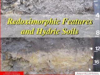
Anaerobic • Waterlogging process • Microbes use up O2 • H2O retards oxygen diffusion to soil • Technical Definition • Free of all O2 • Depleted enough to stress plants • Measurement • O2 meters, Pt electrodes, or a, a’ dipyridyl • Problems • Difficult to measure O2, climate patterns, Reduction is “lower” than anaerobiosis M. Whited - 4/2000
“long enough” “the upper part” • Don’t know exactly how long • as little as 2 days in a lab • possibly in as little as 1 week in the field • The upper part is • the major portion of the rooting zone • usually 6 (sandy soils) to 12 inches (loamy soils) M. Whited - 4/2000
“formed under conditions of” • Artificial drainage does not alter hydric soil soil status • however, it can alter soil properties • less OM • compaction • shift microbial populations • change pH and salinity M. Whited - 4/2000
Growing Season • Above biological zero in upper part • 5 C, 41 F • Rough estimate • soil temp. regimes • More accurate • first frost free dates in soil survey report • WETS Table M. Whited - 4/2000
CriteriaThe criteria for Hydric Soils (Fed. Reg., 2/24/95) 1 All Histels except Folistels and Histosols except Folists 2 The “saturation” criteria 3 Soils that are frequently ponded for long or very long duration during the growing season 4 Soils that are frequently flooded for long or very long duration during the growing season M. Whited - 4/2000
“Saturation” criteria 2 Soils in Aquic suborders, great groups, or subgroups, Albolls suborder, Aquisalids, Pachic subgroups, or Cumulic subgroups that are: a. swp drained with water table = 0.0 ft. during growing season b. pd or vpd and have either (1) water table = 0.0 ft. during growing season if all textures within 20 inches are fine sand or coarser (2) water table 0.5 ft. during growing season if perm. 6.0 in./hr. in all layers w/in 20” (3) water table 1.0 ft. during growing season if perm. < 6.0 in./hr. in any layer w/in 20” M. Whited - 4/2000
Criteria • Main purpose is to create hydric soil lists. • Not all soils on list are hydric, • If any portion of the range of estimated properties for a soil is within the criteria that soil appears on the hydric list. For example, if a soil w/ perm. < 6 in./hr. has an estimated water table of 1 to 2 ft. during any portion of the growing season, that soil would be on the hydric list, even though most of the range in estimated water table is outside the criteria. • Hydric list is an interpretative rating which must be confirmed by on-site investigations M. Whited - 4/2000
Criteria, cont. • Criteria are not intended for on-site application • Criteria 1 is an indicator • Data that proves criteria 3 or 4 exists can be used to document the presence of a hydric soil M. Whited - 4/2000
Hydric Soil Indicators • Indicators are not intended to replace or relieve the requirements contained in the Hydric Soil Definition • Indicators are used to identify the hydric soil component of wetlands; however, there are some hydric soils that lack one of the currently listed indicators • The indicators are “test positive” the lack of an indicator is not “test negative” M. Whited - 4/2000
Draft Data Standard for Hydric SoilsRequirements • Water table measurements • Redox potential measurements • Reduced Iron (Fe II) measurements • In-situ pH measurements • On-site precipitation data • Replicates M. Whited - 4/2000
Summary • All hydric soils must meet the definition • Criteria are used to generate lists • Lists are used off-site to determine if an area is likely or not to contain hydric soils • Indicators are used to identify hydric soils on site • Technical standard is used with data • To prove a hydric soil exists in the absence of an indicator, and to develop new indicators M. Whited - 4/2000
Want to know more? • Publications • NTCHS Interagency Field Indicators • Vepraskas - “Redoximorphic Features” • SSSA, Vepraskas and Sprecher - “Aquic Conditions and Hydric Soils: The Problem Soils” • Tiner - “Wetland Indicators”, CRC Press, May 99 • Vepraskas and Richardson - “Wetland Soils”, Fall 2000 • Training • Interagency Hydric Soils for Wetland Delineation • NRCS Advanced Hydric Soils • NRCS CD-ROM, “Hydric Soils Interactive” M. Whited - 4/2000
WWW Sites • http://www.pwrc.usgs.gov/wli/ • NRCS Wetland Science Inst. • http://www.statlab.iastate.edu/soils/hydric • NRCS/NTCHS hydric soils homepage • http://www.nscss.org/soil.html • Consulting soil scientists, lots of links • http://sws.org/wetlandweblinks.html • SWS, lots of wetland links • http://www.epa.gov/region03/hydricsoils/index.htm • Mid-Atlantic hydric soils committee • http://www.soils.umn.edu/hsi_web/ • UMinn, Hydric Soils Interactive CD on-line M. Whited - 4/2000