Download
1 / 14
140 likes | 395 Views
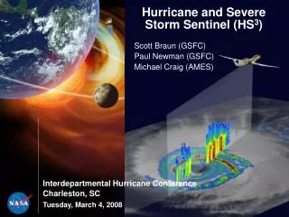
Scott Braun (GSFC) Paul Newman (GSFC) Michael Craig (AMES). Hurricane and Severe Storm Sentinel (HS 3 ). Interdepartmental Hurricane Conference Charleston, SC. Tuesday, March 4, 2008. NASA Hurricane Research Focus Areas. Satellite remote sensing. Sensor development. Numerical modeling.

E N D
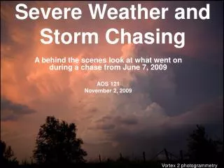
Scott Braun (GSFC) Paul Newman (GSFC) Michael Craig (AMES) Hurricane and Severe Storm Sentinel (HS3) Interdepartmental Hurricane Conference Charleston, SC Tuesday, March 4, 2008
NASA Hurricane Research Focus Areas Satellite remote sensing Sensor development Numerical modeling Field campaigns
NASA ER-2 NASA Field Programs NASA DC-8 Program Manager: Ramesh Kakar Field programs coordinated with NOAA/Hurricane Research Division 1998 2001 2005 2006
Global Hawk NASA has acquired two Global Hawks, based at Dryden
Hurricane Science Questions • • Can we predict hurricane intensity, structure, and rainfall and what are the limits on predictability? • • What are the key processes involved in hurricane genesis and development? • • What are the mechanisms for rapid intensity change? • • What is the role of the Saharan Air Layer? • • How do storms change as they undergo extratropical transition? Often underlying these questions is a focus on distribution of water in all of its phases
Instrument Functional Requirements Mission Functional Requirements Measurement Requirements 3-d wind structure Precipitation radar • Scanning Doppler • 1-2 km horiz. resolution 2-d, 3-d precipitation structure 10-20 h on station Radiometer Tropospheric wind profiles 60-65 k ft altitude Wind lidar • Tropospheric profiles • 20-30 km horiz. resolution Surface wind measurements Real-time downlink Temperature profiles Dropsonde Humidity profiles Microwave sounder Cloud structure Cloud physics lidar Science Traceability Matrix Multispectral imagery Aerosol profiles Scanning radar altimeter Wave heights Science Objectives Can we predict track, intensity, structure, surge and rainfall of landfalling tropical cyclones? Do we understand hurricane genesis and deveopment? Do we understand the rapid intensity changes? What is the role of the SAL? Do we understand the extratropical transition?
NASA Global Hawk Overview • The transfer of two Global Hawk aircraft from the USAF to NASA Dryden has been finalized. • Both aircraft have all the required equipment for flight, and Northrop Grumman is currently performing inspections on the aircraft under a contract with NASA. • FY08 is the project stand-up year, and the initial operating capability will be in early FY09. Bay A G H D E F Bay J Bay B I Bay C
Initial hurricane development 30 hour Global Hawk flights from Dryden 22.5 hour loiter 15.0 hour loiter Out & Back No loiter Nearly all Atlantic, East Pacific, and Central Pacific hurricanes are within range
Measurement Technologies • • Wind lidar technologies • • Scanning Doppler radar (HIWRAP) • • Imaging radiometer (HIRAD) • • Microwave sounder • • Cloud physics radar • • Cloud/aerosol lidar • • Dropsondes
Timeline • Mission definition phase • Hurricane Science & Forecasting workshop: June 2008 • White paper completed: Aug. 2008 • Mission implementation (depending on funding) • Payload selection - Spring-Summer 2009 • Instrument test flights on WB-57f, ER-2, & GH • Test flights on GH - 2009-2010 • Aug.-Sep. 2010 - deployment 1 • Aug.-Sep. 2011 - deployment 2
Hurricane and Severe Storm Sentinel Hurricane Genesis Locations 22 hr. loiter 15 hr. Out & Back HS3 Hurricane and Severe Storm Sentinel HS3 A Proposed Application of the Global Hawk for Hurricane Studies Science Goal: Tounderstand hurricane genesis, intensification, and tracks, and the implications of a warming climate. Key Science Questions: • Can we improve prediction of track, intensity, structure, surge and rainfall for landfalling tropical cyclones? • How do hurricanes form and intensify? • What causes rapid intensity changes? • What’s the role of the Saharan Air Layer? • How do storms change as they undergo extratropical transition? Science Objectives: Demonstrate unique expertise in • Long-term duration with Earth Science surveillance • Providing 3-D observations of the wind field both within tropical cyclones and in the environment • Measuring moisture fields, clouds, aerosols, and precipitation • Observing the genesis of tropical cyclones and the intensification from a tropical storm to a hurricane over an extended period - surveillance rather than reconnaissance • Develop infrastructure to enable all Earth Science Focus Areas • Mission requirements: • Surveillance capability on developing tropical systems: > 12 hours • Surveillance from above hurricanes: >60,000 feet • Real-time downlinking of observations • High vert. and horiz. resolution obs. (in and out of precipitation) of: winds, precip, temp, humidity, aerosols, and cloud structure. Mission Platform: • Unmanned Airborne System (UAS) Northrop Grumman Global Hawk • 2000 lb. payload • >30 hour endurance • 65,000 ft. altitude
UASs and the Decadal Survey Oct. 2006: Decadal Survey Subcommittee Report has a specific comment with respect to UASs: “We recommend that ESD appoint a Working Group for Suborbital Science to assist in the development of a strategy for new technology infusion and long-term planning in the Suborbital Science Program.” June 2007: Richard A. Anthes, Decadal Survey Co-Chair before the House Subcommittee on Space and Aeronautics Committee on Science and Technology: “… NASA should increase its suborbital capabilities. NASA’s airborne programs have suffered substantial diminution and should be restored. In addition, NASA should lead in exploiting unmanned aerial vehicles (UAV/ technology). Both conventional and UAV aircraft are needed for instrument development, and hence risk reduction and technology advancement, and for their direct contribution to Earth observations. Increment needed beyond President’s Request in FY08: $10 million.” July 2007: The Senate Appropriations Committee recommended a NASA budget of $17.5B, an increase of 7.2 percent or $1.2B. In that Senate Subcommittee report they stated, "Unmanned Aerial Vehicles [UAV] in Support of Earth Science Objectives. - The Committee initiated a program in fiscal year 2006 utilizing the unique location and assets of the Wallops Flight Facility to begin a program where UAVs would be utilized to achieve key objectives emerging out of the Earth Science Decadal Survey. The Committee strongly encourages NASA to continue this effort in fiscal year 2008.” July 2007: The House Appropriations Committee recommended $17.6B, an increase of 8.2 percent or $1.3B. “The Committee also notes that that National Academies' Earth Science decadal survey urges the use of unmanned aircraft systems (UASs) in essentially all Earth science areas as part of a balanced portfolio. The report states '. . . UAVs have the potential to revolutionize suborbital remote and in situ sensing with their increased range and loiter time, and their ability to penetrate hazardous environments' as compared to conventional aircraft. The Committee urges NASA to build upon its' existing program and should continue this effort with industry. The Committee expects this issue to be addressed in the Agency's FY 2008 operating plan.