Download
1 / 39
500 likes | 1.03k Views
History of Ocean Exploration and Marine Sciences. Chapter 2. 39 slides. Ancient Uses and Explorations. Prehistory and the Rise of Seafaring

E N D
History of Ocean Explorationand Marine Sciences Chapter 2 39 slides
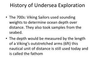
Ancient Uses and Explorations Prehistory and the Rise of Seafaring History doesn’t record who the first people were to explore the oceans, nor when. But archaeologists date Native American primitive fishhooks and spears to 5000 B.C. When was the first sea voyage in a ship? No one knows although several cultures have similar stories of a worldwide flood and a large boat full of animals, the existence of the Ark (4000 B.C.) is widely debated. Therefore, the earliest recorded sea voyage seems to have taken place around 3200 B.C. by the Egyptians. At this time, the north star was not Polaris but Thuban.
Ancient Phoenician Explorations and Discoveries Phoenicia was an ancient civilization centered in the north of ancient Canaan, with its heartland along the coast of modern day Lebanon, Syria and northern Israel. Phoenician civilization was an enterprising maritime trading culture that spread across the Mediterranean during the first millennium BC, between the period of 1200 BC to 900 BC.
Ancient Phoenician Explorations and Discoveries The ancient Phoenicians were among the most important early Western seafarers. Traveled great distances for their day. Established the first trade routes throughout the Mediterranean and as far north as Great Britain. They steered at night by observing the constellations and the north star (Polaris, 430 l.y.a.) – in the ancient world, the north star was called the Phoenician Star. This is one of the earliest references to using the North Star for navigation.
Ancient Polynesian Explorations and Discoveries The significance of Polynesian seafaring is that it is the earliest known regular, long distance, open ocean seafaring beyond sight of land. It’s estimated that it took more than 1000 years for the area to be fully settled. But had been so for hundreds of years when the first Europeans arrived.
Ancient Greek Explorations and Discoveries It was primarily the ancient Greeks who first used mathematical principles and sophisticated maps for seafaring. By applying their advancements in early science and mathematics, this culture contributed to understanding the oceans in many ways. Although western civilization would “lose” the knowledge during the Middle Ages, the Greeks knew that the world was a sphere and not flat.
Ancient Greek Explorations and Discoveries The Greek Pytheas noted that he could predict the tides in the Atlantic based on the phases of the moon. About 150 years later, Eratosthenes (264-194 B.C.) calculated the Earth’s circumference and invented the first lattitude/longitude system – a system of imaginary lines on the Earth, used for navigation and mapping. Hipparchus invented a better system – the one used today – later.
Ancient Greek Explorations and Discoveries Evolution of ancient maps of the known world
The Latitude/Longitude System One of the Greeks’ primary contributions to oceanography and seafaring is the latitude/longitude system. Latitude lines run east-west and longitude lines run north-south. Because they run around the sphere of the Earth, they are numbered in degrees. For further accuracy, degrees are numbered into 60 minutes and minutes into 60 seconds like time.
Prime Meridian and Equator Longitude lines begin at one pole and end at the other. Sometimes called meridians, the 0⁰ meridian runs through the Royal Naval Observatory in Greenwich, England. This is called the Prime Meridian. Directly on the other side of the world is the 180⁰ meridian. If you are looking north, the meridians on the right of the prime meridian are called east longitude all the way to the 180⁰ meridian.
Let’s apply what we just learned to find the wreck of the Titanic!!! 49⁰ 56’ 49’’ W, 41⁰ 43’ 57’’ N
Did you navigate correctly? 49⁰ 56’ 49’’ W, 41⁰ 43’ 57’’ N
The European Middle Ages The period of about 500 A.D. to 1500 in Europe is called the Middle Ages (Also known as the dark ages because Europe entered an age of intellectual darkness.) This was the period that we think of when we think of knights, castles, and feudalism. Except for the Viking Voyages, there was little ocean exploration by Europeans during this period. Middle Ages map of the know world based on descriptions in the bible.
Viking Explorations and Discoveries The Viking period stretches from about 790 A.D. to 1100. During this period Vikings raided nearby land, explored, and established trade routes throughout Britain, Ireland, Southern Europe, Northern Africa, and Asia. This was the only significant exploration taking place in Europe during this period.
Chinese Explorations and Discoveries Although science and exploration lay idle in Europe during the Middle Ages, that wasn’t the case in China. Among many important contributions in that era, the Chinese were responsible for inventing the magnetic compass. Shipbuilding: central rudders and watertight compartments.
End of the Middle Ages and a Route Around Africa The Renaissance (~1400 A.D.) marked the end of the Middle Ages in Europe. With it came new interest in exploration and science.
Exploration of the New World In 1492, Portuguese Christopher Columbus set out on the first of his four famous voyages. As others…..the purpose was to find a route to Asia and the East Indies. Because he was using Ptolemy’s estimation of the Earth’s size (which was too small) He thought he’d reach Asia when he landed on a Caribbean Island.
Vasco daGama’s Journey to India Magellan’s and Drake’s around the world voyage of discovery
The Birth of Marine Science (1700-1900) As Britain began to compete with France and Spain for Global conquest, they realized that the more they knew about the seas and the world, the better. The Royal Navy launched voyages with the objectives of exploration, mapping, and projecting British presence around the world. The crew often included scientists and naturalists.
Cook’s Expeditions The Voyages of Captain James Cook largely received credit as the first expeditions devoted to scientific oceanography. A major contribution to Cook’s voyages was the invention of the chronometer – clock or watch that wasn’t affected by the waves and motion of the sea. One of his major missions was to map the path of Venus between the Earth and the Sun in order to calculate the distance between the Earth and the Sun. Although he never found Antarctica, he did find the Hawaii islands that was his downfall. He was considered an oceanographer, anthropologist and naturalist.
Darwin and the HMS Beagle In addition to his work in the Galapagos and the rest of his five year voyage aboard the Beagle – that we learned about in biology – Darwin also contributed to modern day marine science. Darwin hypothesized that the massive coral reefs they saw could only result when the seafloor slowly sinks. This is accepted by most scientist today.
United States Exploring Expedition One of the most important scientific expeditions launched by the US was the US Exploring Expedition – also referred to as the Wilkes Expedition after its commander, Charles Wilkes. In addition to surveying many parts of North and South America, This expedition found the elusive southern continent – Antarctica. Approximately during the same time, US Naval officer Mathew Maury who was among the first to envision a worldwide pattern for surface winds and currents produced instructions for making long distance sailing more efficient by working with the prevailing currents and winds. Also, his systems for recording oceanographic data from vessels was adopted worldwide.
The Challenger Expedition Recognized as the only expedition to date that was solely devoted to marine science. The deepest place on Earth is the Challenger Deep (35,798 ft.) in the Marianas Trench – named after the expeditions that discovered it. Mt. Everest – the highest point on Earth is 29,035 ft. tall by comparison. Challenger’s contributions to oceanography and marine science were great. From over 4,700 new species to new habitats not previously thought to hold life. NASA named one of its orbiters in its honor.
The Challenger Expedition Challenger Deep
The Challenger Space Orbiter Later in the 20th century NASA named its Apollo 11 lunar module and its 2nd space orbiter – 1983 –(Challenger) after this vessel. Challenger the orbiter exploded 73 seconds into launch on January 28th, 1986. It carried aboard what was supposed to be the first teacher in space, Sharon Christa Corrigan McAuliffe. The alternate teacher chosen, Barbara Morgan, completed that mission recently on August 7th, 2007 aboard shuttle Endeavour (21 years later)
The Oceanography Explosion Too many to list, the great increase in the exploration of oceanography and marine science in general stemmed in large part from the industrial revolution with the evolution of scientific and technological advancements. Three expeditions stand out though…
The German Meteor Expedition, Atlantis, and the HMS Challenger II One of the first modern research cruises, the Meteor’s main accomplishment was the mapping of the Atlantic seafloor with echo-sounding technology. In 1931, the US launched the Atlantis. The significance of the Atlantis is that she was the first ship specifically designed and built for ocean studies. In 1951, the HMS Challenger II began a two year voyage to measure the depths of the ocean. Its greatest discovery was the deepest known point on Earth located at the Marianas Trench – discovered by the 1st Challenger. The deepest spot was named Challenger deep after the 1st vessel.
Atlantis the Space Orbiter NASA honored the Atlantis expeditions by naming its 4th shuttle after it. Atlantis the space orbiter first flew in 1985 and is still in service today.
Other Space Orbiters Were Also Named in Honor of Historical Expedition of Our Oceans. Columbia & Apollo 11 moon lander: American Ocean vessel sent to circle the globe. Discovery: Henry Hudson – Explored the Hudson Bay for the Northwest passage from Atlantic to Pacific. Endeavour (replacement for Challenger) named in honor of Captain James Cook’s vessel.
The shuttle fleet will be retired in 2010 to make way for the next generation of space exploration vehicle. Extra Information About the Shuttle Fleet 1st shuttle built: Enterprise, originally named Constitution. Never flew in space but, was used to test the gliding landings. 1st Shuttle in space: Columbia 1981. Heaviest of the fleet. Destroyed on re-entry (February 1st, 2003) due to heat shield damage from foam that hit wing on launch. 2nd Shuttle in space: Challenger 1983. Lost 73 seconds into launch due to rocket booster failure on January 28th, 1986. 3rd Shuttle in space: Discovery 1984. Still in service. 4th Shuttle in space: Atlantis 1985. Still in service. 5th and last shuttle to be built: Endeavour 1992. Still in service.