Download
1 / 22
220 likes | 374 Views
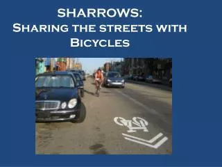
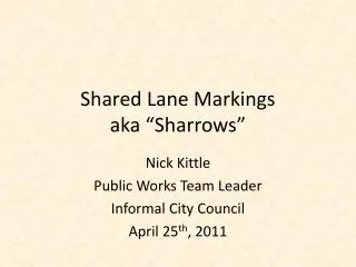
Shared Lane Markings aka “ Sharrows ”. Nick Kittle Public Works Team Leader Informal City Council April 25 th , 2011. Shared Lane Markings. The “ Sharrow ” Roadway Pavement Marking Reinforce State Law Do Not Designate Bike Lane Relatively New Manual of Uniform Traffic Control Devices

E N D
Shared Lane Markingsaka “Sharrows” Nick Kittle Public Works Team Leader Informal City Council April 25th, 2011
Shared Lane Markings The “Sharrow” • Roadway Pavement Marking • Reinforce State Law • Do Not Designate Bike Lane • Relatively New • Manual of Uniform Traffic Control Devices • Provides Guidance to Both Bicyclists and Drivers
Creating Expectations Purpose • Alerts motorists where bicyclists are supposed to be when sharing the travel lane • Reinforce State Law • Guide bicyclists where to ride when sharing the travel lane • Supports both driver and bicyclist expectations of where each will be positioned in order to safely pass
Share The Road It Doesn’t: • Mean the bicyclist must take the whole lane • Mean that motorists may not pass • Mean bicyclists should lessen their awareness of their surroundings • Replace designated bicycle lanes or create designated bicycle lanes It Does: • Reinforce current State law • Provides Law Enforcement a clear demarcation to help enforce the law • Raise the awareness that motorists and bicyclists are supposed to share the road
Appropriate Routes Route Selection • Installed on roadways with posted speeds of 35 mph or less only • Placed on roadways where gaps in the bike system exist • Placed on roadways where increased awareness would be beneficial • Placed to encourage proper cycling, vehicular and pedestrian interactions • Placed on roadways where travel lanes are too narrow to install dedicated bike lanes
Sharrow History • First Shared Lane Marking designs developed in Denver, San Francisco – mid- to late 1990s • Approved experiments conducted in California, results led to Shared Lane Marking approval in CA first – 2004 • Testing conducted in various U.S. cities for possible national approval (Chicago, Ft. Collins, etc.) – 2006 – 2008 • Marking included in draft MUTCD update; extensive comment period offered but no comments against use – 2007 - 2009 • Marking approved for national use (MUTCD) – Dec. 2009
Success • Results of Shared Lane Marking testing showed: • Over 90% of bicyclists on the test facility properly place over the symbol • Decrease in evasive maneuvers between vehicles and bicyclists • Increased distance between bicyclists and parked cars • Increased distance between motorists when passing bicyclists • Fewer bicyclists riding the wrong way on the road • Fewer bicyclists riding on the sidewalk
DRIVING How to Operate Around SLMs BICYCLING Line up with the center of the shared lane marking for better lane positioning Do not make left turns from the right lane or right side of the travel lane Do not ride against the flow of traffic – always ride with traffic Do not weave in and out of parked cars Do not pass stopped vehicles on the right side Wait until you can provide at least 3’ of passing space Consider slowing down a little when passing Do not honk your horn when passing a bicyclist
Sharrow Facts “Sharrow” Education • Bicyclists are supposed to ride at the point of the arrows • The point of the arrow is 4’ off the side of a travel lane or; • 11’ from a curb with on-street parking • Places the bicyclist to the right of a traveled area • Provides minimum 3’ clear zone from parked cars
Adopted City Process Underway2007 to Present • Information provided starting in 2007 • Share the Road Grant (CDOT) • One of two communities selected in the State • 17 different agencies invited to participate • Bicycle Advisory Committee recommendation • Citizens Transportation Advisory Board supported • Education/General Public Communication • Media Campaign • Bike Month Exposure
Implementation Plan Implementation • Commence Education and Media Campaign • Install prior to Bike Month • Find an “ideal” location to educate the public first with accompanying media campaign • Target Dates: • May 9th first location • May 16th 30th Street • May 23rd Pikes Peak/ Colorado
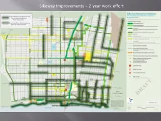
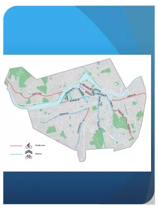
Proposed Shared Lane Markings Projects • 30th Street Corridor • W. Colorado Avenue to Centennial Blvd. • Recommended as a pilot corridor by CTAB’s Bicycle Advisory Subcommittee (BAC) • Frequently used by bicyclists now due to limited parallel corridors and several major attractors along corridor • Connects with Centennial Blvd. bicycle lanes and planned Uintah St. bicycle lanes/route (late 2011 construction anticipated) • Made Possible Through CDOT grant and Bike Tax Funding
Proposed Shared Lane Markings Projects • Hancock/Pikes Peak/W. Colorado • Connects Memorial Park/Velodrome, Downtown to west side of Colorado Springs – popular cycling areas • Recommended as another pilot corridor by newly elected Councilman Leigh who is privately fundraising • Intersects with several existing and planned bicycle routes / lanes • Regular use by bicyclists currently; concern about poor bicycling and motorists behaviors
Proposed Shared Lane Markings Projects • Hancock/Pikes Peak/W. Colorado • Connects Memorial Park/Velodrome, Downtown to west side of Colorado Springs – popular cycling areas • Recommended as another pilot corridor by newly elected Councilman Leigh who is privately fundraising • City Contribution is equipment and labor for proper installation • Creates choices for transportation • Several sections are ideal and all are acceptable
Proposed Shared Lane Markings Projects • Other 2011 Proposed Locations to Fill Gaps • Chelton Rd. bicycle lane intersection/segment gaps • E. Bijou Street bicycle lane intersection/segment gaps • Acacia Dr./Meadow Lane – frequently used segment • Cresta Rd./ 21st St. bicycle lanes – intersection and segment gaps • Meadowridge Dr. bicycle lane intersection/segment gaps • Cache La Poudre bicycle lane – segment gaps • W. Uintah St. bicycle lane intersection/segment gaps • Tejon Street – bicycle lane gaps; sections with diagonal parking
Sharrow Tests-Cambridge, MA Overall results from Cambridge, MA, indicate the following: • A total of 94 percent of bicyclists rode over the sharrows. • There was more operating space for bicycles as motor vehicle spacing from parked motor vehicles increased. • A number of variables related to the operations of bicycles and motor vehicles showed positive effects. • A total of 94 percent of the bicyclists rode over the shared lane marking. • The percentage of bicyclists who took the lane decreased from 13 to 8 percent. • The percentage of avoidance maneuvers (i.e., changing speed or direction to avoid another party) decreased from 76 to 37 percent. • The percentage of bicyclists who yielded (i.e., gave way to a motorist) decreased from 23 to 7 percent. • The percentage of motorists who yielded (i.e., gave way to a bicyclist) increased from 5 to 9.5 percent. • http://www.fhwa.dot.gov/publications/research/safety/pedbike/10044/10044.pdf
Sharrow Tests-Chapel Hill, NC Overall results from Chapel Hill, NC, indicate the following: • A total of 91 percent of bicyclists tracked over the sharrows and rode at a safe distance from the edge of curb with more of an effect in the downhill direction. • Motorists moved away from the sharrows, providing more operating space for bicyclists. • A number of variables related to the operations of bicycles and motor vehicles showed positive effects. • Bicyclist sidewalk riding decreased in the downhill direction. • There was no change in the percentage of bicyclist wrong-way riding. • http://www.fhwa.dot.gov/publications/research/safety/pedbike/10044/10044.pdf • The percentage of avoidance maneuvers decreased from 81 to 71 percent. • The percentage of motorists staying in the lane when following bicyclists increased from 20 to 29 percent. • A total of 91 percent of the bicyclists rode over the sharrows—97 percent in the downhill direction and 88 percent in the uphill direction. Bicyclists riding uphill traveled slower and tended to ride closer to the curb. • The percentage of motorists who made no movement to change lanes when overtaking a bicyclist increased from 24 to 32 percent.
Relevant Bicycle Laws • Bicyclists shall ride in the right hand lane of a roadway as far to the right as judged safe by the person riding the bicycle • Bicyclists may use a lane other than the right lane when making left turns, overtaking slower vehicles or avoiding hazards/obstacles • People can ride a bicycle on a sidewalk in Colorado Springs except for in designated locations in the Downtown and Old Colorado City business districts. When riding on a sidewalk, a bicyclist must yield to pedestrians and travel at a reasonable speed. • Motorists are required to provide a minimum of 3’ of space between their vehicles and bicyclists they are passing.
City Bicycle System Stats • 85 miles of designated bicycle lanes • 110+ miles of off-street urban multi-use trails • Several trail tunnels and overpasses • System development primarily funded with grants, PPRTA List A funding, Bicycle Tax funds and small amounts of General Fund dollars • Silver-level Bicycle Friendly Communities award (2008)