Download
1 / 107
1.07k likes | 1.35k Views
Hebrew University of Jerusalem. Paleoseismology. Elisa Kagan Hebrew University of Jerusalem & the Geological Survey of Israel July 23, 2008 (PhD advisors: Amotz Agnon, Moti Stein, Mira Bar-Matthews). Paleoseismology is the study of the timing, location, and size of ancient earthquakes.

E N D
Hebrew University of Jerusalem Paleoseismology Elisa Kagan Hebrew University of Jerusalem & the Geological Survey of Israel July 23, 2008 (PhD advisors: Amotz Agnon, Moti Stein, Mira Bar-Matthews)
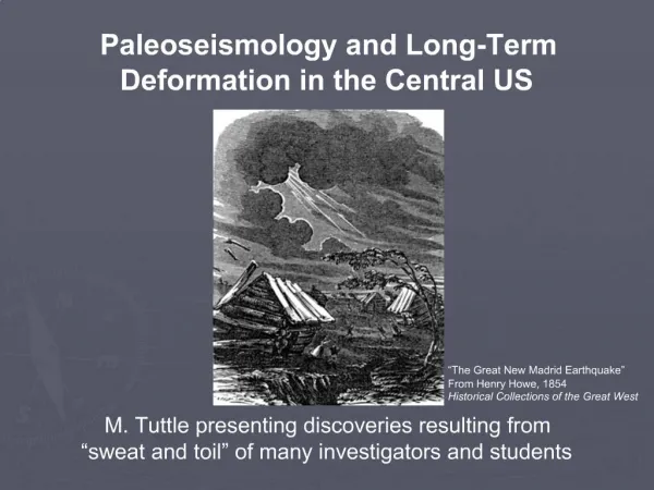
Paleoseismology is the study of the timing, location, and size of ancient earthquakes. San Andeas Fault, California
plates • Interested in knowing: • Recurrence of earthquakes • Location • Magnitude • Local Intensities, site effects • Mechanisms • Segmentation • Fault interactions • Directivity • Etc………….. • TOOLS: • Instrumental Record • Historical Record • Paleoseismic Record • (Faults, deformed sediments • e.g. lake sediments, speleothems)
Paleoseismology - WHY? Instrumental is so precise! BUT… way too short Historical…. Quite detailed…. BUT, not totally reliable and also TOO SHORT (up to 2000 years) Long, detailed, and well-dated paleoseismic record needed 10’s-100’s of thousands of years • largest quakes may not be included in historical records • more seismic cycles • insight into long-term recurrence times and patterns (G&R, clustering…)
Surface rupture is recorded in the landscape and the sediments
Modeling $$$
Paleoseismic Datapre-instrumentalcaveats • Site specific • Data sets CAN be small, sparse, analog (changing in a continuous manner relative to another quantity ) • Quantification of uncertainty - major challenge
We need: • Earthquake-induced geological evidence (on-fault or off-fault) • Preserved evidence • Accessibility • Dateable material • Preferably continuous record • Preferably multi-site, multi-archive
ON-FAULT PALEOSEISMOLOGY Fault scarp created by the 1959 Hebgen Lake, Montana, earthquake
ON-FAULT STUDIES Trenching across faults Across Seattle Fault Bet Zayda (near the Kinneret) San Andreas, 1600 earthquake
ON-Fault: • Fault-specific • Can measure rupture • Can measure recurrence • Can differentiate different segments • Can interpret magnitude
Example Fault Database from California (CDMG) Need to “trench” each and every one!
Slip Rates (mm/yr) By Segment Very detailed information!
Average Recurrence Interval (years) At Measurement Sites
On-Fault not always available May be covered by soil, alluvium, lake, ocean This includes basically all subduction zone quakes (e.g. majority of devastating tsunami-triggering earthquakes) Japan: Fault scarp, hidden deep within a black spruce thicket...
OFF-FAULT evidence PRO & CON: Can include evidence of earthquakes from various faults
TECTONICSETTING Off-fault evidence can record earthquakes from various locations and distances
Paleo-tsunami deposits Chile
Fallen Boulders MSc Mor Kanari Kiryat Shemona
A stream channel offset by the San Andreas fault, Carrizo Plain, central California (photo by Robert E. Wallace) Geomorphology deformed landforms
Dendroseismology – tree-ring analysis, earthquake-damaged trees
Liquefaction induced features
Clastic Dikes in Lisan Fm., PhD - Zafrir Levy
Speleoseismology Soreq Cave (Bet Shemesh), Fallen Stalagmite
Archaeoseismology Nimrod crusader fortress offset Susita Ateret - Vadum Iacob - N. Wall
Cross correlation of data types: • Paleoseismicity • Plate tectonics • GPS • Instrumental
Modified Mercalli Intensity Scale עוצמה • Gives a local characteristic of the earthquake at a site. • Based on response of people and structures. • MMI is generally larger near the epicenter of an earthquake, and decreases with distance. • However, site effects can cause anomalies in this trend. The real measure of the "badness" of the earthquake Based on human observations of damage and effects of earthquakes, not any measurement by a machine.
examples: • IV. Felt indoors by many, outdoors by few. • Awakened few, especially light sleepers.Frightened no one, unless apprehensive from previous experience.Vibration like that due to the passing of heavy or heavily loaded trucks.Sensation like heavy body striking building or falling of heavy objects inside.Rattling of dishes, windows, doors; glassware and crockery clink and clash.Creaking of walls, frame, especially in the upper range of this grade.Hanging objects swung, in numerous instances.Slightly disturbed liquids in open vessels. Rocked standing motor cars noticeably.
VIII. Fright general -- alarm approaches panic. • Disturbed persons driving motor cars.Trees shaken strongly -- branches, trunks, broken off, especially palm trees.Ejected sand and mud in small amounts.Changes: temporary, permanent; in flow of springs and wells; dry wells renewed flow; in temperature of spring and well waters.Damage slight in structures (brick) built especially to withstand earthquakes. • Considerable in ordinary substantial buildings, partial collapse: racked, tumbled down, wooden houses in some cases; threw out panel walls in frame structures, broke off decayed piling.Fall of walls.Cracked, broke, solid stone walls seriously.Wet ground to some extent, also ground on steep slopes.Twisting, fall, of chimneys, columns, monuments, also factory stacks, towers.Moved conspicuously, overturned, very heavy furniture.
Modified Mercalli Intensity Map Borah Peak EarthquakeOct 28, 1983Ms=7.3
INQUA SCALE “A global catalogue and mapping of earthquake environmental effects" Using the present to interpret the past Calibrate the scale: modern, measured earthquakes & geological effects Then: use paleoseismic evidence and calibrate to magnitude etc… Request: report to them ALL geological effects after an earthquake
Pic of macaronis * מה נעשה עד כה בתחום? Forti&Postpischl, 1984. Marine Geology Postpischl et al, 1991. Tectonophysics Lacave et al., 2004 J. Earthquake Engineering Kagan et al., 2005. GeologyGilli, 2005. Comptes Rendus Geoscience
What happens underground during an earthquake? • Seismological studies showenhancement of amplitudes(x6 and more) may occur at depths (but also at times reduction) • due tointerferenceof upcoming and downgoing waves (e.g. Bard and Tucker, 1985) Site effect is yet unknown
Case Study Soreq Caves
Location Map Eshtaol Map bet-shemesh N Soreq Cave Beit-Shemesh Har-Tuv Cave To Jerusalem
אזור העבודה - מערות שורק והר-טוב *עבודות קודמות בנושא פלאואקלים, קארסט, והידרולוגיה במערת שורק: Asaf, 1975; Even, 1983; Frumkin et al., 1994; Kaufman et al., 1998; Ayalon et al., 1998,1999,2002; Bar-Matthews et al., 1991,1996,1997,1999,2000,2001, 2002. • השקעה רציפה kyr 185<
דמיון רב בין שתי המערות • התמוטטויות ותופעות נזק רבות • מיקום מאפשר רישום רעידות אדמה מהעתק ים המלח ואולי מהעתקים נוספים • סינוןשל רעידות קטנות
איך יודעים שרעידות אדמה גרמו לנזקים במערות אלו?
anthropogenic נזק אנתרופוגני? נזק מבעלי חיים? לא!! אין כניסות טבעיות!! חציבה רק במאה האחרונה תיארוך התופעות פותר את בעיית החציבה
Perma-frost נהרות תת-קרקעים? השתפלות? לא היו במערות המחקר פרמה-פרוסט? תנועת קרח? • לא במרכז ישראל! • תקופות קרח לא היו קרות מספיק • ולא היה כיסוי קרח
Climate-static load • עומס סטטי? • רעידת אדמה תהיה ה"טריגר" • זקיפים גם נשברו • אירועים אקלימיים? • לא נמצאה קורלציה
מה עשינו? * פיתוח השיטה * קביעת גילי התמוטטויות, והארכת הרקורד הקייםמ-70ky (מהליסן) ל-185 ky * קורלציה עם הרקורד הפלאוסייסמי הקיים • תרומה לרקורד הפלאוסייסמי של אזור המרוחק מההעתק הפעיל, רקורד של הרעידות הגדולות