Download
1 / 25
250 likes | 390 Views
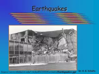
Earthquakes. Dr. R. B. Schultz. Source:www.elmhurst.edu/~richs/EC/102/Lectures/ Earthquakes . ppt. Global Earthquake Locations. Earthquakes Shaking of earth due to movement of rocks along a fault. Rocks under stress accumulate strain energy over time.

E N D
Earthquakes Dr. R. B. Schultz Source:www.elmhurst.edu/~richs/EC/102/Lectures/Earthquakes.ppt
Earthquakes • Shaking of earth due to movement of rocks along a fault. • Rocks under stress accumulate strain energy over time. • When stress exceeds strength of rocks, rock breaks. • Strain energy is released as seismic waves. The longer that energy is stored up and is maintained without release, the more likely that a strong earthquake will occur.
Types of seismic waves Body waves -- travel through interior Primary or "P" Waves: Primary waves Highest velocity Causes compression and expansion in direction of wave travel. Secondary or "S" Waves: Secondary or shear waves Slower than P waves but faster than surface waves. Causes shearing of rock perpendicular to direction of wave propagation Cannot travel through liquids Surface waves-- travel on surface of earth Cause vertical & horizontal shaking Travel exclusively along surface of earth
Primary or “P” Wave Secondary or “S” Wave
Determining the location of an earthquake First, distance to earthquake is determined. 1. Seismographs record seismic waves 2. From seismograph record called the seismogram, measure time delay between P & S wave arrival 3. Use travel time curve to determine distance to earthquake as function of P-S time delay Now we know distance waves traveled, but we don't know the direction from which they came. We must repeat the activity for each of at least three (3) stations to triangulate a point (epicenter of quake). Plot a circle around seismograph location; radius of circle is the distance to the quake. Quake occurred somewhere along that circle. Do the same thing for at least 3 seismograph stations; circles intersect at epicenter. Thus, point is triangulated and epicenter is located.
Determining the magnitude of an earthquake Magnitude-- measure of energy released during earthquake. There are several different ways to measure magnitude. Most common magnitude measure is Richter Magnitude, named for the renowned seismologist, Charles Richter. Richter Magnitude • Measure amplitude of largest S wave on seismograph record. • Take into account distance between seismograph & epicenter. Richter Scale • Logarithmic numerical (NOT a physical) scale • Increasing one whole unit on Richter Scale represents 10 times greater magnitude. • Going up one whole unit on Richter Scale represents about a 30 times greater release of energy. Intensity • Intensity refers to the amount of damage done in an earthquake • Mercalli Scale is used to express damage
Hazards associated with Quakes • Shaking: Frequency of shaking differs for different seismic waves. High frequency body waves shake low buildings more. Low frequency surface waves shake high buildings more. Intensity of shaking also depends on type of subsurface material. Unconsolidated materials amplify shaking more than rocks do. Fine-grained, sensitive materials can lose strength when shaken. They lose strength by liquefaction. Buildings respond differently to shaking depending on construction styles, materials Wood -- more flexible, holds up well Earthen materials -- very vulnerable to shaking. • Ground displacement: Ground surface may shift during an earthquake (esp. if focus is shallow). Vertical displacements of surface produce fault scarps. • Tsunamis (NOT tidal waves) Tsunamis are huge waves generated by earthquakes undersea or below coastal areas. If earthquake displaces sea surface, wave is generated that can grow as it moves over sea surface. • Fires Usually occurs from shifting of subsurface utilities (gas lines)
Tsunami Movement: ~600 mph in deep water ~250 mph in medium depth water ~35 mph in shallow water
Earthquake Prediction (?) How can scientists predict an earthquake? Currently, that is not possible. Future technology will monitor subsurface seismic waves and periodic shifting indicative of future slippage. Tracking organic movement is also a source of future study.
Earthquake Hazard Potential Map Parkfield, CA “Earthquake Capital of the World”
World’s Largest Earthquake: 1964 Anchorage, Alaska Registered 8.6 on Richter Scale
Key Terminology Seismic waves Body waves Surface waves Primary (“P) waves Secondary (“S”) waves Love (“L”) waves Seismograph Seismogram Focus Epicenter Time-travel curve Magnitude Intensity Richter Scale Mercalli Scale Logarithmic Liquefaction Fault scarp Tsunami Hazard potential map
Pertinent Web Sites Coastal Storms and Tsunamis Hazard Information (USGS) The United States Geological Survey (USGS) page on coastal storms and tsunamis hazards features links to several related articles and sites. Disaster Finder (NASA) A complete index to the best disaster Web sites on the Internet. Earthquake Activity An online exercise that tracks today's earthquake activity and predicts the location of the next quake. Earthquake Data Links An extensive listing of links to earthquake data and information. Earthquake Exercise (USGS) This module contains an exercise in which students are asked to examine the frequency and distribution of earthquake epicenters and compare these epicenters to the distribution of plate boundaries and cities. Earthquake Hazard Information (USGS) The United States Geological Survey (USGS) page on earthquake hazards features links to several related articles and sites. Earthquake Information, Real-Time (USGS) Near-real-time Earthquake Bulletin provided by the National Earthquake Information Service (NEIS) of the U. S. Geological Survey. Earthquakes Links This Central Michigan University site maintained by Dr. Mark Francek lists several good links to websites containing information relative to topics discussed in the chapter. Earthquake Links (Houghton Mifflin) Links to several earthquake sites, including class lecture notes, arranged by topic. Earthquake Links (NAGT) An extensive listing of earthquake links arranged by topic from the National Association of Geology Teachers (NAGT). Earthquake Links (USGS) Links to numerous earthquake related Internet sites hosted by the United States Geological Survey (USGS). Earthquake Locator Earthquake Locator is an interface developed as an illustration of what is possible using the World Wide Web and the Internet. Earthquake Maps on the Web A detailed listing of recent earthquake maps available on the Web featuring hyperlinks to maps for most regions. Earthquakes Activity (Geosphere) An excellent interactive activity on earthquakes from the University of Montana's Geosphere. With this activity learners study recent seismograms, create seismograms, and locate earthquakes using Internet resources.
Earthquakes: Frequently Asked Questions (FAQ) Frequently asked questions (FAQ) about earthquakes from the United States Geological Survey (USGS). Earthquake Tutorial Earthquake tutorial from Texas A & M University. Earthquake Tutorial (UPSeis Home Page) An earthquake tutorial from Michigan Technical University. Earthquake Wave Animations Excellent animations of faults, plate subduction, earthquake wave propagation, and other processes from PBS' Savage Earth program. Earth's Interior & Plate Tectonics An excellent site to begin exploring Earth's interior and plate tectonics. Earth's Interior Links (Houghton Mifflin) Links to several Earth's interior sites, including class lecture notes, arranged by topic. Earth's Interior Tutorial An excellent overview of the structure and composition of Earth's interior. EarthWaves—Our Changing Planet EarthWaves is a Web site dedicated to the subject of our planet, and the many changes encompassing it. You'll find topics here ranging from earthquakes to the ozone layer. EQNET A one-stop site for multiple sources of earthquake information including geology, earthquake engineering, seismology, earthquake images, archives containing information about recent earhquakes, etc. Geology Labs On-line An excellent source for on-line, interactive, geology labs. Global Seismic Hazard Assessment Program In order to mitigate the risk associated to the recurrence of earthquakes, the GSHAP promotes a regionally coordinated, homogeneous approach to seismic hazard evaluation; the ultimate benefits are improved national and regional assessments of seismic hazards, to be used by national decision makers and engineers for land use planning and improved building design and construction. The site includes a great map showing global seismic hazards.
IRIS Consortium The Incorporated Research Institutions for Seismology (IRIS) is a consortium of United States Universities that have research programs in seismology. The purpose of IRIS is to develop and operate the infrastructure needed for the acquisition and distribution of high quality seismic data. Modified Mercalli Intensity Scale (USGS) The modified Mercalli intensity scale. National Earthquake Information Center (USGS) The National Earthquake Information Center (NEIC), a part of the Department of the Interior, U.S. Geological Survey, has three main missions. First, the NEIC determines, as rapidly and as accurately as possible, the location and size of all destructive earthquakes that occur worldwide. Second, the NEIC collects and provides to scientists and to the public an extensive seismic database that serves as a solid foundation for scientific research, principally through the operation of modern digital national and global seismograph networks and through cooperative international agreements. The NEIC is the national data center and archive for earthquake information. Third, the NEIC pursues an active research program to improve its ability to locate earthquakes and to understand the earthquake mechanism. National Geophysical Data Center The National Geophysical Data Center (NGDC) manages environmental data in the fields of marine geology and geophysics, paleoclimatology, solar-terrestrial physics, solid earth geophysics, and glaciology (snow and ice). Planet Earth (Discovery.com) The Discovery-Planet Earth site features a variety of interesting information, reports, and links on Earth science and related subjects. Recent Earthquakes and Active Volcanoes (Virtual Times) Here is a great place to investigate recent earhquakes and volcano events. Richter Magnitude Scale (USGS) The Richter magnitude scale from the United States Geological Survey (USGS). San Andreas Fault and the Bay Area A virtual field trip along the San Andreas fault. Seismic Animation Programs Several great programs, including Seismic Eruption ans Seismic Waves , by Alan Jones. Seismic Data (CERI) Seismic data from the Center for Earthquake Research and Information with extensive information on the New Madrid fault zone.
Seismicity Reports and Current Seismicity (USGS) United States Geological Survey (USGS) reports containing detailed information on recent earthquakes in Northern California and other information on large earthquakes in the U.S. and around the world. Seismic Wave Animations Great animations from Michael Wysession at Washington University. Seismic Waves, Seismographs, Locating Earthquakes A discussion of seismic waves, recording instruments, and locating an earthquake. Seismology: Common Terms Glossary of some common terms in seismology. SeismoSurfing the Internet A very comprehensive listing of known worldwide Internet connections where original seismic data or seismic research information is available. Seismo-Watch Home Page A comprehensive site specializing in earthquake reporting. Southern Arizona Seismic Observatory (SASO) The Southern Arizona Seismic Observatory (SASO) is an organized research group in the Department of Geosciences at the University of Arizona. Southern California Earthquakes A detailed presentation of southern California earthquakes and faults. Tsunami An interactive, online, tsunami-information resource. Tsunami Information Tsunami information from the National Earthquake Information Center of the USGS. University of Nevada at Reno Seismological Laboratory The Nevada Seismological Laboratory at the University of Nevada, Reno, investigates earthquakes and their effects in Nevada and eastern California. Virtual Earthquake Virtual Earthquake is an interactive computer program designed to introduce you to the concepts of how an earthquake epicenter is located and how the Richter magnitude of an earthquake is determined.


