Download
1 / 29
290 likes | 559 Views
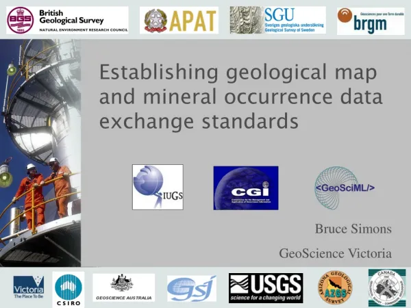
Establishing geological map and mineral occurrence data exchange standards. Bruce Simons GeoScience Victoria. Outline. Data exchange requirements (Interoperability) Exchange standard for geological data (GeoSciML) Testing the GeoSciML standard The Mineral Occurrence extension The Future.

E N D
Establishing geological map and mineral occurrence data exchange standards Bruce Simons GeoScience Victoria
Outline • Data exchange requirements (Interoperability) • Exchange standard for geological data (GeoSciML) • Testing the GeoSciML standard • The Mineral Occurrence extension • The Future
Delivering Government Digital Geoscience Data • The problem • access to Government geoscience information is fragmented and inefficient 2004 Minerals Exploration Action Agenda … • existing information is distributed across eight state and federal agencies • each with its own information management systems and data formats • up to 80% of time acquiring pre-competitive data is taken up by reformatting disparate data from government sources • a disincentive to exploration
Why is it so hard? • 8 Australian jurisdictions provide digital geoscience map data • 8 data structures and delivery systems • 2 (at least) proprietary software specific data formats • cannot access more than one agency’s data at a time • The Solution is “Interoperability” • Establish a software-independent DATA TRANSFER STANDARD • “the ability of software and hardware on different machines from different vendors to share data”
Interoperability Requirements interoperability semantic Data Content (Ontologies, Vocabularies) schematic Data Structure (GeoSciML, MineralOccurrences, O&M) syntax Data Language (GML, XML) systems Data Services (WFS, WMS, WCS)
Systems Agreement • Agree to use Web Services (WFS, WMS, WCS) • Software capabilities are limited to simple data models • Existing vendor and open source software aim to support OGC web service specifications (e.g. GML and complex features) • Ongoing collaborative work with software developers to serve the complex feature model needed for geological information • Not all required OGC standards properly specified and tested • E.g. Registries, binding WFS to WMS, handling xpath/href links
Syntax Agreement • How do you convert standard representations of complex data models (UML) to standard schema (GML)? • Need to establish UML rules (single inheritance, associations must have role names, etc) • Need to establish conversion rules (what to do with Union, interface classes etc) • Establish name spaces • Need software to enable automatic generation of schema
Interoperability Requirements interoperability semantic Data Content (Ontologies, Vocabularies) schematic Data Structure (GeoSciML, MineralOccurrences, O&M) syntax Data Language (GML, XML) systems Data Services (WFS, WMS, WCS)
lithology Victoria South Australia CompoundMaterial «Type» EarthMaterial::Rock + consolidationDegree: CGI_Term + lithology: ControlledConcept [1..*] Schematic Agreement
Interoperability Requirements interoperability semantic Data Content (Ontologies, Vocabularies) schematic Data Structure (GeoSciML, MineralOccurrences, O&M) syntax Data Language (GML, XML) systems Data Services (WFS, WMS, WCS)
Cainozoic? Late? Early? Archaean? Bolindian? Eastonian? Gisbornian? Palaeozoic? Semantic Agreement • Select geologic features where age = “xxx”
Semantic Agreement • Geological data is largely text-based and interpretive. Simple numerical data is rare. • Compliance to many controlled vocabularies is not a trivial exercise • Compliance to vocabularies is crucial to be able to construct standardised requests on distributed data • Establish language independent identifiers that local terms and languages can be mapped to • GGIC Controlled Vocabularies Working Group and CGI Geoscience Concepts Task Group
- OGC, ISO, W3C - CGI-IUGS - INSPIRE, GGIC Interoperability Requirements Summary • availability of appropriate technologies • common data structure • software independence • common data content • commitment to these standards
Open data standards Efficiencies for government Efficiencies for industry Benefits for the wider geoscience community Interoperability Benefits
What is GeoSciML? • A Geological Data Model • based on real world concepts • represents the complexity of geology (hierarchical, relational) • tells users what geological information goes where • developed by the scientific community • internationally agreed • builds on established standards such as GML (Geographic Markup Language) • uses the ISO ‘feature’ model • GeoScience Markup Language • the markup language delivers the model to web services • is machine readable
GeoScience Markup Language Australia USA Committee for the Management and Application of Geoscience Information Canada UK Interoperability Working Group France Sweden Japan Italy
TheGeoSciML Data Model Geological unit features • unit types (lithostratigraphic, chronostratigraphic) «FeatureType» Metadata entity set information:: GeologicFeature::MappedFeature +metadata MD_Metadata +metadata 0..1 {n} + observationMethod: CGI_TermValue [1..*] + positionalAccuracy: CGI_Value +occurrence 0..1 0..1 Description 0..* +metadata +specification 1 • age and geological history (events) AnyDefinition «FeatureType» +geologicHistory «FeatureType» «Type» GeologicFeature::GeologicFeature GeologicAge::GeologicEvent Vocabulary::ControlledConcept 0..* +feature + observationMethod: CGI_TermValue [1..*] + eventAge: CGI_Value + identifier: ScopedName + purpose: DescriptionPurpose = instance + eventEnvironment: CGI_TermValue [0..*] + name: LocalizedGenericName [1..*] +preferredAge 0..1 + eventProcess: CGI_TermValue [1..*] +classifier • unit parts (child/parent relations) 0..1 «FeatureType» «DataType» 0..* GeologicUnit::GeologicUnit +containedUnit «DataType» GeologicUnit::CompositionPart GeologicUnit::GeologicUnitPart 1 «estimatedProperty» + role: ScopedName + role: ScopedName + bodyMorphology: CGI_TermValue [0..*] «estimatedProperty» 0..* +part + compositionCategory: CGI_TermValue [0..1] «estimatedProperty» + lithology: ControlledConcept [1..*] • composition (earth materials) +composition + exposureColor: CGI_TermValue [0..*] + proportion: CGI_Value 0..* «estimatedProperty» + material: CompoundMaterial [0..1] + outcropCharacter: CGI_TermValue [0..*] + proportion: CGI_Value + rank: ScopedName [0..1] +metamorphicCharacter • metamorphism «DataType» +weatheringCharacter 0..1 GeologicUnit::MetamorphicDescription 0..1 «estimatedProperty» «DataType» • weathering character + metamorphicFacies: CGI_TermValue [0..*] GeologicUnit::WeatheringDescription + metamorphicGrade: CGI_TermValue [0..1] «estimatedProperty» + peakPressureValue: CGI_NumericValue [0..1] + environment: CGI_Term [0..*] + peakTemperatureValue: CGI_NumericValue [0..1] «FeatureType» • physical properties + weatheringDegree: CGI_Term [0..1] + protolithLithology: EarthMaterial [0..*] GeologicUnit:: + weatheringProcess: CGI_Term [0..*] LithologicUnit + weatheringProduct: EarthMaterial [0..*] +physicalProperty «FeatureType» 0..* • spatial representation GeologicUnit::ChronostratigraphicUnit «DataType» GeologicUnit::PhysicalDescription «estimatedProperty» + beddingPattern: CGI_TermValue [0..*] «estimatedProperty» + beddingStyle: CGI_TermValue [0..*] + density: CGI_Numeric [0..1] • vocabularies + beddingThickness: CGI_Value [0..*] + magneticSusceptibility: CGI_Value [0..1] + definingAge: CGI_Value + permeability: CGI_Value [0..1] + unitThickness: CGI_Numeric [0..*] + porosity: CGI_Value [0..1] • metadata «FeatureType» «FeatureType» GeologicUnit::LithostratigraphicUnit GeologicUnit:: LithodemicUnit «estimatedProperty» + beddingPattern: CGI_TermValue [0..*] + beddingStyle: CGI_TermValue [0..*] + beddingThickness: CGI_Value [0..*] + unitThickness: CGI_Numeric [0..*] Presented as a series of class diagrams which show the properties of, and relationships between, geological features
Geological Data Model Benefits • data providers need only “map” their own local data structures to the data transfer structure • data providers don’t need to change their local database structures to use the transfer standard • allows language independent terminology to be used (i.e. controlled vocabularies) • is open source • software vendor independent
WMS WFS WMS WFS USGS USGS schema GeoSciML WMS WFS BGS schema BGS GeoSciML WMS WFS GSV GSV schema GeoSciML GeoSciML GA WMS WFS GA schema GeoSciML Benefits • a standard GML schema for geological data GSC GSC schema GeoSciML GML Client
Testing the GeoSciML standard • Testbed 1 2005 - A borehole demonstrator between UK and France • Testbed 2 2006 – A six nation demonstrator delivering geologicalmap data from globally distributed sources using GeoSciML v1.1 • Testbed 2 Use cases • display map, query one feature, return attributes in GeoSciML • query several map features, return GeoSciML file for download • reclassify map features based on Age or Lithology
GeoSciML Testbed2 GeoSciML Accessing GeoSciML data using a web client in Canada Uppsala, SV Vancouver, CA Keyworth, UK Ottawa, CA Orleans, FR Reston, VA Portland, OR Canberra, AU
Lessons Learnt from Testbed2 • Successfully demonstrated WMS/WFS delivery, display and download of distributed data sources and simple query functions • Not previously attempted with such a complex model • Identified capabilities and limitations of WFS and OGC standards • Highlighted technical challenges to be able to deliver and consume complex features using WFS • Highlighted the need to establish well-defined limits for any web data services • Reinforced the importance of documentation of the data model to guide participants
Testbed 3 (in progress) • Wide ranging and ambitious use cases • Use Case 1 – Render a geological map from multiple data sources • symbols based on age or lithology • language dependent legend • Use Case 2 – Return GML for mapped features in bounding box • service profiles may vary to deliver sampling features, mapped features of geologic structures, links to composition or a stratigraphic lexicon • Use Case 3 – User defined query (eg “all GeologicUnits of Silurian age”) • Use Case 4 – Data transport for import/export from applications • GSI3D, GeoModeller, ESRI, dB to dB • Use Case 5 – Register of Web, Vocabulary, Symbology services • Delivery at IGC33, August 2008 – Oslo, Norway
The Mineral Occurrences extension • GGIC established standard • Extension of GeoSciML • Data exchange model for mineral occurrences • Develop a standard model that includes reserves and resources • Standardised vocabularies
Mineral Occurrences Model Mapped Feature «FeatureType» +geologicHistory +feature «FeatureType» «FeatureType» GeologicAge::GeologicEvent GeologicFeature::GeologicFeature 0..* +specification +occurrence GeologicFeature::MappedFeature + eventAge: CGI_Value + observationMethod: CGI_TermValue [1..*] 1 Description 0..* + observationMethod: CGI_TermValue [1..*] + eventEnvironment: CGI_TermValue [0..*] + purpose: DescriptionPurpose = instance +preferredAge + positionalAccuracy: CGI_Value + eventProcess: CGI_TermValue [1..*] 0..1 Mapped Feature Mineral System Mineral System Mineral Deposit Model «DataType» +parent MineralSystem 0..1 «DataType» +geneticDescription SupergeneProcesses + associationType: CGI_TermValue Earth Resource +child 0..1 «FeatureType» + depth: CGI_Numeric [0..1] 0..* EarthResource + material: EarthMaterial [0..*] 0..* + type: CGI_TermValue [0..1] + sourceReference: CI_Citation [0..*] Mineral Deposit Model 0..* «DataType» +supergeneModification «estimatedProperty» 1 MineralDepositModel +classification + dimension: EarthResourceDimension [0..1] Resource + expression: CGI_TermValue [0..*] 0..* «estimatedProperty» 0..1 Earth Resource Material + form: CGI_TermValue [0..*] + mineralDepositGroup: ScopedName [1..*] «DataType» +composition + linearOrientation: CGI_LinearOrientation [0..*] + mineralDepositType: ScopedName [0..*] 1 EarthResourceMaterial + planarOrientation: CGI_PlanarOrientation [0..*] 1 Endowment + shape: CGI_TermValue [0..*] 0..* + earthResourceMaterialRole: ERMaterialRoleCode «DataType» + material: EarthMaterial Endowment 1 1 +deposit +source + includesReserves: Boolean Earth Resource Material Earth Resource Commodity + includesResources: Boolean «DataType» Reserve +oreAmount RawMaterial «FeatureType» 0..* + material: EarthMaterial MineralOccurrence «DataType» «DataType» + rawMaterialRole: RawMaterialRoleCode OreMeasure CommodityMeasure «estimatedProperty» +composition 0..* + type: MineralOccurrenceTypeCode + calculationMethod: CharacterString +measureDetails «estimatedProperty» + date: TM_GeometricPrimitive 0..* 0..* + commodityAmount: CGI_Numeric [0..1] +resourceExtraction Endowment Mining Activity 1 1..* Product + dimension: EarthResourceDimension [0..1] + cutOffGrade: CGI_Numeric [0..1] «FeatureType» + proposedExtractionMethod: CGI_TermValue [0..1] «FeatureType» + grade: CGI_Numeric [0..1] MiningActivity + sourceReference: CI_Citation [1..*] Product 0..* +commodityDescription + activityDuration: TM_Period «estimatedProperty» + productName: CGI_TermValue 1..* + activityType: MiningActivityTypeCode 1..* +sourceCommodity + ore: CGI_Numeric +commodityOfInterest 1 Commodity + sourceReference: CI_Citation [1..*] 1..* + oreProcessed: CGI_Numeric [0..1] «FeatureType» «estimatedProperty» +producedMaterial Commodity 1..* +relatedActivity + grade: CGI_Numeric [0..1] 0..* Resource Reserve 1 + production: CGI_Numeric [0..1] 0..* «DataType» + commodityGroup: ScopedName [0..*] Product Mining Activity «DataType» + recovery: CGI_Numeric [0..1] Resource + commodityName: ScopedName 0..1 +associatedMine Reserve Mine Mine «estimatedProperty» + category: ResourceCategoryCode «FeatureType» + category: ReserveCategoryCode + commodityImportance: ImportanceCode [0..1] + includesReserves: Boolean Mine +relatedMine + commodityRank: Integer [0..1] 0..1 + endDate: TM_Instant [0..1] + mineName: MineNamePreference [1..*] + sourceReference: CI_Citation + startDate: TM_Instant [0..1] + status: MineStatusCode
Mineral Occurrences • Describes Earth Resources independent of associated human activities • Caters for descriptions of Earth Resources • Utilises GeoSciML MappedFeature to describe spatial representation • Utilises GeoSciML EarthMaterial to describe host and associated materials • Deliver mineral occurrence data through the Australian Geoscience Portal • Real time access to the latest data
Where to from here? • Within Australia… • An Australian Geoscience Portal • All government geoscience map data • Data served from distributed state and federal sites to a single portal • Using the GeoSciML, Mineral Occurrence and Observation & Measurements data transfer standards
OneGeology1:1 million digital world geology of 87 nationsAustralia – 1:2.5M and 1.1M (east) Where to from here? • Other Geoscience “ML’s” currently under development • Landslides • Geochronology • Geochemistry • Water • Hydrogeology • Earthquakes
Questions? Web sites CGI Home http://www.cgi-iugs.org/ GeoSciML Data Model Working Group home http://www.cgi-iugs.org/tech_collaboration/data_model/downloads.html CGI Data Model Collaboration twiki https://www.seegrid.csiro.au/twiki/bin/view/CGIModel/ Testbed 3 Use Cases https://www.seegrid.csiro.au/twiki/bin/view/CGIModel/TestBed3UseCases